Near Henryville in Clark County, Indiana — The American Midwest (Great Lakes)
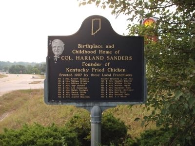
Birthplace and Childhood Home of Col. Harland Sanders
Photographed by Courtesy:: Marilyn S. Wolf, August 28, 2011
1. Birthplace and Childhood Home of Col. Harland Sanders Marker
Founder of Kentucky Fried Chicken
Erected 1987 by these Local Franchisees:
Mr. & Mrs. Robert Bagshaw
Mr. & Mrs. William Bridges
Mr. & Mrs. William Bright
Mr. & Mrs. Roy Burchel
Mr. & Mrs. Lee Cummings
Mr. & Mrs. Ralph Fordyce
Mr. & Mrs. Henry Gilley
Mr. & Mrs. Robert Heil
Mr. & Mrs. Everitt Houchen
Pauline Houchen & Joe Ann
Mr. & Mrs. Charles Howser
Mr. & Mrs. William Mullins
Mr. & Mrs. Marvin Payne
Mr. & Mrs. Raymond Popp
Mr. & Mrs. Henry Rothbaur
Mr. & Mrs. Bud Stotts
Mr. & Mrs. Hershel Wells
Mr. & Mrs. T. J. White
Erected 1987 by Local Franchisees. (Marker Number 10.1987.1.)
Topics and series. This historical marker is listed in this topic list: Industry & Commerce. In addition, it is included in the Indiana Historical Bureau Markers series list. A significant historical year for this entry is 1987.
Location. Marker is missing. It was located near 38° 32.399′ N, 85° 46.531′ W. Marker was near Henryville, Indiana, in Clark County. It was on State Road 160 east of Interstate 65, on the right when traveling east. Located at West edge of Henryville - you can park in the Shell gas-station
this page online

Regionally, this marker was in Southern Indiana. It was also in the American Midwest, in the Ohio River Valley, and in the Corn Belt. Globally, it was in North America, the Western Hemisphere, the Western World, and the Anglosphere. Historically, it found itself in what was once the territory of the Mississippian Culture and also the Northwest Territory.
Other nearby markers. At least 8 other markers are within 8 miles of this location, measured as the crow flies: Clark State Forest (approx. one mile away); “Colonel” Harland Sanders (approx. 3.6 miles away); General Jefferson C. Davis 1828-1879 (approx. 4 miles away); Pigeon Roost (approx. 5.2 miles away); a different marker also named Pigeon Roost (approx. 5.3 miles away); Massacre September 3, 1812 (approx. 5.3 miles away); This Burial Site (approx. 5.3 miles away); Patriot Burials (approx. 7.2 miles away). Touch for a list and map of all markers in Henryville.
More about this marker. Marker was blown away
Photographed by Courtesy:: Marilyn S. Wolf, August 28, 2011
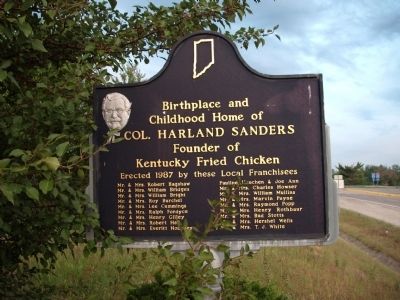
2. Obverse Side - - Birthplace and Childhood Home of Col. Harland Sanders Marker
Also see . . . Colonel Sanders - Wikipedia. (Submitted on September 1, 2011, by Bill Pfingsten of Bel Air, Maryland.)
Additional keywords. KFC
Photographed by Courtesy:: Marilyn S. Wolf, August 28, 2011
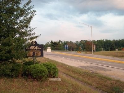
3. Looking West - - Birthplace and Childhood Home of Col. Harland Sanders Marker
Photographed by Courtesy:: Marilyn S. Wolf, August 28, 2011
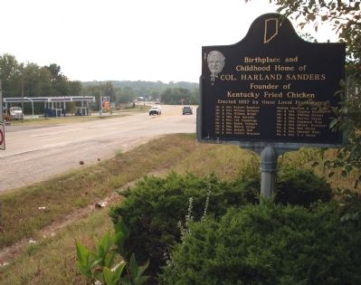
4. Looking East - - Birthplace and Childhood Home of Col. Harland Sanders Marker
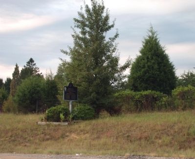
Photographed by Courtesy:: Marilyn S. Wolf, August 28, 2011
5. Looking South - - Birthplace and Childhood Home of Col. Harland Sanders Marker
Credits. This page was last revised on March 3, 2026. It was originally submitted on August 29, 2011, by Al Wolf of Veedersburg, Indiana. This page has been viewed 3,098 times since then and 152 times this year. Last updated on April 18, 2024, by Trevor L Whited of Kokomo, Indiana. Photos: 1, 2, 3, 4, 5. submitted on August 29, 2011, by Al Wolf of Veedersburg, Indiana. • Bill Pfingsten was the editor who published this page.
