Findlay in Hancock County, Ohio — The American Midwest (Great Lakes)
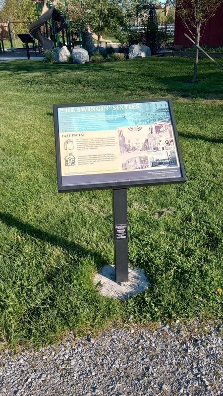
The Swingin' Sixties
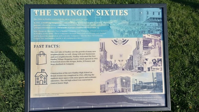
The 1960s in Findlay celebrated the old as it welcomed the new!
In 1962, a weeklong Sesquicentennial celebration in July included four parades, a historical pageant, a beard growing competition, fireworks, burying a time capsule, and crowning a Sesquicentennial Queen. Thousands of people attended the festivities.
Dow Chemical, Hercules Tire & Rubber Company, and Whirlpool all built new factories in Findlay in the 1960s. These companies brought thousands of new jobs and worked well to boost the population and economy. Companies like the Ohio Oil Company, Cooper Tire and Rubber, and RCA all continued to thrive.
Fast Facts:
The east side of Findlay saw the growth of many new neighborhoods, as well. Along with new businesses and new neighborhoods, Findlay welcomed the Fort Findlay Village Shopping Center which opened in 1962. It featured stores like Kroger, Britts, JCPenney, and Sears Roebuck & Company.
Construction of the new Findlay High School on Broad Avenue was completed in 1963, offering the students more space with extra sports and academic amenities. The old high school was converted to Central Junior High.
[Captions:]
1. Sesquicentennial Parade in 1962. 2. Sesquicentennial Downtown. 3. Sesquicentennial Time Capsule. 4. Sesquicentennial Beard Contest. 5. Central Middle School. 6. Mall Entrance in the 1960s.
Hancock County celebrated a weeklong Sesquicentennial celebration 1962
Erected by Hancock Historical Museum.
Topics. This historical marker is listed in these topic lists: Industry & Commerce • Notable Events. A significant historical year for this entry is 1962.
Location. 41° 2.253′ N, 83° 35.613′ W. Marker is in Findlay, Ohio, in Hancock County. Marker is at the intersection of County Route 236 and Carey Road (Ohio Route 568), on the left when traveling north on County Route 236. Touch for map. Marker is at or near this postal address: 8884 Co Rd 236, Findlay OH 45840, United States of America. Touch for directions.
Other nearby markers. At least 8 other markers are within walking distance of this marker. The Great Black Swamp (here, next to this marker); Hancock County Joins World War II (here, next to this marker); The Mighty Blanchard (a few steps from this marker); The Roaring 1920s (a few steps from this marker); Fort Findlay (a few steps from this marker); Welcome To Brucklacher Memorial Park (a few steps from this marker); The Flood Of 1913 (a few steps from this marker); Hancock County Underground Railroad (a few steps from this marker). Touch for a list and map of all markers in Findlay.
Credits. This page was last revised on April 24, 2024. It was originally submitted on April 23, 2024, by Craig Doda of Napoleon, Ohio. This page has been viewed 28 times since then. Photos: 1, 2, 3. submitted on April 23, 2024, by Craig Doda of Napoleon, Ohio. • Devry Becker Jones was the editor who published this page.


