Findlay in Hancock County, Ohio — The American Midwest (Great Lakes)
Riverside Park
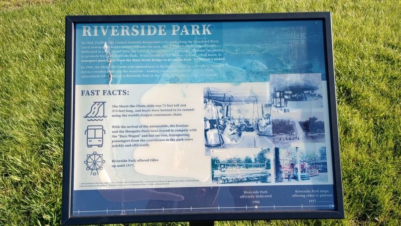
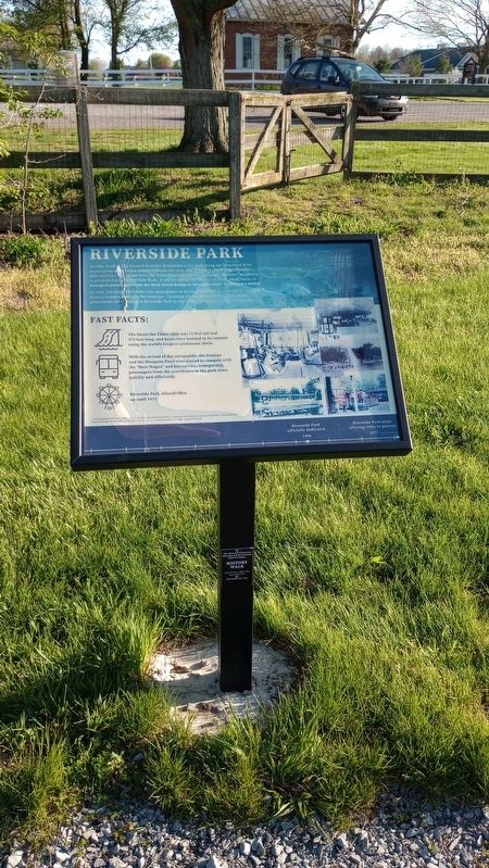
In 1904, Findlay City Council formally designated a city park along the Blanchard River. Local newspapers held a contest to name the area, and "Riverside Park was officially dedicated in 1906. A year later, the Council bought the 250 passenger "Pastime" steamship to promote travel to Riverside Park. It was joined by the "Mosquito Fleet small boats, to transport passengers from the Main Street Bridge to Riverside Park-all for just a nickel!
In 1908, the Shoot-the-Chute ride opened next to the beach. This 8-person vehicle plunged down a wooden slide into the reservoir - soaking riders and bystanders alike. More amusement rides arrived at Riverside Park in the 1930s, including a Merry-Go-Round!
Fast Facts:
The Shoot-the-Chute slide was 75 feet tall and 375 feet long, and boats were hoisted to its summit using the world's longest continuous chain.
With the arrival of the automobile, the Pastime and the Mosquito Fleet were forced to compete with the "Buzz Wagon" and bus service, transporting passengers from the courthouse to the park more quickly and efficiently.
Riverside Park offered rides up until 1977.
[Captions:]
1. Boat landing at Riverside park, 1910. 2. Bumper Cars at Riverside Park. 3. Riverside Park Merry Go Round in the 1930s. 4. Riverside Park Chute the Chutes in the 1920s. 5. "Pastime" Steamship on the Blanchard River. 6. Rides at Riverside Park.
Riverside Park officially dedicated 1906
Riverside Park stops offering rides to patrons 1977
Erected by Hancock Historical Museum.
Topics. This historical marker is listed in this topic list: Parks & Recreational Areas. A significant historical year for this entry is 1904.
Location. 41° 2.253′ N, 83° 35.597′ W. Marker is in Findlay, Ohio, in Hancock County. Marker is at the intersection of County Road 236 and Carey Road (State Route 568), on the left when traveling north on County Road 236. Touch for map. Marker is at or near this postal address: 8884 Co Rd 236, Findlay OH 45840, United States of America. Touch for directions.
Other nearby markers. At least 8 other markers are within walking distance of this marker. How Oil Saved Findlay (here, next to this marker); The Flood Of 1913 (here, next to this marker); The Roaring 1920s (a few steps from this marker); "Boom Town" (a few steps from this marker); Hancock County & The Civil War (a few steps from this marker); Hancock County Underground Railroad (a few steps from this marker); Fort Findlay (a few steps from this marker); Hancock County Joins World War II (a few steps from this marker). Touch for a list and map of all markers in Findlay.
Credits. This page was last revised on April 24, 2024. It was originally submitted on April 23, 2024, by Craig Doda of Napoleon, Ohio. This page has been viewed 33 times since then. Photos: 1, 2, 3. submitted on April 23, 2024, by Craig Doda of Napoleon, Ohio. • Devry Becker Jones was the editor who published this page.


