Smithland in Livingston County, Kentucky — The American South (East South Central)
Federal Commissary Building
— Kentucky Ohio River Civil War Heritage Trail —
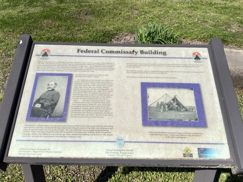
An anonymous commissary officer in 1863 described the soldiers' rations...
...the regulations provide that each man shall be entitled to a certain fixed amount daily, which amount is designated "a ration." Rations consist of beef, salt and fresh, pork, bacon, flour, pilot or hard bread, cornmeal, coffee, sugar, beans, peas, rice, hominy, molasses, vinegar, soap, candles, and desiccated vegetables. The latter are usually potatoes, cut, scalded, dried, and put up in barrels. When thus prepared they have very much the appearance of coarse cornmeal, and are used as a preventive of scurvy. Each day's ration subsistence for one man-in bulk averages 3 pounds in weight.....All of these rations, forming the entire subsistence of the army are under the charge of the Chief Commissary, by whom the corps commissaries are supplied, and these in turn supply the division commissaries. Brigade officers draw from the division commissaries, and regimental from brigade officers. The men draw their rations by companies, and they are then divided among the messes. The cost of each ration, including transportation, is about 20 cents.
Montgomery C. Meigs (above) was Quartermaster General of the United States Army with the rank of brigadier general. He served as head of the department, providing the armies in the field with all kinds of supplies, except those with which they ate or fought. His responsibilities also included transportation by railroad, wagon, and ship of both the army and its supplies, including army clothing, camp and garrison equipage, cavalry and artillery horses, fuel, forage, straw, material for bedding, and stationery. His department also oversaw the operations of the Military Telegraph Corps.
All food for the Army was purchased by contract and administering such a large scale operation took a large number of men and a great deal of space for storage, processing, and shipping forward to troops in the field.
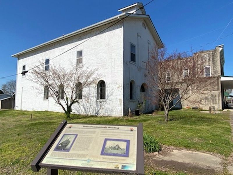
The building was also used as a hospital during the War. After the war it was used as a Masonic Hall. The First Baptist Church also met here from 1687-1913.
This building is listed on the National Register of Historic Places. (caption) Unlike the Smithland commissary, many Civil War commissaries were little more than a simple tent similar to commissary in above photogaph.
Erected by The Kentucky Transportation Cabinet. (Marker Number 16.)
Topics. This historical marker is listed in this topic list: War, US Civil.
Location. 37° 8.419′ N, 88° 24.388′ W. Marker is in Smithland, Kentucky, in Livingston County. Marker is at the intersection of North Court Street and Charlotte Street, on the left when traveling north on North Court Street. Touch for map. Marker is at or near this postal address: 203 N Court St, Smithland KY 42081, United States of America. Touch for directions.
Other nearby markers. At least 8 other markers are within 3 miles of this marker, measured as the crow flies. Confluence of the Cumberland and Ohio Rivers (about 500 feet away, measured in a direct line); Methodist Church (about 700 feet away); Dallam-Bush House (about 700 feet away); County Named, 1798 (approx. 0.2 miles away); A Civil War Base (approx. 0.2 miles away); Livingston County Courthouse (approx. 0.2 miles away); Ned Buntline / Gower House (approx. 0.2 miles away); Jefferson’s Sister (approx. 3.1 miles away). Touch for a list and map of all markers in Smithland.
Credits. This page was last revised on April 24, 2024. It was originally submitted on April 23, 2024, by Darren Jefferson Clay of Duluth, Georgia. This page has been viewed 36 times since then. Photos: 1, 2. submitted on April 24, 2024, by Darren Jefferson Clay of Duluth, Georgia. • Bernard Fisher was the editor who published this page.

