Findlay in Hancock County, Ohio — The American Midwest (Great Lakes)
Fort Findlay
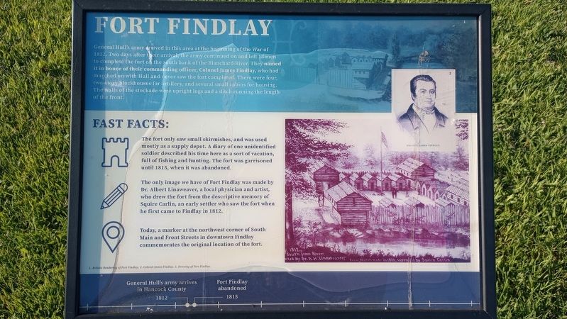
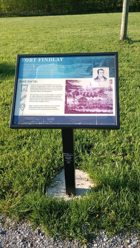
General Hull's army arrived in this area at the beginning of the War of 1812. Two days after their arrival, the army continued on and left 13 men to complete the fort on the south bank of the Blanchard River. They named it in honor of their commanding officer, Colonel James Findlay, who had marched on with Hull and never saw the fort completed. There were four, two-story blockhouses for artillery, and several small cabins for housing. The walls of the stockade were upright logs and a ditch running the length of the front.
Fast Facts:
The fort only saw small skirmishes, and was used mostly as a supply depot. A diary of one unidentified soldier described his time here as a sort of vacation, full of fishing and hunting. The fort was garrisoned until 1815, when it was abandoned.
The only image we have of Fort Findlay was made by Dr. Albert Linaweaver, a local physician and artist, who drew the fort from the descriptive memory of Squire Carlin, an early settler who saw the fort when he first came to Findlay in 1812.
Today, a marker at the northwest corner of South Main and Front Streets in downtown Findlay commemorates the original location of the fort.
[Captions:]
1. Artistic Rendering of Fort Findlay. 2. Colonel James Findlay. 3. Drawing of Fort Findlay.
General Hull's army arrives in Hancock County 1812
Fort Findlay abandoned 1815
Erected by Hancock Historical Museum.
Topics. This historical marker is listed in these topic lists: Forts and Castles • Native Americans • Settlements & Settlers • War of 1812. A significant historical year for this entry is 1812.
Location. 41° 2.248′ N, 83° 35.605′ W. Marker is in Findlay, Ohio, in Hancock County. Marker is on County Route 236, 0.2 miles north of Carey Road (Ohio Route 568), on the left when traveling north. Touch for map. Marker is at or near this postal address: 8884 Co Rd 236, Findlay OH 45840, United States of America. Touch for directions.
Other nearby markers. At least 8 other markers are within walking distance of this marker. The Mighty Blanchard (here, next to this marker); Hancock County Underground Railroad (here, next to this marker); The Flood Of 1913 (a few steps from this marker); The Great Black Swamp (a few steps from this marker); Hancock County & The Civil War (a few steps from this marker); The Roaring 1920s (a few steps from this marker); Hancock County Joins World War II (a few steps from this marker); The Swingin' Sixties (a few steps from this marker). Touch for a list and map of all markers in Findlay.
Credits. This page was last revised on April 24, 2024. It was originally submitted on April 24, 2024, by Craig Doda of Napoleon, Ohio. This page has been viewed 34 times since then. Photos: 1, 2, 3, 4. submitted on April 24, 2024, by Craig Doda of Napoleon, Ohio. • Devry Becker Jones was the editor who published this page.


