Stonycreek Township near Stoystown in Somerset County, Pennsylvania — The American Northeast (Mid-Atlantic)
First View
Flight 93 National Memorial
| — | National Park Service, U.S. Department of the Interior | — |
Photographed by Sean Flynn, April 24, 2024
1. First View Marker
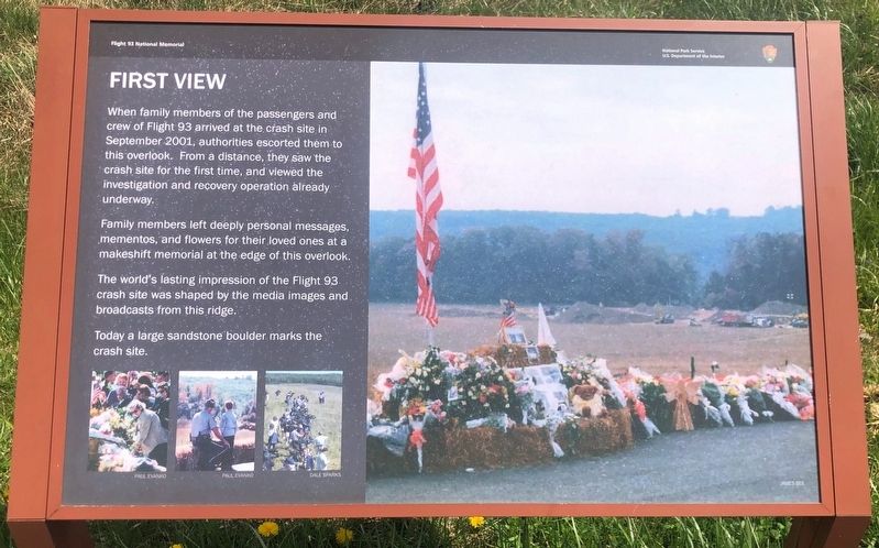
Family members left deeply personal messages, mementos, and flowers for their loved ones at a makeshift memorial at the edge of this overlook. The world's lasting impression of the Flight 93 crash site was shaped by the media images and broadcasts from this ridge.
Today a large sandstone boulder marks the crash site.
Erected by National Park Service.
Topics. This historical marker is listed in these topic lists: 9/11 Attacks • Communications • Disasters. A significant historical date for this entry is September 11, 2001.
Location. 40° 3.287′ N, 78° 54.374′ W. Marker is near Stoystown, Pennsylvania, in Somerset County. It is in Stonycreek Township. It can be reached from Western Overlook Road. The marker is located at the Flight 93 National Memorial. It is at roughly the halfway point of the ¾-mile pathway between the Visitors Center and the
this page online

Regionally, this marker is in the Laurel Highlands. It is also in the American Northeast, in the Mid-Atlantic, in Appalachia, and specifically in Northern Appalachia. Globally, it is in North America, the Western Hemisphere, the Western World, and the Anglosphere. Historically, it finds itself in what was once the Haudenosaunee (Iroquois) Confederacy and also one of the original Thirteen Colonies.
Other nearby markers. At least 8 other markers are within walking distance of this marker: Flight 93 (within shouting distance of this marker); The Search for Evidence (within shouting distance of this marker); a different marker also named View from the Flight Path Overlook (about 400 feet away); Welcome To Flight 93 National Memorial (about 400 feet away); Flight 93 Temporary Memorial (approx. 0.3 miles away); Overlooking History (approx. 0.3 miles away); Crash Site and Debris Field (approx. 0.3 miles away); Flight 93 National Memorial (approx. 0.3 miles away). Touch for a list and map of all

Photographed by Sean Flynn, April 24, 2024
2. First View Marker
The site of the crash of Flight 93 is below and to the right of the ridge in this photo.
Another marker is no longer nearby. View from the Flight Path Overlook (was about 400 feet away, measured in a direct line but has been replaced with another marker now near it).
Also see . . . National Park Service: Flight 93 National Memorial. (Submitted on April 24, 2024, by Sean P. Flynn of Oak Park, Illinois.)

Photographed by Sean Flynn, April 24, 2024
3. First View Marker
The Flight Path Overlook and the Flight 93 National Memorial Visitors Center are in the background.
Credits. This page was last revised on April 29, 2024. It was originally submitted on April 24, 2024, by Sean P. Flynn of Oak Park, Illinois. This page has been viewed 239 times since then and 25 times this year. Photos: 1, 2, 3. submitted on April 24, 2024, by Sean P. Flynn of Oak Park, Illinois.
