
Cascade in Cascade County, Montana — The American West (Mountains)
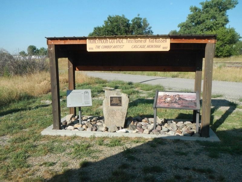
Who was looking for who?

Photographed by Barry Swackhamer, August 15, 2022
1. Who was looking for who? Marker
"Capt Lewis & 3 men went on to the mountain to take a meridian altitude, passed about 40 Small Camps, which appeared to be abandoned about 10 or 12 days. Suppose they were Snake Indians, a fiew miles above I Saw the poles Standing in thir position of a verry large lodge of 60 feet Diamater, & the appearance of a number of Leather Lodges about, this Sign was old & appeared to have been last fall" -- Captain William Clark, July 16, 1805
Erected by Lewis and Clark Trail Heritage Foundation.
Topics and series. This historical marker is listed in these topic lists: Arts, Letters, Music • Exploration. In addition, it is included in the
this page online
Location. 47° 16.177′ N, 111° 41.948′ W. Marker is in Cascade, Montana, in Cascade County. It is on Russell Drive South near Central Avenue East, on the right when traveling north. Touch for map. Marker is at or near this postal address: 20 Russell Drive South, Cascade MT 59421, United States of America. Touch for directions.

Regionally, this marker is in andspecifically entral Montana in Russell Country. It is also in the American Mountain West and in the Lewis & Clark Corridor. Globally, it is in North America, the Rocky Mountains, the Western Hemisphere, the Western World, and the Anglosphere. Historically, it finds itself in what was once Rupert’s Land and also the Louisiana Purchase.
Other nearby markers. At least 8 other markers are within 10 miles of this marker, measured as the crow flies: Charlie and Nancy Russell Honeymoon Cottage (here, next to this marker); Point of Reference (approx. 7.7 miles away); Sentinel of the Rockies (approx. 7.7 miles away); Transition Terrain (approx. 7.7 miles away); From Too Much to Not Enough (approx.
Photographed by Barry Swackhamer, August 15, 2022
2. Who was looking for who? Marker
Central plaque: The picture at right, "Indians Discovering Lewis & Clark" by Charles M. Russell was completed in 1898 here in Russell's first home - The Honeymoon Cottage - as described by the sign on the left. -- Gene Dwyer
Credits. This page was last revised on April 25, 2024. It was originally submitted on April 25, 2024, by Barry Swackhamer of Brentwood, California. This page has been viewed 246 times since then and 49 times this year. Photos: 1, 2. submitted on April 25, 2024, by Barry Swackhamer of Brentwood, California.
