Pershore in Worcestershire, England, United Kingdom — Northwestern Europe (the British Isles)
The Story of Pershore, The Abbey and the Park
No. 4 A Race Through the Years

Photographed by Ray Gurganus, April 7, 2024
1. The Story of Pershore, The Abbey and the Park Marker
681-689: Ethelred of Marcia gave estates to Oswald to establish a monastery at Pershore.
972: King Edgar's charter confirmed the estate. The Benedictine Rule was introduced.
976-983: An anti-monastic reaction. Two thirds of the Pershore estate seized.
1002-1020: A new church built by 1020 following a fire in 1002.
1056: Earl Odda. Benefactor died at Deerhurst and was buried at Pershore.
1065: Edward the Confessor gave the alienated lands to endow Westminster Abbey.
1090-1130: The Norman Abbey built. The south transept and tower piers remain.
1223: A fire on St Urban's day destroyed the Norman quire.
1239: The Early English quire and the combined triforium and clerestory completed.
1288: Another fire brought down the Norman tower and wined the quire roof.
1290-1330: The ploughshare lierne vaulting and the tower rebuilt in the Decorated style.
1540: Surrender of the monastery. The monks quire bought for £400 to be the parish church.
1686: The north buttress built to support the tower after the transept fell.
1862-1864: Restoration by Gilbert Scott. The lantern tower opened up.
1913:
this page online
1960: Re-ordering of the sanctuary by George Pace.
1992-1994: Restoration of the south transept, tower and roofs.
1996-1997: Laying of stone floor with under-floor heating after archaeological investigation.
The Park
Originally the Abbey grounds was used by the monks for growing vegetables, fruit and for fish from the ponds.
In 1762 the land around the land around the farm and the open fields of Holy Cross were enclosed its likely the Park was a farmed area.
1904 maps show two fish ponds, still in existence and areas of orchard.
Abbey house was built after dissolution of the monastery as a private residence. Rebuilt into a gothic mansion in Victorian times. Bought in 1910 by monks who lived there till 1928. Demolished in the 1930s. Pershore Bowling Club building in the 1930s.
Play area opened in 1957, refurbished at intervals over the years. The latest being in 2006.
Public Conveniences constructed in 1993.
Car Park at Abbey Road constructed in 1997.
Water Play opened in Summer 2005.
Skate Park opened in Summer 2006.
Erected by Wychavon
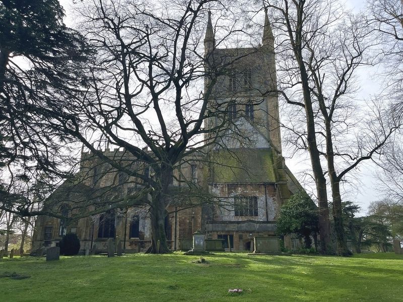
Photographed by Ray Gurganus, April 7, 2024
2. The Story of Pershore, The Abbey and the Park Marker
Topics. This historical marker is listed in this topic list: Religion & Religious Structures.
Location. 52° 6.575′ N, 2° 4.65′ W. Marker is in Pershore, England, in Worcestershire. It can be reached from no nearby street. Touch for map. Marker is in this post office area: Pershore, England WR10, United Kingdom. Touch for directions.

Regionally, this marker is in the Midlands. Globally, it is on the Atlantic Ocean, in the North Atlantic Region, in Europe, in Atlantic Europe, on one of the British Isles, in the Western World, and in the Anglosphere. Historically, it finds itself in what was once the Roman Empire.
Other nearby markers. At least 8 other markers are within 10 kilometers of this marker, measured as the crow flies: A different marker also named The Story of Pershore, The Abbey and the Park (within shouting distance of this marker); a different marker also named The Story of Pershore, The Abbey and the Park (within shouting distance of this marker); a different marker also named The Story of Pershore, The Abbey and the Park
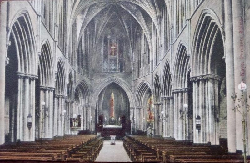
Photographed by John Valentine and Sons, circa 1905
3. The Nave - Pershore Abbey
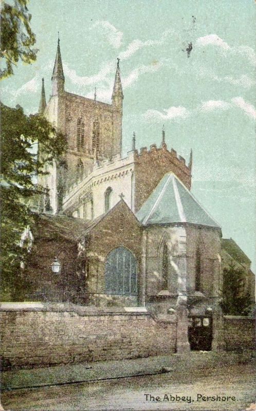
Photographed by Christian Novels Publishing Company, circa 1910
4. The Abbey, Pershore
Credits. This page was last revised on June 24, 2026. It was originally submitted on April 26, 2024, by Ray Gurganus of Washington, District of Columbia. This page has been viewed 317 times since then and 44 times this year. Photos: 1, 2. submitted on April 26, 2024, by Ray Gurganus of Washington, District of Columbia. 3, 4. submitted on May 1, 2024. • Andrew Ruppenstein was the editor who published this page.
