West Warren in Worcester County, Massachusetts — The American Northeast (New England)
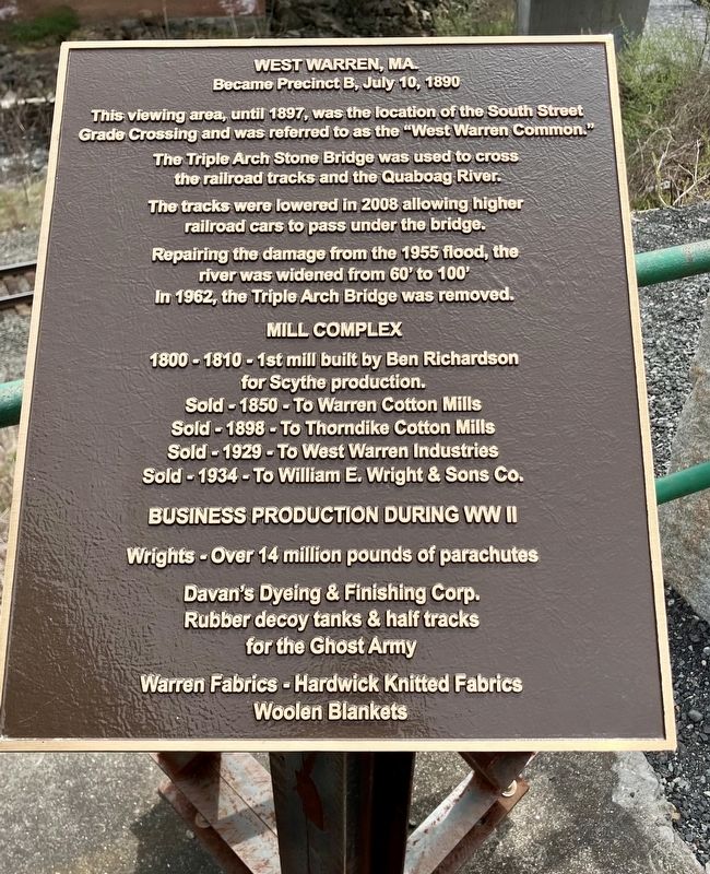
West Warren, MA.
Became Precinct B, July 10, 1890
Photographed by Trudi Jacobson, April 27, 2024
1. West Warren, MA Marker
This viewing area, until 1897, was the location of the South Street Grade Crossing and was referred to as the "West Warren Common."
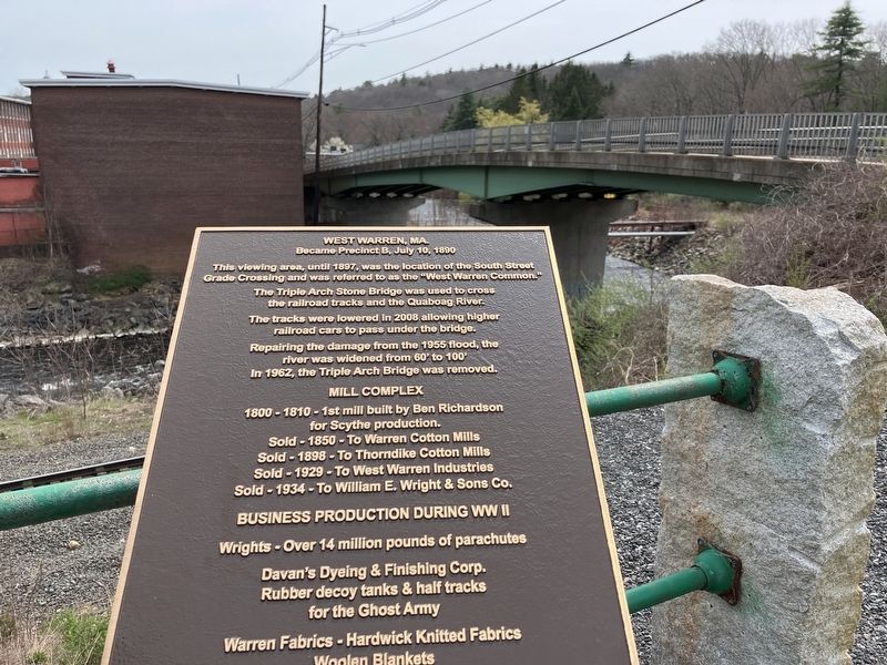
The Triple Arch Stone Bridge was used to cross the railroad tracks and the Quaboag River.
The tracks were lowered in 2008 allowing higher railroad cars to pass under the bridge.
Repairing the damage from the 1955 flood, the river was widened from 60' to 100'
In 1962, the Triple Arch Bridge was removed.
Sold-1850-To Warren Cotton Mills
Sold-1898-To Thorndike Cotton Mills
Sold-1929-To West Warren Industries
Sold-1934-To William E. Wright & Sons Co.
Davan's Dyeing & Finishing Corp.
Rubber decoy tanks & half tracks for the Ghost Army
Warren Fabrics - Hardwick Knitted Fabrics Woolen Blankets
Topics. This historical marker is listed in these topic lists: Bridges & Viaducts • Industry & Commerce • Railroads & Streetcars • War, World II. A significant historical year for this entry is 1800.
Location. 42° 12.707′ N, 72° 14.074′ W.
this page online

Regionally, this marker is in the Quiet Corner and in Greater Worcester. It is also in the American Northeast and in New England. Globally, it is in North America, the Western Hemisphere, the Western World, and the Anglosphere. Historically, it finds itself in what was once one of the original Thirteen Colonies.
Other nearby markers. At least 8 other markers are within 6 miles of this marker, measured as the crow flies: Warren Civil War Memorial (approx. 2.1 miles away); Gen. Henry Knox Trail (approx. 2.8 miles away); Boston Post Road (approx. 2.8 miles away); Ware Revolutionary War Memorial (approx. 3.4 miles away); Birthplace of Lucy Stone (approx. 4 miles away); a different marker also named Birthplace of Lucy Stone (approx. 4 miles away); West Brookfield Veterans Memorial (approx. 5.1 miles away); West Brookfield Veterans Monument

Photographed by Trudi Jacobson, April 27, 2024
2. West Warren, MA Marker and Mill Complex

Photographed by Trudi Jacobson, April 27, 2024
3. West Warren, MA Marker
Photographed by Trudi Jacobson, April 27, 2024
4. West Warren, MA. Marker
Credits. This page was last revised on May 3, 2024. It was originally submitted on April 27, 2024, by Trudi Jacobson of Slingerlands, New York. This page has been viewed 821 times since then and 154 times this year. Photos: 1, 2, 3. submitted on April 27, 2024, by Trudi Jacobson of Slingerlands, New York. 4. submitted on April 28, 2024, by Trudi Jacobson of Slingerlands, New York. • Michael Herrick was the editor who published this page.
