Sanger in Denton County, Texas — The American South (West South Central)
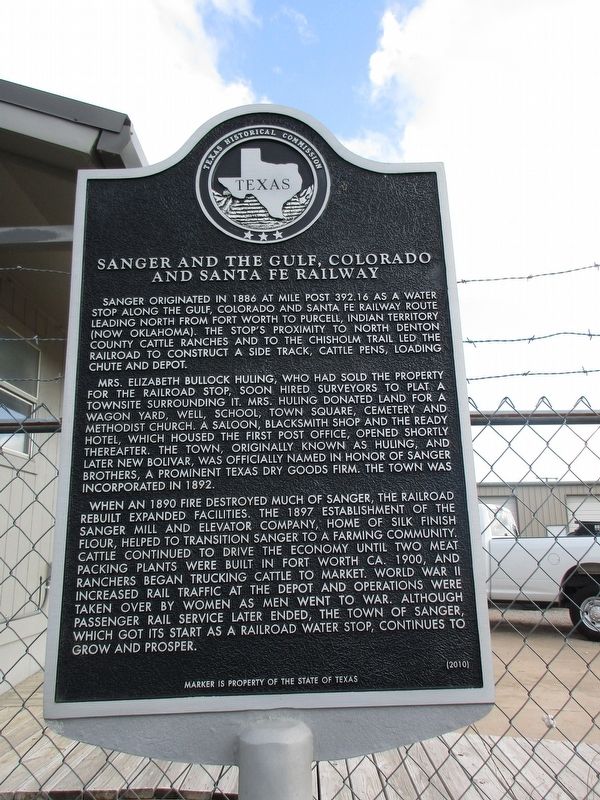
Sanger and the Gulf, Colorado and Santa Fe Railway
Photographed by Jeff Leichsenring, April 28, 2024
1. Sanger and the Gulf, Colorado and Santa Fe Railway Marker
Mrs. Elizabeth Bullock Huling, who had sold the property for the railroad stop, soon hired surveyors to plat a townsite surrounding it. Mrs. Huling donated land for a wagon yard, well, school, town square, cemetery and Methodist church. A saloon, blacksmith shop and the Ready Hotel, which housed the first post office, opened shortly after. The town, originally known as Huling, and later New Bolivar, was officially named in honor of Sanger Brothers, a prominent Texas dry goods firm. The town was incorporated in 1892.
When an 1890 fire destroyed much of Sanger, the railroad rebuilt expanded facilities. The 1897 establishment of the Sanger Mill and Elevator Company, Home of Silk Finish Flour, helped to transition Sanger to a farming community. Cattle continued to drive
this page online
Erected 2010 by Texas Historical Commission. (Marker Number 16443.)
Topics. This historical marker is listed in these topic lists: Agriculture • Industry & Commerce • Railroads & Streetcars • Settlements & Settlers.
Location. 33° 21.738′ N, 97° 10.18′ W. Marker is in Sanger, Texas, in Denton County. It is at the intersection of Bolivar Street and North 1st Street, on the right when traveling east on Bolivar Street. Touch for map. Marker is at or near this postal address: 100 Bolivar Street, Sanger TX 76266, United States of America. Touch for directions.

Regionally, this marker is in the Prairies & Lakes Region and in the Dallas-Fort Worth Metropolitan Area. Globally, it is in North America,
Photographed by Jeff Leichsenring, April 28, 2024
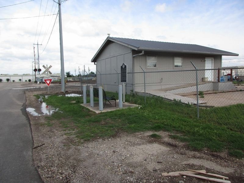
2. Sanger and the Gulf, Colorado and Santa Fe Railway Marker
There is a bench located next to the marker to allow guests to sit down and read the marker.
Other nearby markers. At least 8 other markers are within 8 miles of this marker, measured as the crow flies: Galilee Missionary Baptist Church (approx. ¼ mile away); Sanger Presbyterian Church (approx. 0.4 miles away); Bolivar Cemetery (approx. 4.1 miles away); Gribble Springs Baptist Church (approx. 4.2 miles away); Townsite of Bolivar (approx. 4.4 miles away); Green Valley Schools (approx. 7 miles away); Tyson Cemetery (approx. 7.1 miles away); Forester Ranch (approx. 7.9 miles away). Touch for a list and map of all markers in Sanger.
Credits. This page was last revised on April 30, 2024. It was originally submitted on April 29, 2024, by Jeff Leichsenring of Garland, Texas. This page has been viewed 326 times since then and 66 times this year. Photos: 1, 2. submitted on April 29, 2024, by Jeff Leichsenring of Garland, Texas. • James Hulse was the editor who published this page.
