
Bountiful in Davis County, Utah — The American Mountains (Southwest)
The Bamberger
| — | Bountiful Area Historic Site | — |
Photographed by Jeremy Snow, May 1, 2024
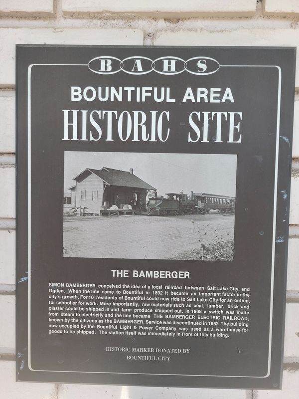
1. The Bamberger Marker
SIMON BAMBERGER conceived the idea of a local railroad between Salt Lake City and Ogden. When the line came to Bountiful in 1892 it became an important factor in the city's growth. For 10¢ residents of Bountiful could now ride to Salt Lake City for an outing, for school or for work. More importantly, raw materials such as coal, lumber, brick and plaster could be shipped in and farm produce shipped out. In 1908 a switch was made from steam to electricity and the line became The Bamberger Railroad, known by the citizens as the Bamberger. Service was discontinued in 1952. The building now occupied by the Bountiful Light & Power Company was used as a warehouse for goods to be shipped. The station itself was immediately in front of this building.
Erected by Bountiful City.
Topics. This historical marker is listed in these topic lists: Industry & Commerce • Railroads & Streetcars. A significant historical year for this entry is 1892.
Location. 40° 53.231′ N, 111° 53.16′ W. Marker is in Bountiful, Utah, in Davis County. It is on South 200 West, on the left when traveling north. Touch for map. Marker is at or near
this page online

Regionally, this marker is in the Wasatch Front and in Greater Salt Lake. It is also in the American Mountain West and on the Colorado Plateau. Globally, it is in North America, the Rocky Mountains, the Western Hemisphere, the Western World, and the Anglosphere. Historically, it finds itself in what was once New Spain and also Mexico’s Alta California.
Other nearby markers. At least 8 other markers are within walking distance of this marker: Bliss Hall (about 700 feet away, measured in a direct line); Bountiful Lumber and Supply Company (approx. ¼ mile away); Bountiful Centennial Monument (approx. 0.3 miles away); Perrigrine Sessions Dugout (approx. 0.3 miles away); Rampton Family (approx. 0.3 miles away); Daniel Wood Cemetery (approx. 0.4 miles away); Daniel Wood (approx. 0.4 miles away); The People's Opera House and Mercantile Company of Bountiful (approx. 0.4 miles away). Touch for a list and map of all markers in Bountiful.

Photographed by Jeremy Snow, May 1, 2024
2. The Bamberger Marker
Credits. This page was last revised on May 1, 2024. It was originally submitted on May 1, 2024, by Jeremy Snow of Cedar City, Utah. This page has been viewed 314 times since then and 36 times this year. Photos: 1, 2. submitted on May 1, 2024, by Jeremy Snow of Cedar City, Utah. • Andrew Ruppenstein was the editor who published this page.
