Brownwood in Brown County, Texas — The American South (West South Central)
Camp Bowie
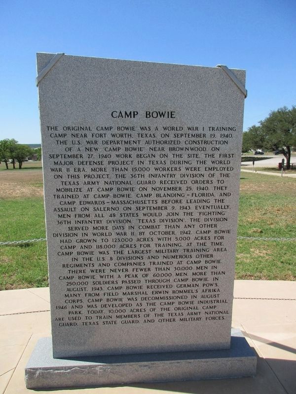
Photographed by Jeff Leichsenring, April 16, 2023
1. Camp Bowie Marker
The original Camp Bowie was a World War I training camp near Fort Worth, Texas. On September 19, 1940, the U.S. War Department authorized construction of a new "Camp Bowie" near Brownwood. On September 27, 1940 work began on the site. The first major defense project in Texas during the World War II era, more than 15,000 workers were employed on this project. The 36th Infantry Division of the Texas Army National Guard received orders to mobilize at Camp Bowie on November 25, 1940. They trained at Camp Bowie, Camp Blanding - Florida, and Camp Edwards - Massachusetts before leading the assault on Salerno on September 9, 1943. Eventually, men from all states would join the fighting 36th Infantry Division Texas Division. The division served more days in combat than any other division in World War II. By October, 1942, Camp Bowie had grown to 123,000 acres with 5,000 acres for camp and 118,000 acres for training. At the time, Camp Bowie was the largest military training area in the U.S. 8 divisions and numerous other regiments and companies trained at Camp Bowie. There were never fewer than 30,000 men in Camp
this page online
Topics. This historical marker is listed in these topic lists: Industry & Commerce • War, World II. A significant historical month for this entry is August 1943.
Location. 31° 40.664′ N, 98° 59.5′ W. Marker is in Brownwood, Texas, in Brown County. It can be reached from the intersection of Crockett Drive and Memorial Park Drive, on the right. Touch for map. Marker is in this post office area: Brownwood TX 76801, United States of America. Touch for directions.

Regionally, this marker is in Big Country. Globally, it is in North America, a Gulf of Mexico state, the Western Hemisphere, the Western World, and the Anglosphere. Historically, it finds itself in what was once New Spain, the Comanchería, the Republic of Texas, and one of the Confederate States of America.
Other nearby markers. At least 8 other markers are within walking distance of this marker: Charles E. (Commando) Kelly (here, next to this marker); The Lost Battalion (Java) (here, next to this marker); Central Texas Veterans' Memorial (here, next to this marker); World War I Memorial (a few steps from this marker); a different marker also named World War I Memorial (a few steps from this marker); World War I (a few steps from this marker); Colonel Jack T. Bradley (a few steps from this marker); "Fighting" 36th Infantry Division (a few steps from this marker). Touch for a list and map of all markers in Brownwood.
Credits. This page was last revised on July 13, 2024. It was originally submitted on May 4, 2024, by Jeff Leichsenring of Garland, Texas. This page has been viewed 712 times since then and 65 times this year. Photo 1. submitted on April 20, 2023, by Jeff Leichsenring of Garland, Texas. • J. Makali Bruton was the editor who published this page.
