Bury St Edmunds in Suffolk, England, United Kingdom — Northwestern Europe (the British Isles)
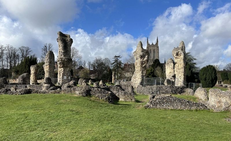
The Abbot's Palace

Photographed by Ray Gurganus, March 27, 2024
1. The Abbot's Palace Marker
In 1044, King Edward the Confessor gave the monks the right to elect the abbot. Most abbots were monks who had spent their lives at Bury. The abbot was a leading figure in the kingdom-he sat in the House of Lords, held great control over the town and much of Suffolk, and wore a mitre, which gave him the same status as a bishop. He was not under the authority of any other churchman in England and answered directly to the head of the Catholic Church-the pope.
Right: Eleanor of Castile and her husband Edward I were in Sicily when they learned they were king and queen. They prayed to St Edmund for their safe journey back to England. On their return, they came here to give thanks, staying in the Abbot's Palace.
Royal Visitors
Drawn by the shrine of the martyred King Edmund, kings and queens occasionally came to stay in the abbot's palatial lodgings. Royal visits brought prestige but at great financial cost. When Henry VI visited in
this page online
Below: The Abbot's Palace before and after demolition: The top view from 1720 shows (from left) the Great Hall, kitchen, Abbot's Hall and Queen's Chamber. The bottom is the same view from 1803.
Richard Yates, History and Antiquities of the Abbey of St Edmund's Cry, 1843.
Erected by English Heritage.
Topics. This historical marker is listed in these topic lists: Forts and Castles • Religion & Religious Structures. A significant historical year for this entry is 1044 CE.
Location. 52° 14.687′ N, 0° 43.118′ E. Marker is in Bury St Edmunds, England, in Suffolk. It can be reached from no nearby street. In the Abbey Gardens. Touch for map. Marker is in this post office area: Bury St Edmunds, England IP33 1RS, United Kingdom. Touch for directions.

Regionally, this marker is in East Anglia. Globally, it is on the Atlantic Ocean, in the North Atlantic Region, in Europe, in Atlantic Europe, on one of the British Isles, in the Western World, and in the Anglosphere.
Photographed by Ray Gurganus, March 27, 2024
2. The Abbot's Palace
Other nearby markers. At least 8 other markers are within walking distance of this marker: St Edmunds Abbey (within shouting distance of this marker); The Great Court (within shouting distance of this marker); The Chapter House (within shouting distance of this marker); The Cloister (about 90 meters away, measured in a direct line); The Heart of the Church (about 90 meters away); Cnut's Church and its Successor (about 90 meters away); The Eastern End (about 120 meters away); The Magna Carta (about 120 meters away). Touch for a list and map of all markers in Bury St Edmunds.
Credits. This page was last revised on June 24, 2026. It was originally submitted on May 4, 2024, by Ray Gurganus of Washington, District of Columbia. This page has been viewed 108 times since then and 6 times this year. Photos: 1, 2. submitted on May 4, 2024, by Ray Gurganus of Washington, District of Columbia. • Andrew Ruppenstein was the editor who published this page.
