Fayetteville in Cumberland County, North Carolina — The American South (South Atlantic)
John England
1786 - 1842
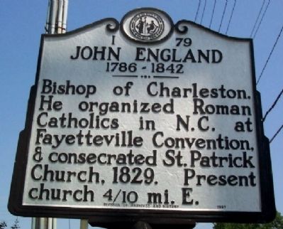
Photographed by William Fischer, Jr., July 28, 2009
1. John England Marker
Erected 1997 by Division of Archives and History. (Marker Number I-79.)
Topics and series. This historical marker is listed in this topic list: Religion & Religious Structures. In addition, it is included in the North Carolina Division of Archives and History series list. A significant historical year for this entry is 1829.
Location. 35° 1.857′ N, 78° 55.82′ W. Marker is in Fayetteville, North Carolina, in Cumberland County. It is at the intersection of Village Drive and Owen Drive, on the right when traveling west on Village Drive. Marker is across the intersection from a stylized Eiffel Tower at the Bordeaux [Shopping] Center. Touch for map. Marker is in this post office area: Fayetteville NC 28304, United States of America. Touch for directions.

Regionally, this marker is in the Coastal Plain. It is also in the American South and specifically in the Upper South. Globally, it is in North America, the Western Hemisphere, the Western World, and the Anglosphere.
this page online
Other nearby markers. At least 8 other markers are within 3 miles of this marker, measured as the crow flies: Saint Patrick Catholic Church (approx. 0.4 miles away); MacPherson Church (approx. one mile away); The Fayetteville Observer (approx. 2.1 miles away); James C. Dobbin (approx. 2.2 miles away); Confederate Women's Home (approx. 2½ miles away); Southwest Tower (1849 - 1856) (approx. 2.6 miles away); Gun Carriage and Turning Shop (1842 - 1849) (approx. 2.6 miles away); Engine House (1838 - 1848) (approx. 2.6 miles away). Touch for a list and map of all markers in Fayetteville.
Another marker is no longer nearby. Cumberland County Confederate Memorial (was approx. 2.4 miles away but has been permanently removed).
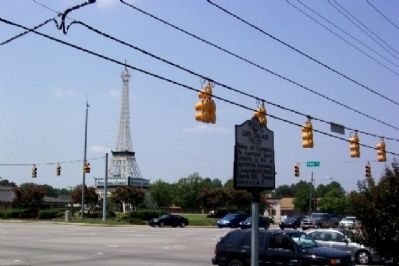
Photographed by William Fischer, Jr., July 28, 2009
2. John England Marker
Bordeaux Shopping Center in background.
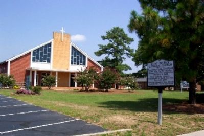
Photographed by William Fischer, Jr., July 28, 2009
3. Saint Patrick's Church
2844 Villge Drive.
Credits. This page was last revised on November 28, 2019. It was originally submitted on November 17, 2009, by William Fischer, Jr. of Reynoldsburg, Ohio. This page has been viewed 1,194 times since then and 29 times this year. Photos: 1, 2, 3. submitted on November 17, 2009, by William Fischer, Jr. of Reynoldsburg, Ohio.
