Centerville in Davis County, Utah — The American Mountains (Southwest)
Kilbourn-Leak House
National Register
| — | Centerville City Historic Site | — |

Photographed by Jeremy Snow, May 1, 2024
1. Kilbourn-Leak House Marker
National Register of Historic Places Registration Form:
Click for more information.
Click for more information.
Ozias Kilbourn built this two-story Classical style rock house with the help of the skilled Scottish stonemason Charles Duncan in the late 1860s. The sandstone quoins or cornerstones, characteristic of Duncan's work, are believed to have been salvaged from pieces discarded from the construction of the LDS Temple in Salt Lake City.
Ozias married Electa Granteer in 1832 in Pennsylvania. Both joined the LDS church in Nauvoo, Illinois in 1843 where Ozias served as a bodyguard for Joseph Smith. The Kilbourns arrived in Salt Lake City in 1847 and were among the earliest settlers of Centerville in 1849. They had ten children. In 1874 Ozias married Rachel Bennet, and they had two children. In 1877 he married Angeline Cole with whom he had five children.
The Kilbourns sold the property in 1891, after which five different owners occupied the house before Orval and Sally Leak, the current owners, purchased it in 1933 and raised four daughters here. The Leaks removed an enclosed one-story shed roof front porch, and rebuilt the windows in the 1940s. They were fruit growers and planted the orchard on the property. Orval
this page online
Marker placed in 1997 by Orval and Sally Leak
Division of State History
Erected 1997 by Utah Division of State History.
Topics. This historical marker is listed in these topic lists: Architecture • Settlements & Settlers. A significant historical year for this entry is 1860.
Location. 40° 55.132′ N, 111° 52.533′ W. Marker is in Centerville, Utah, in Davis County. It is on North 200 East, on the right when traveling north. Touch for map. Marker is at or near this postal address: 170 N 200 East, Centerville UT 84014, United States of America. Touch for directions.

Regionally, this marker is in the Wasatch Front and in Greater Salt Lake. It is also in the American Mountain West and on the Colorado Plateau. Globally, it is in North America, the Rocky Mountains, the Western Hemisphere, the Western World, and the Anglosphere. Historically, it finds itself in what was once New Spain and also Mexico’s Alta California.
Other nearby markers. At least 8 other markers are within 2 miles of this marker, measured as the crow flies: Stage Coach Station (about 700 feet away, measured
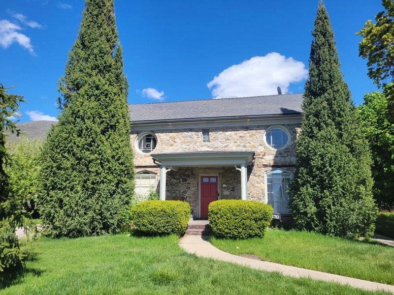
Photographed by Jeremy Snow, May 1, 2024
2. Kilbourn-Leak House
Additional keywords. National Register of Historic Places
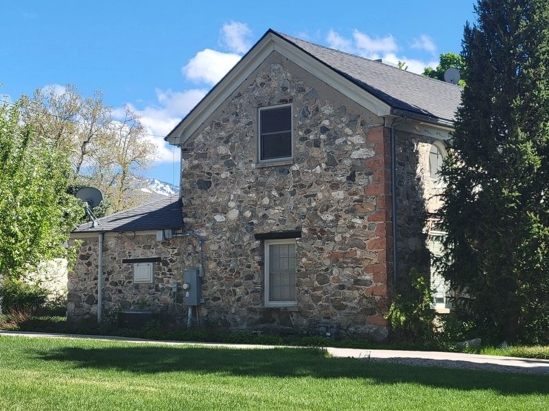
Photographed by Jeremy Snow, May 1, 2024
3. Kilbourn-Leak House Side View
Credits. This page was last revised on May 12, 2024. It was originally submitted on May 7, 2024, by Jeremy Snow of Cedar City, Utah. This page has been viewed 362 times since then and 46 times this year. Photos: 1, 2, 3. submitted on May 7, 2024, by Jeremy Snow of Cedar City, Utah. • Andrew Ruppenstein was the editor who published this page.
