Near Blevins in Hempstead County, Arkansas — The American South (West South Central)
The First Courthouse for the County of Hempstead
Territory Of Arkansas

Photographed by Jason Armstrong, April 22, 2023
1. The First Courthouse For The County Of Hempstead Marker
Erected 1986.
Topics. This historical marker is listed in these topic lists: Government & Politics • Settlements & Settlers. A significant historical year for this entry is 1836.
Location. 33° 50.952′ N, 93° 35.966′ W. Marker is near Blevins, Arkansas, in Hempstead County. It is on Arkansas 29 2 miles south of U.S. 371, on the right when traveling north. Touch for map. Marker is in this post office area: Blevins AR 71825, United States of America. Touch for directions.

Regionally, this marker is in the Gulf Coastal Plain and in Caddo Territory. It is also in the American South, specifically in the Upper South, and in the Piney Woods. Globally, it is in North America, the Western Hemisphere, the Western World, and the Anglosphere. Historically, it finds itself in what was once New Spain, the territory of the Mississippian Culture, the Louisiana Purchase, one of the Confederate States of America, and the Antebellum South.
Other nearby markers. At least 8 other markers are within 8 miles of this marker, measured as the crow flies: James Black's Shop (approx. 6.8 miles away); Homesite of Dr. Isaac Newton Jones and Elizabeth Littlejohn Jones (approx. 6.9 miles
this page online
Also see . . . Hempstead County Courthouse (1818-1824) (Clio). Full citation: Williams, Joshua. "Hempstead County Courthouse (1818-1824)." Clio: Your Guide to History. May 18, 2022. Accessed May 9, 2024.
Excerpt: On December 15, 1818, Hempstead County was formed as part of Missouri Territory. Later on March 2, 1819 it became part of Arkansas Territory. Hempstead County was one of the original five counties that formed Arkansas Territory. It stretched as far east as modern day Union County and then went all the way west to the current into portion of southeast Oklahoma and northeast Texas.(Submitted on May 10, 2024.)
The county seat of Hempstead County was established at the log home of John English that was situated along Marlbrook Creek. On June 28, 1819, twenty-five men met at his home to organize a court of common pleas for the county of Hempstead. The home of John English was situated along the main road, the Southwest Trail, that went directly through the community of Marlbrook.

Photographed by Jason Armstrong, April 22, 2023
2. The First Courthouse For The County Of Hempstead Marker
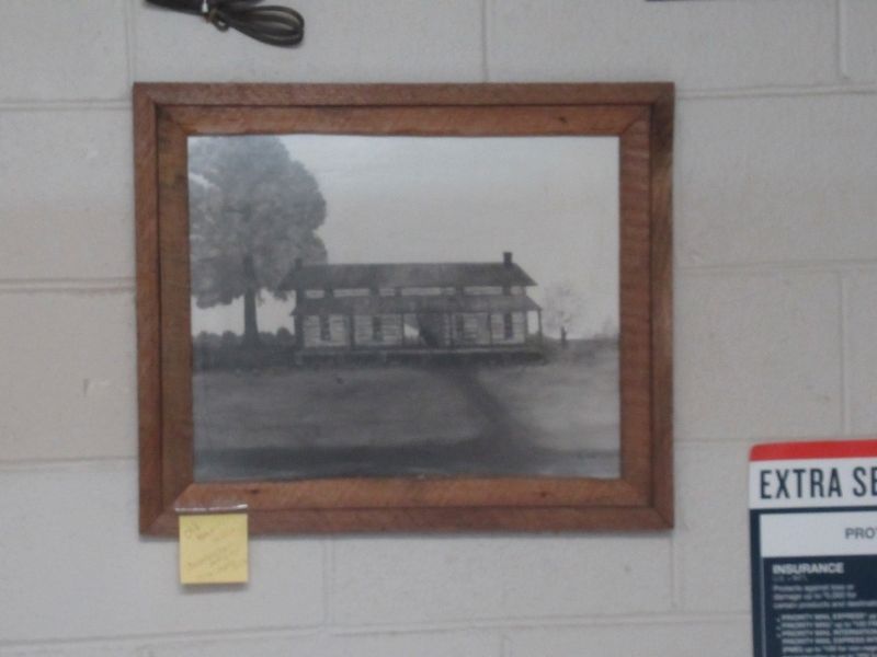
Photographed by Jason Armstrong, April 22, 2023
3. The Old Courthouse
Picture located in the Blevins Post Office just north of marker.
Credits. This page was last revised on June 28, 2025. It was originally submitted on May 8, 2024, by Jason Armstrong of Talihina, Oklahoma. This page has been viewed 374 times since then and 68 times this year. Photos: 1, 2, 3. submitted on May 8, 2024, by Jason Armstrong of Talihina, Oklahoma. • Andrew Ruppenstein was the editor who published this page.
