Sandy in Salt Lake County, Utah — The American Mountains (Southwest)
Sandy Elementary

Photographed by Jeremy Snow, May 8, 2024
1. Sandy Elementary Marker
Re-dedicated May 2009
Erected 2009.
Topics. This historical marker is listed in this topic list: Education. A significant historical year for this entry is 1908.
Location. 40° 35.584′ N, 111° 52.905′ W. Marker is in Sandy, Utah, in Salt Lake County. It is on East 8680 South, on the right when traveling north. On the lawn of Sandy Elementary. Touch for map. Marker is at or near this postal address: 272 E 8680 S, Sandy UT 84070, United States of America. Touch for directions.

Regionally, this marker is in the Wasatch Front and in Greater Salt Lake. It is also in the American Mountain West and on the Colorado Plateau. Globally, it is in North America, the Rocky Mountains, the Western Hemisphere, the Western
this page online
Other nearby markers. At least 8 other markers are within walking distance of this marker: Church Takes Root in Sandy / Early Sandy Schools (about 400 feet away, measured in a direct line); Amos and Ida Jensen House (about 600 feet away); Sandy City Bank (about 700 feet away); Sandy Tithing Office (approx. 0.2 miles away); Sandy-Alta Railroad (approx. 0.2 miles away); Mary Ellen Parmley House (approx. 0.2 miles away); Sandy Co-op (approx. ¼ mile away); ZCMI Co-op Building 1890-1908 / Sandy Co-op (approx. ¼ mile away). Touch for a list and map of all markers in Sandy.
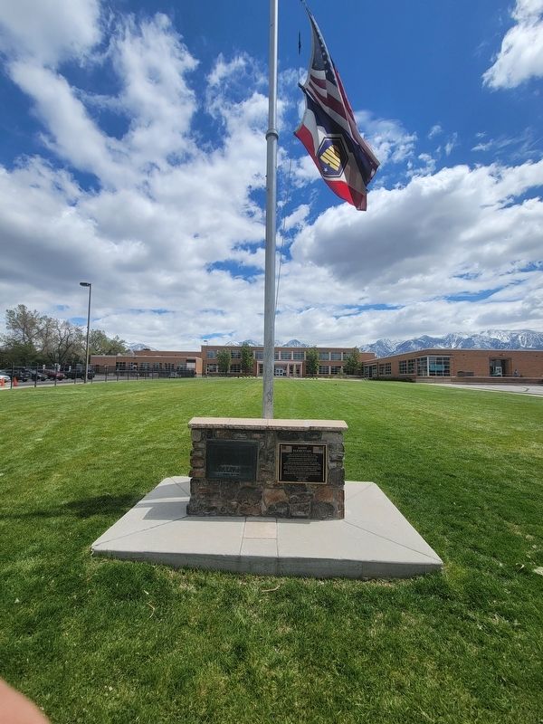
Photographed by Jeremy Snow, May 8, 2024
2. Sandy Elementary Marker

Photographed by Jeremy Snow, May 8, 2024
3. Sandy Community Memorial
The people of Sandy Community dedicate this monument to those of her brave and loyal sons and daughters who answered their country's call when freedoms we cherish were in jeopardy. In this memorial we express our deep gratitude for their contribution toward preserving our democratic way of life.
Most humbly we pay tribute to those noble patrios who paid the supreme sacrifice for God and County in the service of their native land.
Deicated Nov. 11, 1953
Credits. This page was last revised on June 12, 2024. It was originally submitted on May 9, 2024, by Jeremy Snow of Cedar City, Utah. This page has been viewed 336 times since then and 42 times this year. Photos: 1, 2, 3. submitted on May 9, 2024, by Jeremy Snow of Cedar City, Utah. • Bill Pfingsten was the editor who published this page.
