Brougham in Cumbria, England, United Kingdom — Northwestern Europe (the British Isles)
The Keep in the 14th Century
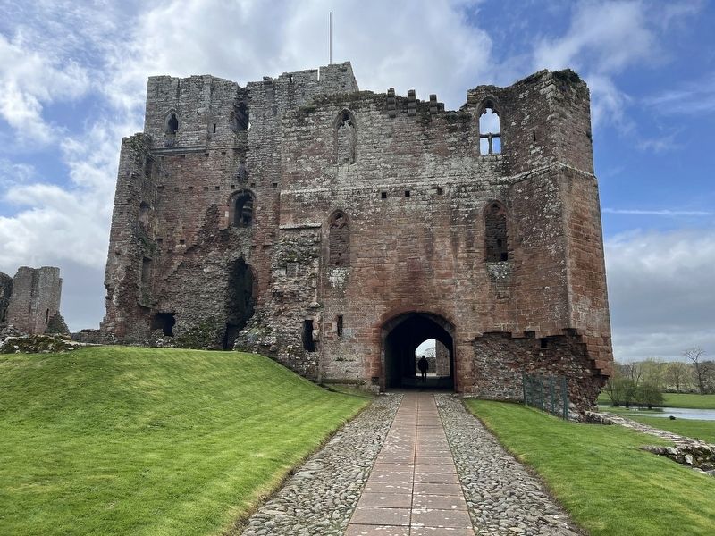
Brougham Castle
Photographed by Ray Gurganus, April 11, 2024
1. The Keep in the 14th Century Marker
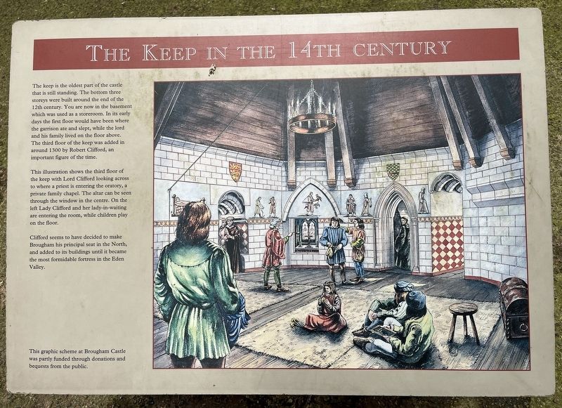
This illustration shows the third floor of the keep with Lord Clifford looking across to where a priest is entering the oratory, a private family chapel. The altar can be seen through the window in the centre. On the left Lady Clifford and her lady-in-waiting are entering the room, while children play on the floor.
Clifford seems to have decided to make Brougham his principal seat in the North, and added to its buildings until it became the most formidable fortress in the Eden Valley.
This graphic scheme at Brougham Castle was partly funded through donations and bequests from the public.
Topics. This historical marker is listed in this topic list: Forts and Castles.
Location. 54° 39.245′ N,
this page online

Regionally, this marker is in North West England. It is also in British Border Reivers Country. Globally, it is on the Atlantic Ocean, in the North Atlantic Region, in Europe, in Atlantic Europe, on one of the British Isles, in the Western World, and in the Anglosphere. Historically, it finds itself in what was once the Roman Empire.
Other nearby markers. At least 8 other markers are within 3 kilometers of this marker, measured as the crow flies: The Castle of Robert de Vieuxpont (a few steps from this marker); A Bustling Market Town (approx. 2.4 kilometers away); St Andrew's Churchyard (approx. 2.4 kilometers away); Great Dockray (approx. 2.4 kilometers away); The Board & Elbow (approx. 2.4 kilometers away); A Long Tradition (approx. 2.5 kilometers away); Sign of the Times (approx. 2.5 kilometers away); Penrith Castle (approx. 2.6 kilometers away).
Photographed by Ray Gurganus, April 11, 2024
2. Brougham Castle
Credits. This page was last revised on May 15, 2024. It was originally submitted on May 14, 2024, by Ray Gurganus of Washington, District of Columbia. This page has been viewed 128 times since then and 12 times this year. Photos: 1, 2. submitted on May 14, 2024, by Ray Gurganus of Washington, District of Columbia. • Andrew Ruppenstein was the editor who published this page.
