Beverly Hills in Los Angeles County, California — The American West (Pacific Coastal)
Beverly Hills 9/11 Memorial
Photographed by Craig Baker
1. Beverly Hills 9/11 Memorial
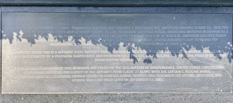
At 8:45 a.m. on September 11, 2001, terrorists hijacked and crashed a passenger jet, American Airlines Flight 11, into the North Tower of New York City's World Trade Center. As live television coverage began, Americans watched in horror as a second plane, United Airlines Flight 175, slammed into the South Tower at 9:03 a.m. At 9:38 a.m., American Airlines Flight 77 smashed into the Pentagon outside of the nation's capitol. A fourth jet, United Airlines Flight 93 bound for Washington, D.C., crashed outside of Shanksville, Pennsylvania at 10:03 a.m.
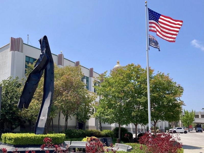
Positioned above you is a historic steel artifact that once served as a structural member at the World Trade Center site. It is supported by a Pentagon shaped base and prominently looks out, ever vigilant, towards the field of greenery representing Shanksville.
Encased in the foundation of this memorial are copies of the Declaration of Independence, United States Constitution, Gettysburg Address, and a piece of the aircraft from Flight 77 along with the captain's insignia wings.
The Beverly Hills 9/11 Memorial Garden serves to forever honor, respect, and remember
this page online
Erected 2011 by Beverly Hills Firefighter's Association, Beverly Hills Police Officer's Association, Rotary Club of Beverly Hills, and others.
Topics and series. This historical marker and memorial is listed in this topic list: 9/11 Attacks. In addition, it is included in the Rotary International, and the World Trade Center Beams series lists. A significant historical date for this entry is September 11, 2001.
Location. 34° 4.33′ N, 118° 23.957′ W. Marker is in Beverly Hills, California, in Los Angeles County. It is at the intersection of Rexford Drive and South Santa Monica Boulevard, on the right when traveling south on Rexford Drive. Touch for map. Marker is at or near this postal address: 445 N Rexford Dr, Beverly Hills CA 90210, United States of America. Touch for directions.

Regionally, this marker and memorial is in Greater Los Angeles and in the Transverse Ranges. It is also on the American Pacific Coast. Globally, it is in North America, on the Ring of Fire, on the Pacific Rim, in the Western Hemisphere, in the Western World, and in the Anglosphere.
Photographed by Craig Baker, May 19, 2024
2. Beverly Hills 9/11 Memorial
Other nearby markers. At least 8 other markers are within walking distance of this marker: Edelweiss Chocolates (about 700 feet away, measured in a direct line); Harry Harris Shoes (about 800 feet away); Beverly Hills Main Post Office (approx. 0.2 miles away); Morocco Junction (approx. 0.2 miles away); Moreton Bay Fig (approx. 0.2 miles away); Nate 'N Al (approx. 0.2 miles away); Ah Fong's (approx. ¼ mile away); Pixie Town (approx. ¼ mile away). Touch for a list and map of all markers in Beverly Hills.
Credits. This page was last revised on May 20, 2024. It was originally submitted on May 20, 2024, by Craig Baker of Sylmar, California. This page has been viewed 387 times since then and 56 times this year. Photos: 1, 2. submitted on May 20, 2024, by Craig Baker of Sylmar, California.
