Katonah in Westchester County, New York — The American Northeast (Mid-Atlantic)
The Barn Complex
John Jay Homestead
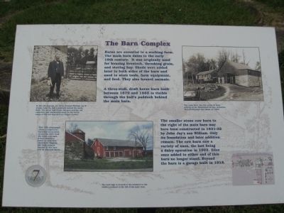
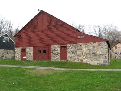
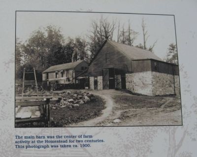
Barns are essential to a working farm. The main barn dates to the early 19th century. It was originally used for housing livestock, threshing grain, and storing hay. Sheds were added later to both sides of the barn and used to store tools, farm equipment, and feed. They also housed animals.
A three-stall, draft horse barn built between 1870 and 1885 is visible through the bullís paddock behind the main barn.
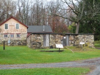
The smaller stone cow barn to the right of the main barn may have been constructed in 1831-32 by John Jayís son William. Only its foundation and later addition remain. The cow barn saw a variety of uses, the last being a dairy operation in 1922. Silos once added to either end of this barn no longer stand. Beyond the barn is a garage built in 1918.
Erected by Friends of the Jay Homestead. (Marker Number 7.)
Topics. This historical marker is listed in these topic lists: Agriculture • Notable Places. A significant historical year for this entry is 1870.
Location. 41° 15.124′ N, 73° 39.52′ W. Marker is in Katonah, New York, in Westchester County. Marker can be reached from Jay Street (New York State Route 22) 0.1 miles south of Beaver Dam Road, on the left when traveling south. Located on the grounds of the John Jay Homestead. Touch for map. Marker is at or near this postal address: 400 Route 22, Katonah NY 10536, United States of America. Touch for directions.
Other nearby markers. At least 8 other markers are within walking distance of this marker. Intergenerate Chicken Co-op (a few steps from this marker); The Stable Courtyard (within shouting distance of this marker); The Farm Managerís Cottage (within shouting distance of this marker); The Brick Lot (about 300 feet away, measured in a direct line); Bedford House (about 300 feet away); The Schoolhouse and Homestead Lawn (about 400 feet away); The John Jay Potting Sheds (about 500 feet away); The North Lawn (about 500 feet away). Touch for a list and map of all markers in Katonah.
Photographed By Michael Herrick, November 10, 2009
4. Colonel William Jay II
[ detail from the marker ]
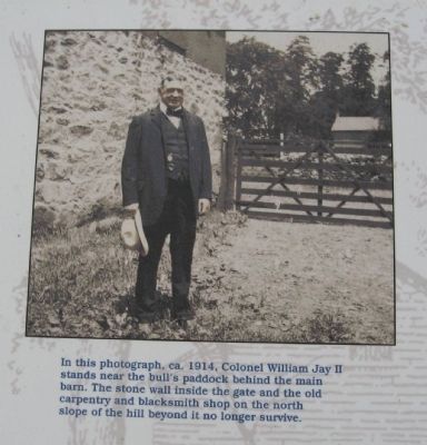
In this photograph, ca. 1914, Colonel William Jay II stands near the bullís paddock behind the main barn. The stone wall inside the gate and the old carpentry and blacksmith shop on the north slope of the hill beyond it no longer survive.
In this photograph, ca. 1914, Colonel William Jay II stands near the bullís paddock behind the main barn. The stone wall inside the gate and the old carpentry and blacksmith shop on the north slope of the hill beyond it no longer survive.
Photographed By Michael Herrick, November 10, 2009
5. Horse Barn
[ detail from the marker ]
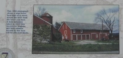
This 1952 photograph shows a large horse barn that once stood across the drive from the stone cow barn. A farm inventory taken in 1912 lists equipment, wagons, and farm animals housed in this barn and its attached sheds.
This 1952 photograph shows a large horse barn that once stood across the drive from the stone cow barn. A farm inventory taken in 1912 lists equipment, wagons, and farm animals housed in this barn and its attached sheds.
Credits. This page was last revised on June 16, 2016. It was originally submitted on November 21, 2009, by Michael Herrick of Southbury, Connecticut. This page has been viewed 720 times since then and 24 times this year. Photos: 1, 2, 3, 4, 5, 6. submitted on November 21, 2009, by Michael Herrick of Southbury, Connecticut. • Syd Whittle was the editor who published this page.
