Katonah in Westchester County, New York — The American Northeast (Mid-Atlantic)
The Carriage Drive and Roadways
John Jay Homestead
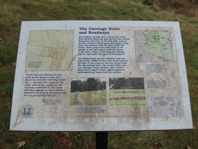
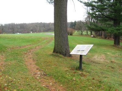
The original carriage drive entered the estate from the Post Road one mile north of the current Homestead driveway. In the mid-19th century, an allee (avenue) of European and copper beech trees was planted along the drive below the house. These grand trees still stand at the bottom of the hill along a restored section of the drive. Enjoy a walk down the sloping lane to experience this part of the property.
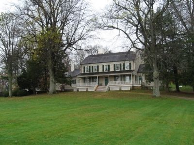
The Homestead’s current entrance road was built in the 1960’s by New York State because the sale of Jay property severed access from the old carriage drive. The modern drive now cuts through a large meadow and a sunken stone fence called a ha-ha, which separates the formal front lawns from the meadow.
“Uncle has just finished in the front of the house a haw-haw fence; he intends removing a rail one … between the house and the road, and as the nature of the haw-haw conceals it, the Lawn will then appear of great extent, and from its form & verdance will be very grateful to the eye …”
(Excerpt from a letter dated April 8, 1808, from Susan Livingston Ridley (cousin) to Maria Jay Banyer.)
Erected by Friends of the Jay Homestead. (Marker Number 12.)
Topics. This historical marker is listed in these topic lists: Agriculture • Notable Places. A significant historical date for this entry is April 8, 1855.
Location. 41° 15.082′ N, 73° 39.64′ W. Marker is in Katonah, New York, in Westchester County. Marker can be reached from Jay Street (New York State Route 22) 0.1 miles south of Beaver Dam Road, on the left when traveling south. Located on the grounds of the John Jay Homestead. Touch for map. Marker is at or near this postal address: 400 Route 22, Katonah NY 10536, United States of America. Touch for directions.
Other nearby markers. At least 8 other markers are within walking distance of this marker. The Terrace Garden (a few steps from this marker); The North Lawn (within shouting distance of this marker); The Schoolhouse and Homestead Lawn (within shouting distance of this marker); The Beech Allee (Avenue) and Stone Fences (about 300 feet away, measured in a direct line); Bedford House (about 400 feet away); John Jay Homestead (about 400 feet away); The Stable Courtyard (about 500 feet away); The Homestead Farm (about 500 feet away). Touch for a list and map of all markers in Katonah.
Photographed By Michael Herrick, November 10, 2009
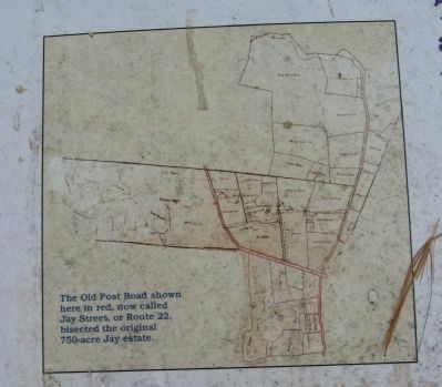
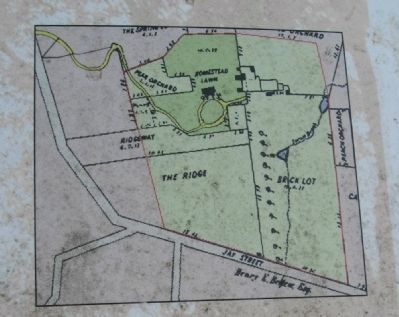
3. Map of the Carriage Drive
[ detail from the marker ]
The carriage drive, shown on yellow on this map, brought family and visitors up a winding course through the avenue, pear orchards and up the rise to the carriage circle in front of the house, presenting a dramatic first view.
The carriage drive, shown on yellow on this map, brought family and visitors up a winding course through the avenue, pear orchards and up the rise to the carriage circle in front of the house, presenting a dramatic first view.
Photographed By Michael Herrick, November 10, 2009
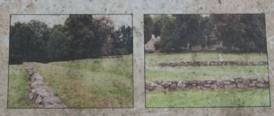
5. The Cartway and Stone Fences
[ detail from the marker ]
The cartway, seen in the center of the this (left) photograph, allowed access to other areas of the farm. Because it was sunken, its muddy track was concealed from the family’s view.
According to Jay’s niece, Susan Livingston Ridley, these stone ha-ha fences significantly increased the apparent length and beauty of the front lawn when they were first constructed in 1808.
Credits. This page was last revised on June 16, 2016. It was originally submitted on November 21, 2009, by Michael Herrick of Southbury, Connecticut. This page has been viewed 649 times since then and 22 times this year. Photos: 1, 2, 3, 4, 5, 6. submitted on November 21, 2009, by Michael Herrick of Southbury, Connecticut. • Syd Whittle was the editor who published this page.
