Katonah in Westchester County, New York — The American Northeast (Mid-Atlantic)
The Beech Allee (Avenue) and Stone Fences
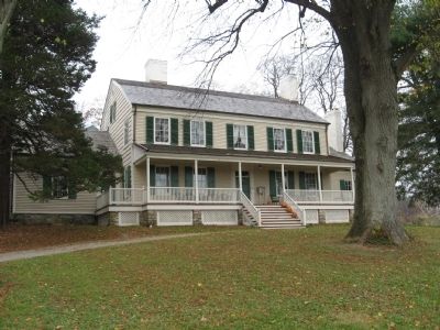
John Jay Homestead
Inscription.
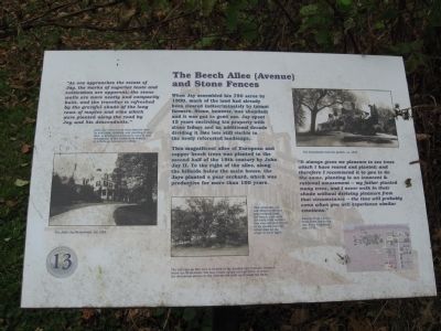
When Jay assembled his 750 acres by 1800, much of the land had already been cleared indiscriminately by tenant farmers. Stone, however, was abundant and it was put to good use. Jay spent 15 years encircling his property with stone fences and an additional decade dividing it into lots still visible in the newly reforested landscape.
This magnificent allee of European and copper beech trees was planted in the second half of the 19th century by John jay II. To the right of the allee, along the hillside below the main house, the Jays planted a pear orchard which was productive for more than 100 years.
“As one approaches the estate of Jay, the marks of superior taste and cultivation are apparent; the stone walls are more neatly and compactly built and the traveler is refreshed by the grateful shade of maples and elms which were planted along the road by jay and his descendants.”
(John Jay’s success in nurturing the land by sculpting, dividing and planting it over time, is apparent a generation later in this description of the estate from Homes of American Statesmen (1854).
“It always gives me pleasure to see trees which I have reared and planted; and therefore I recommend it to you to do the same, planting is an innocent & rational amusement – my father planted many trees, and I never walk in their shade without deriving pleasure from that circumstance – the time will probably come when you will experience similar emotions.”
(Excerpt from a letter from John Jay to his son Peter Augustus Jay, 1792.)
Erected by Friends of the Jay Homestead. (Marker Number 13.)
Topics. This historical marker is listed in these topic lists: Agriculture • Notable Places. A significant historical year for this entry is 1800.
Location. 41° 15.045′ N, 73° 39.609′ W. Marker is in Katonah, New York, in Westchester County. Marker can be reached from Jay Street (New York State Route 22) 0.1 miles Beaver Dam Road, on the left when traveling south. Located on the grounds of the John Jay Homestead. Touch for map. Marker is at or near this postal address: 400 Route 22, Katonah NY 10536, United States of America. Touch for directions.
Other nearby markers. At least 8 other markers are within walking distance of this marker. John Jay Homestead (within shouting distance of this marker); The Carriage Drive and Roadways (about 300 feet away, measured in a direct line); Bedford House (about 300 feet away); The Terrace Garden (about 300 feet away); The Homestead Farm (about 300 feet away); The North Lawn (about 400 feet away); The Glasshouse Complex and Herb Garden
(about 400 feet away); The Schoolhouse and Homestead Lawn (about 400 feet away). Touch for a list and map of all markers in Katonah.
Credits. This page was last revised on June 16, 2016. It was originally submitted on November 21, 2009, by Michael Herrick of Southbury, Connecticut. This page has been viewed 764 times since then and 21 times this year. Photos: 1, 2, 3, 4, 5, 6. submitted on November 21, 2009, by Michael Herrick of Southbury, Connecticut. • Syd Whittle was the editor who published this page.


