Near Monasterboice in County Louth, Leinster, Ireland — Mid-East (and Dublin)
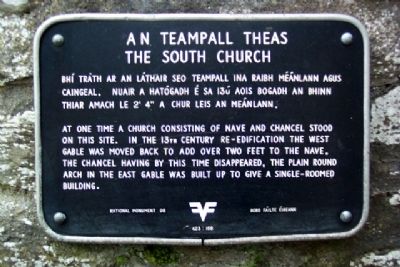
The South Church / An Teampall Theas
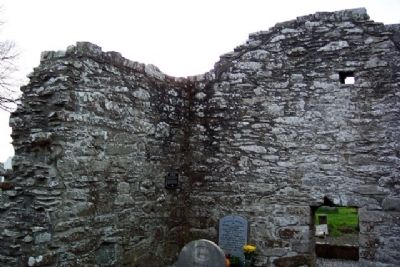
At one time a church consisting of nave and chancel stood on this site. In the 13th century re-edification the west gable was moved back to add over two feet to the nave. The chancel having by this time disappeared, the plain round arch in the east gable was built up to give a single-roomed building.
——————
Bhí tráth ar an láthair seo teampall ina raibh méánlann agus caingeal. Nuair a hathógadh é sa 13ú aois bogadh an bhinn thiar amach le 2'4" a chur leis an meánlann.
Erected by Bord Fáilte Éireann. (Marker Number 98.)
Topics. This historical marker is listed in these topic lists: Cemeteries & Burial Sites • Churches & Religion • Notable Places • Settlements & Settlers.
Location. 53° 46.657′ N, 6° 25.066′ W. Marker is near Monasterboice, Leinster, in County Louth. Marker is on the south interior wall of the South Church, in the Monasterboice monastery site, about 0.8 miles west of the village of Monasterboice, and about 0.5 miles WNW of the intersection of Tower View road with routes R132, N1, and M1. Touch for map. Touch for directions.
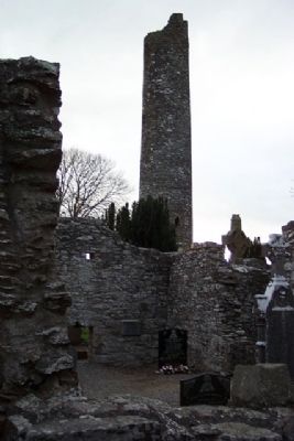
Other nearby markers. At least 8 other markers are within 13 kilometers of this marker, measured as the crow flies. The North Church / An Teampall Thuaidh (a few steps from this marker); Round Tower / An Cloigtheach (within shouting distance of this marker); Monasterboice / Mainistir Bhuithe (within shouting distance of this marker); Knowth / Cnogbha (approx. 9.7 kilometers away); The Woodhenge/Pit circle / The Winter Soltice (approx. 10 kilometers away); Slane Abbey (approx. 10.6 kilometers away); Saint Patrick on the Hill of Slane (approx. 10.6 kilometers away); Duleek 1916 - 1981 Hunger Strike Monument (approx. 12.9 kilometers away). Touch for a list and map of all markers in Monasterboice.
Also see . . . Monasterboice. (Submitted on November 21, 2009.)
Credits. This page was last revised on January 1, 2024. It was originally submitted on November 21, 2009, by William Fischer, Jr. of Scranton, Pennsylvania. This page has been viewed 1,083 times since then and 11 times this year. Photos: 1, 2, 3. submitted on November 21, 2009.


