
Jermyn in Lackawanna County, Pennsylvania — The American Northeast (Mid-Atlantic)
6 Jermyn Churches
2003
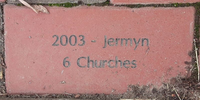
Photographed by William Fischer, Jr., May 19, 2024
1. 6 Jermyn Churches Marker
Preaching Salvation In Christ
since 1883
P.M. Church
763 Jefferson Ave.
Est. Nov. 12 1892
St. James St. George Episcopal Church
Founded 1872
St. Michael's Orthodox Church
Established 1909
1st United Methodist Church,
Jermyn PA
Established 1872
Sac[red] Heart of Mary Ch[urch]
Est November 18 1889
By Most Rev. Wm OHara
Topics. This historical marker is listed in this topic list: Religion & Religious Structures. A significant historical date for this entry is November 18, 1889.
Location. 41° 31.711′ N, 75° 32.99′ W. Marker is in Jermyn, Pennsylvania, in Lackawanna County. It is on Jefferson Avenue south of Bacon Street, on the left when traveling south. On the Jermyn Community Center grounds. Touch for map. Marker is at or near this postal address: 440 Jefferson Avenue, Jermyn PA 18433, United States of America. Touch for directions.

Regionally, this marker is in the Wyoming Valley and in Greater Scranton and Wilkes-Barre. It is also in the American Northeast, in the Mid-Atlantic, in Appalachia, and specifically in Northern Appalachia. Globally, it is in North America, the Western Hemisphere, the
this page online
Other nearby markers. At least 8 other markers are within walking distance of this marker: John Jermyn (here, next to this marker); Jermyn Memorial Garden Circles of Life (here, next to this marker); War Memorial (a few steps from this marker); The Founders of First Aid in America (a few steps from this marker); World War Memorial (approx. 0.2 miles away); World War I Veterans Park (approx. 0.2 miles away); The Borough of Jermyn (approx. ¼ mile away); First Aid Pioneer (approx. 0.4 miles away). Touch for a list and map of all markers in Jermyn.

Photographed by William Fischer, Jr., May 19, 2024
2. 6 Jermyn Churches Marker

Photographed by William Fischer, Jr., May 19, 2024
3. 6 Jermyn Churches Marker
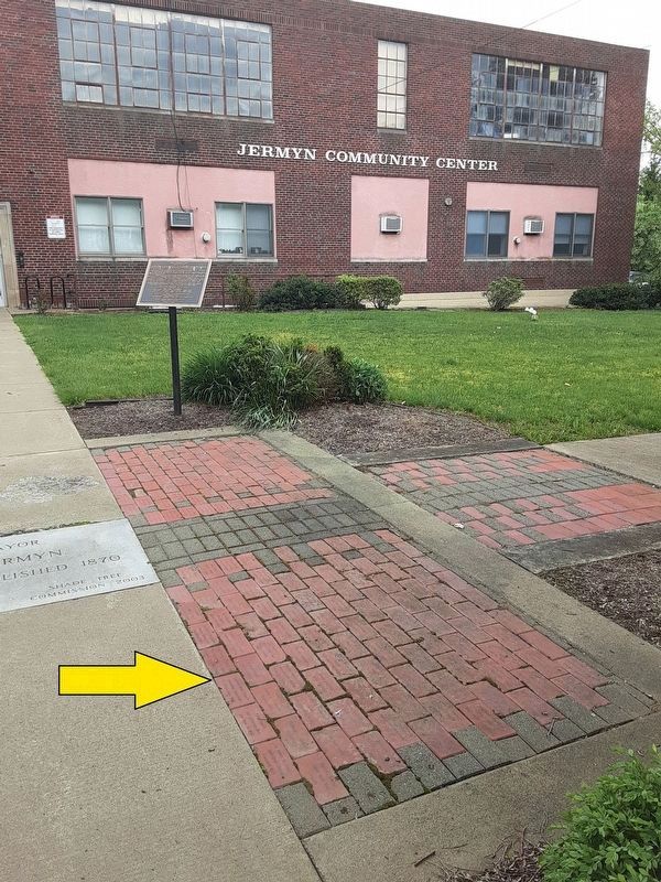
Photographed by William Fischer, Jr., May 19, 2024
4. 6 Jermyn Churches Markers
Credits. This page was last revised on May 24, 2024. It was originally submitted on May 24, 2024, by William Fischer, Jr. of Reynoldsburg, Ohio. This page has been viewed 259 times since then and 15 times this year. Photos: 1, 2, 3, 4. submitted on May 24, 2024, by William Fischer, Jr. of Reynoldsburg, Ohio.
