Altavista in Campbell County, Virginia — The American South (Mid-Atlantic)
Founders Square
Photographed by Cosmos Mariner, May 11, 2024
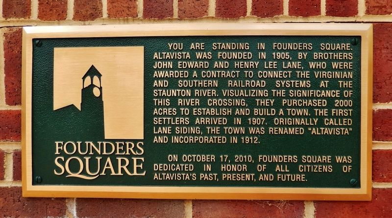
1. Founders Square Marker
You are standing in Founders Square. Altavista was founded in 1905, by brothers John Edward and Henry Lee Lane, who were awarded a contract to connect the Virginian and Southern Railroad systems at the Staunton River. Visualizing the significance of this river crossing, they purchased 2000 acres to establish and build a town. The first settlers arrived in 1907. Originally called Lane Siding, the town was renamed “Altavista” and incorporated in 1912.
On October 17, 2010, Founders Square was dedicated in honor of all citizens of Altavista’s past, present, and future.
Topics. This historical marker is listed in these topic lists: Industry & Commerce • Railroads & Streetcars • Settlements & Settlers. A significant historical year for this entry is 1905.
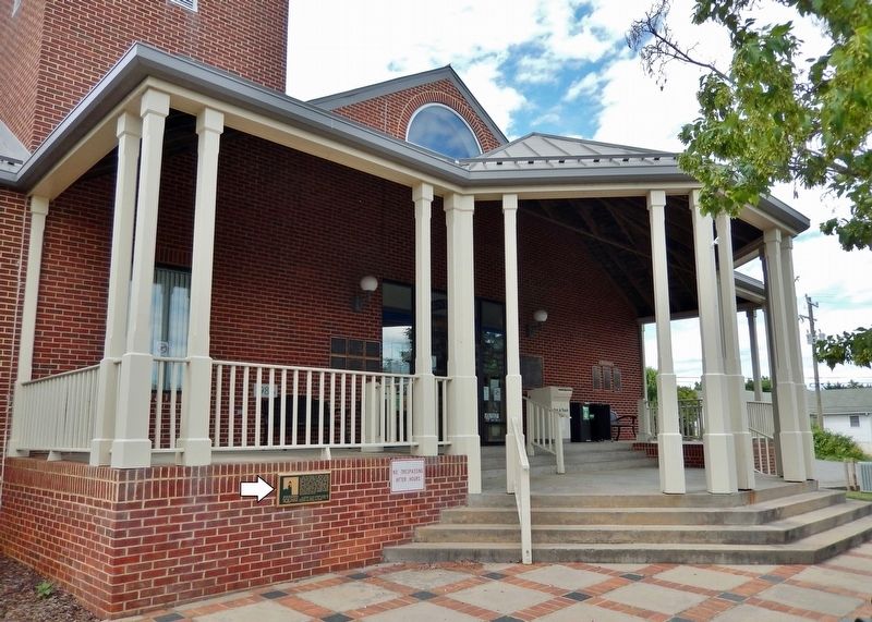
Location. 37° 6.591′ N, 79° 17.474′ W. Marker is in Altavista, Virginia, in Campbell County. It can be reached from the intersection of Washington Street and Broad Street, on the left when traveling east. The marker is mounted at waist-level on the front wall of the Staunton River Memorial Library. Touch for map. Marker is at or near this postal address: 500 Washington
this page online

Regionally, this marker is in the Piedmont and in Central Virginia. It is also in the American South and specifically in the Upper South. Globally, it is in North America, the Western Hemisphere, the Western World, and the Anglosphere. Historically, it finds itself in what was once the territory of the Mississippian Culture, one of the original Thirteen Colonies, one of the Confederate States of America, and the Antebellum South.
Other nearby markers. At least 8 other markers are within walking distance of this marker: Colonel Charles Lynch (a few steps from this marker); Colonel Frank Board, MD (a few steps from this marker); General James Dearing (a few steps from this marker); Campbell Lodge 316 (within shouting distance of this marker); Founding the Town of Altavista (about 300 feet away, measured in a direct line); 1928 Bridge Between Hurt and Altavista (approx. 0.2 miles away); Route of Old "97" (approx. 0.2 miles away); Purple Heart Monument (approx. ¼ mile away). Touch for a list and map of all markers in Altavista.
Also see . . .
1. Altavista, Virginia (Wikipedia).

Photographed by C. Ryan Dodson, September 5, 2026
2. Founders Square Marker
In 1905, the Lane Company had been awarded a contract to build 51 kilometers of railroad between Leesville and The Mansion for the Tidewater Railway Company, which was incorporated by Campbell County native William Nelson Page and financier and industrialist Henry Huttleston Rogers. This railroad would intersect with the Southern Railway.(Submitted on May 25, 2024, by Cosmos Mariner of Cape Canaveral, Florida.)The Lane Company, noticing the intersection between two important railways, bought 2000 acres and started planning a town called Lane's Siding. The first settlers arrived in the town of Lane's Siding in a small red caboose on September 9, 1907.
2. Town History (www.altavistava.gov). Excerpt:
The name for the Lane’s new community came from the name of their old farm in Albemarle County. Engineers were hired to lay out a town with streets and lots, complete with water, sewer, telephone service, and electric lines. Settlement was encouraged by the awarding of free lots. By 1912 the new Town of Altavista was incorporated. That year also saw the formation of the Lane Company, maker of the famous Lane cedar chests.(Submitted on May 25, 2024, by Cosmos Mariner of Cape Canaveral, Florida.)From its very beginning as a box manufacturer, the Lane Company would become one of Altavista’s major employers.Photographed by Cosmos Mariner, May 11, 20243. Founders Square MarkerThe marker is mounted on the front wall of the Staunton River Memorial Library, facing Washington Street.

Photographed by Cosmos Mariner, May 11, 2024
4. Founders Square
Looking northwest across Founders Square; Staunton River Memorial Library is in the background.
Credits. This page was last revised on September 16, 2026. It was originally submitted on May 25, 2024, by Cosmos Mariner of Cape Canaveral, Florida. This page has been viewed 276 times since then and 34 times this year. Photos: 1. submitted on May 25, 2024, by Cosmos Mariner of Cape Canaveral, Florida. 2. submitted on September 11, 2026, by C. Ryan Dodson of Danville, Virginia. 3, 4. submitted on May 25, 2024, by Cosmos Mariner of Cape Canaveral, Florida.
