Moulay Lyazid in Marrakesh, Marrakesh-Safi, Morocco — Africa (Northern Africa)
Walls of Marrakesh
Photographed by J. Makali Bruton, May 19, 2024
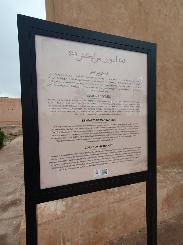
1. Walls of Marrakesh Marker

أسوار مراكش
1126 علبريد الزعيم المرابطي علرين يوسف حيث أحاط المدينة بدائرة من الأسوان ومن المحتمل أن يكون السبب وراء هذا القرار هو الخوف من التهديدات القادمة من دولة الموحدين، وبحسب ما ورد فقد
this page online
Photographed by J. Makali Bruton, May 19, 2024
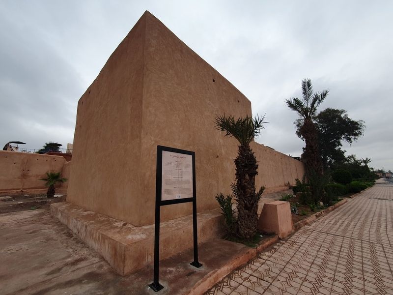
2. Walls of Marrakesh and Marker
Tamazight text not transcribed
Remparts de Marrakech
Les Remparts de Marrakech ont été construits pour la première fois en 1126 par le chef Almoravide Ali Ben Youssef, qui a entouré la ville d'un cercle de murs defencifs, et cette décision a probablement été causée par la peur des menaces de l'État Almohade, et c'est apparemment le juge de Qortoba, Walid Ben Rochd, qui a persuadé l'émir almoravide de les construire. Après l'entrée des Almohades dans la ville, la deuxième partie de celle-ci a été construite pour protéger la Kasbah au sud à la fin du XIIIe siècle après JC pour inclure la zone nord entourant la Zaouïa Abbasside et à l'époque de l'État Saadien la partie orientale des murs de la ville a été construite, les remparts du palais Badii et Bab Hmer et ceux entourant le palais de la Bahia.
Walls of Marrakech
The walls of Marrakesh were first built in 1126 by the Almoravid leader Ali Ben Youssef, who ordered to surround the city by a circle of walls, and this decision was probably caused by fear of threats from the Almohad state, and it was reported that the judge of Qortoba, Walid Ben Roshd, who persuaded the Almoravid Emir to build the walls. After the entry of the Almohads to the city, the second part of the walls was built to protect the Kasbah in the south at the end of the thirteenth century AD to include the northern area surrounding the Abbasid Zawiya. However, in the era of the Saadian state, the eastern part of the walls was built; the walls of the Badii Palace and Bab Hmer and those surrounding the Bahia Palace.
Topics. This historical marker is listed in these topic lists: Architecture • Forts and Castles.
Location. 31° 36.767′ N, 7° 59.375′ W. Marker is in Marrakesh, Marrakesh-Safi. It is in Moulay Lyazid. It is on Route d'Ourika north of Rue Bab Irhli, on the right when traveling north. Touch for map. Marker is in this post office area: Marrakesh, Marrakesh-Safi 40000, Morocco. Touch for directions.

Regionally, it is in Africa, North Africa, The Maghreb, and in a coastal Mediterranean country. Historically, it finds itself in what was once Portuguese colonies, a Spanish colony, and specifically a French colony.
Other nearby markers. At least 8 other markers are within walking distance of this marker: Saadian Tombs (approx. half a kilometer away); Moulay El Yazid Mosque Square (approx. half a kilometer away); West Building (approx. half a kilometer away); Bab Agnaw (approx. half a kilometer away); Room of Lalla Massaouda (approx. half a kilometer away); Badia Palace (approx. 0.8 kilometers away); Place Qzadriya (approx. 0.9 kilometers away); Youssef Ibn Tachfine Mausoleum (approx. 0.9 kilometers away). Touch for a list and map of all markers in Marrakesh.
Also see . . . Walls of Marrakesh at Wikipedia. (Submitted on May 27, 2024, by J. Makali Bruton of Washington, District of Columbia.)
Credits. This page was last revised on May 29, 2024. It was originally submitted on May 27, 2024, by J. Makali Bruton of Washington, District of Columbia. This page has been viewed 188 times since then and 15 times this year. Photos: 1, 2. submitted on May 27, 2024, by J. Makali Bruton of Washington, District of Columbia.
