Boonville in Cooper County, Missouri — The American Midwest (Upper Plains)
The End of the Line

Photographed by Jason Voigt, May 14, 2024
1. The End of the Line Marker
Caboose is a nautical term of Dutch origin that means "ship's galley." This "galley' with it's makeshift crow's nest (called a cupola), was an essential part of trains as early as the 1840s. Modern technology began to replace the duties of the brakeman and watchman in the 1980s, and today, cabooses are rarely used for more than exhibitions. This decline led to a number of cabooses being scrapped, sold or donated to museums, communities and private individuals. Along or near Katy Trail State Park, cabooses can be seen in Clinton, Windsor, Sedalia, Boonville, New Franklin, Hartsburg, Marthasville,
this page online
The last freight train to leave Boonville on Katy tracks was Oct, 14, 1986. Caboose #134 was acquired by the Union Pacific Railroad along with other holdings of the Missouri-Kansas-Texas Railroad in 1988. Train enthusiast and members of the Boonville community arraigned for the acquisition of this caboose in 1997. Together, they re-laid the track in front of the depot, relocated the caboose, and with the help of inmates of Boonville Correctional Center, sanded and repainted it.
Today, Caboose #134 serves as the Boonville Katy Caboose Railroad Museum, which exhibits artifacts and photographs of railroading in the local area. For tours and current hours of operation, visit the Boonville Chamber of Commerce office located adjacent to the caboose at the north end of the depot.
Erected by Missouri Department of Natural Resources & Katy Trail State Park.
Topics and series. This historical marker is listed in this topic list: Railroads & Streetcars. In addition, it is included in the Katy Trail State Park series list. A significant historical year for this entry is 1968.
Location. 38° 58.494′ N, 92° 44.999′ W. Marker
Photographed by Jason Voigt, May 14, 2024
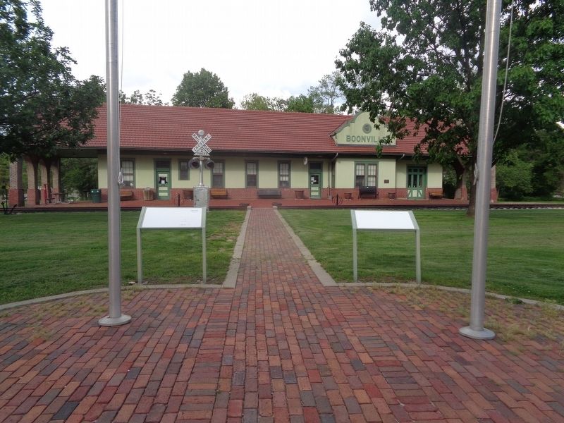
2. The End of the Line Marker
Marker is on the left, in front of the Boonville Visitors Center (formerly a depot)

Regionally, this marker is in the Missouri River Corridor. It is also in the American Midwest, in the Lewis & Clark Corridor, in the Corn Belt, and on the Santa Fe Trail Corridor. Globally, it is in North America, the Western Hemisphere, the Western World, and the Anglosphere. Historically, it finds itself in what was once the territory of the Mississippian Culture, the Louisiana Purchase, and the Antebellum South.
Other nearby markers. At least 8 other markers are within walking distance of this location: Boonville Depot (here, next to this marker); "Caboose #134" (a few steps from this marker); History of Boonville (about 500 feet away, measured in a direct line); Boonville to New Franklin (about 500 feet away); From Boone's Lick to Boonslick (about 500 feet away); Boonville to Pilot Grove (about 500 feet away); 25th Anniversary (about 500 feet away); High Street Office Building (approx. 0.3 miles away). Touch for a list and map of all markers in Boonville.
Credits. This page was last revised on May 28, 2024. It was originally submitted on May 28, 2024, by Jason Voigt of Glen Carbon, Illinois. This page has been viewed 323 times since then and 26 times this year. Photos: 1, 2. submitted on May 28, 2024, by Jason Voigt of Glen Carbon, Illinois.
Editor’s want-list for this marker. a photo of the marker before it faded • Can you help?
