Boonville in Cooper County, Missouri — The American Midwest (Upper Plains)
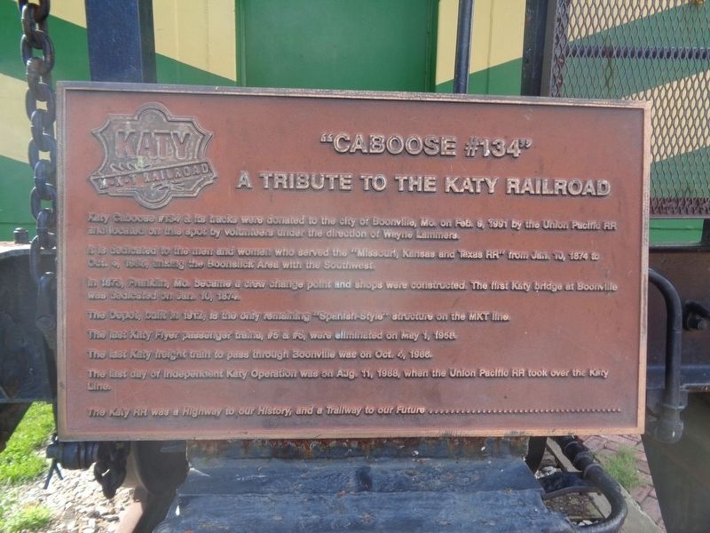
"Caboose #134"
A Tribute to the Katy Railroad
Photographed by Jason Voigt, May 14, 2024
1. "Caboose Marker
It is dedicated to the men and women who served the "Missouri, Kansas and Texas RR" from Jan. 10, 1874 to Oct. 4, 1986, linking the Boonslick Area with the Southwest.
In 1873, Franklin, Mo. became a crew change point and shops were constructed. The first Katy bridge at Boonville was dedicated on Jan. 10, 1874.
The Depot, built in 1912, is the only remaining "Spanish-Style" structure on the MKT line.
The last Katy Flyer passenger trains, #5 & #6, were eliminated on May 1, 1958.
The last Katy freight train to pass through Boonville was on Oct. 4, 1988.
The last day of Independent Katy Operation was on Aug. 11, 1988, when the Union Pacific RR took over the Katy Line.
The Katy RR was a Highway to our History, and a trailway to our Future ...................
Topics and series. This historical marker is listed in these topic lists: Architecture • Railroads & Streetcars. In addition, it is included in the
this page online
Location. 38° 58.504′ N, 92° 44.995′ W. Marker is in Boonville, Missouri, in Cooper County. It is on 1st Street north of Spring Street, on the right when traveling north. Touch for map. Marker is at or near this postal address: 134 1st St, Boonville MO 65233, United States of America. Touch for directions.

Regionally, this marker is in the Missouri River Corridor. It is also in the American Midwest, in the Lewis & Clark Corridor, in the Corn Belt, and on the Santa Fe Trail Corridor. Globally, it is in North America, the Western Hemisphere, the Western World, and the Anglosphere. Historically, it finds itself in what was once the territory of the Mississippian Culture, the Louisiana Purchase, and the Antebellum South.
Other nearby markers. At least 8 other markers are within walking distance of this marker: The End of the Line (a few steps from this marker); Boonville Depot (a few steps from this marker); History of Boonville (about 500 feet away, measured in a direct line); Boonville to New Franklin (about 500 feet away); From Boone's Lick to Boonslick

Photographed by Jason Voigt, May 14, 2024
2. "Caboose #134" Marker
Marker is on the back of the caboose
Also see . . . Katy Trail State Park (Missouri State Parks). (Submitted on May 28, 2024, by Jason Voigt of Glen Carbon, Illinois.)
Photographed by Jason Voigt, May 14, 2024
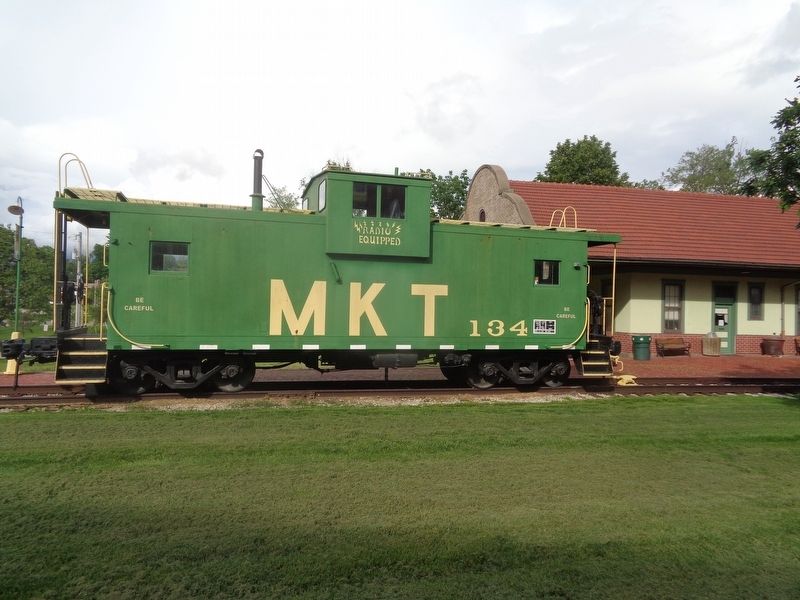
3. "Caboose #134" Marker
Marker and caboose are in front of the Boonville Visitors Center, formerly a train depot
Credits. This page was last revised on May 28, 2024. It was originally submitted on May 28, 2024, by Jason Voigt of Glen Carbon, Illinois. This page has been viewed 398 times since then and 49 times this year. Photos: 1, 2, 3. submitted on May 28, 2024, by Jason Voigt of Glen Carbon, Illinois.
