Near Tensaw in Baldwin County, Alabama — The American South (East South Central)
Wells
| — | Fort Mims Historical and Archaeological Site | — |
Photographed by Mark Hilton, May 28, 2024
1. Wells Marker
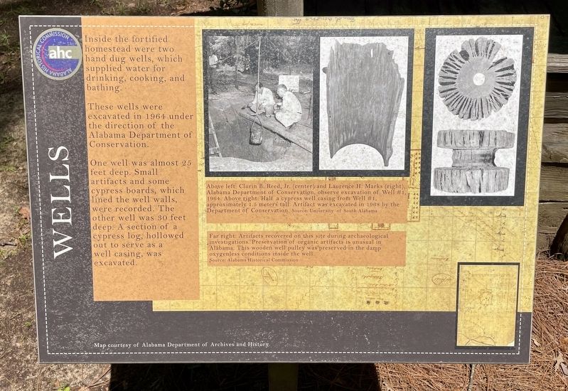
Inside the fortified homestead were two hand dug wells, which supplied water for drinking, cooking, and bathing.
These wells were excavated in 1964 under the direction of the Alabama Department of Conservation.
One well was almost 25 feet deep. Small artifacts and some cypress boards, which lined the well walls, were recorded. The other well was 30 feet deep: A section of a cypress log, hollowed out to serve as a well casing, was excavated.
Captions:
Above left: Clurin B. Reed, Jr. (center) and Laurence H. Marks (right), Alabama Department of Conservation, observe excavation of Well #1, 1964. Above right: Half a cypress well casing from Well #1, approximately 1.5 meters tall. Artifact was excavated in 1968 by the Department of Conservation.
Source: University of South Alabama
Far right: Artifacts recovered on this site during archaeological investigations. Preservation of organic artifacts is unusual in Alabama. This wooden well pulley was preserved in the damp oxygenless conditions inside the well.
Source: Alabama Historical Commission
Erected 2022 by the Alabama Historical
this page online
Topics. This historical marker is listed in this topic list: Forts and Castles. A significant historical year for this entry is 1964.
Location. 31° 10.814′ N, 87° 50.282′ W. Marker is near Tensaw, Alabama, in Baldwin County. It can be reached from Fort Mims Road 0.4 miles north of Boatyard Road, on the right when traveling west. Located with Fort Mims site. Touch for map. Marker is at or near this postal address: 1813 Fort Mims Rd, Stockton AL 36579, United States of America. Touch for directions.

Regionally, this marker is on the Gulf Coast and in the Mobile Bay area. It is also in the American South, specifically in the Deep South, and on the Gulf Coast. Globally, it is in North America, a Gulf of Mexico state, the Western Hemisphere, the Western World, and the Anglosphere. Historically, it finds itself in what was once New Spain, the Viceroyalty of New France, the territory of the Mississippian Culture, one of the Confederate States of America, and the Antebellum South.
Other nearby markers. At least 8 other markers are within walking distance of this marker: The Kitchen (a few steps from this marker);

Photographed by Mark Hilton, May 28, 2024
2. Wells Marker
Photographed by Mark Hilton, July 25, 2015
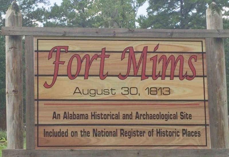
3. Fort Mims Site sign.
Credits. This page was last revised on June 4, 2024. It was originally submitted on May 29, 2024, by Mark Hilton of Montgomery, Alabama. This page has been viewed 362 times since then and 47 times this year. Photos: 1, 2, 3. submitted on May 29, 2024, by Mark Hilton of Montgomery, Alabama.
