
Augusta in Bracken County, Kentucky — The American South (East South Central)
Whitehall
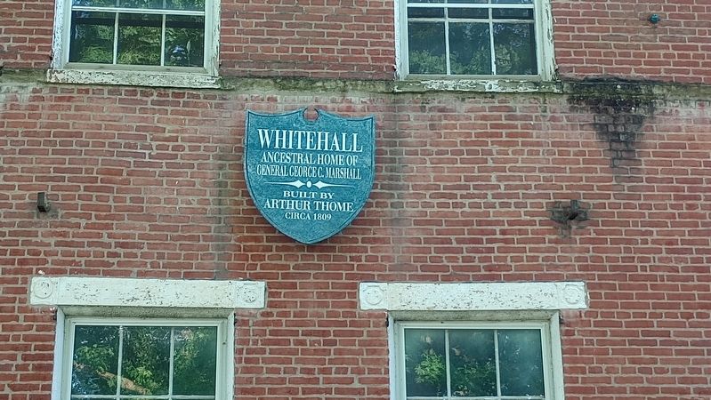
Photographed by Craig Doda, May 25, 2024
1. Whitehall Marker
Built by Arthur Thome circa 1809
Topics. This historical marker is listed in this topic list: Architecture. A significant historical year for this entry is 1809.
Location. 38° 46.373′ N, 84° 0.373′ W. Marker is in Augusta, Kentucky, in Bracken County. It is at the intersection of Elizabeth Street and Everett Jones Drive, on the left when traveling north on Elizabeth Street. Touch for map. Marker is at or near this postal address: 206 Elizabeth Street, Augusta KY 41002, United States of America. Touch for directions.

Regionally, this marker is in Kentucky’s Outer Bluegrass. It is also in the American South, specifically in the Upper South, and in the Ohio River Valley. Globally, it is in North America, the Western Hemisphere, the Western World, and the Anglosphere. Historically, it finds itself in what was once the territory of the Mississippian Culture and also the Antebellum South.
Other nearby markers. At least 8 other markers are within walking distance of this marker: Wells - Myers Home (within shouting distance of this marker); V.F.W. Post 9535 Veterans Memorial
this page online

Photographed by Craig Doda, May 25, 2024
2. Whitehall Marker
Credits. This page was last revised on May 31, 2024. It was originally submitted on May 29, 2024, by Craig Doda of Napoleon, Ohio. This page has been viewed 522 times since then and 28 times this year. Photos: 1, 2. submitted on May 29, 2024, by Craig Doda of Napoleon, Ohio. • James Hulse was the editor who published this page.
