Near Tensaw in Baldwin County, Alabama — The American South (East South Central)
The North Wall and Loom House
| — | Fort Mims Historical and Archaeological Site | — |
Photographed by Mark Hilton, May 28, 2024
1. The North Wall and Loom House Marker
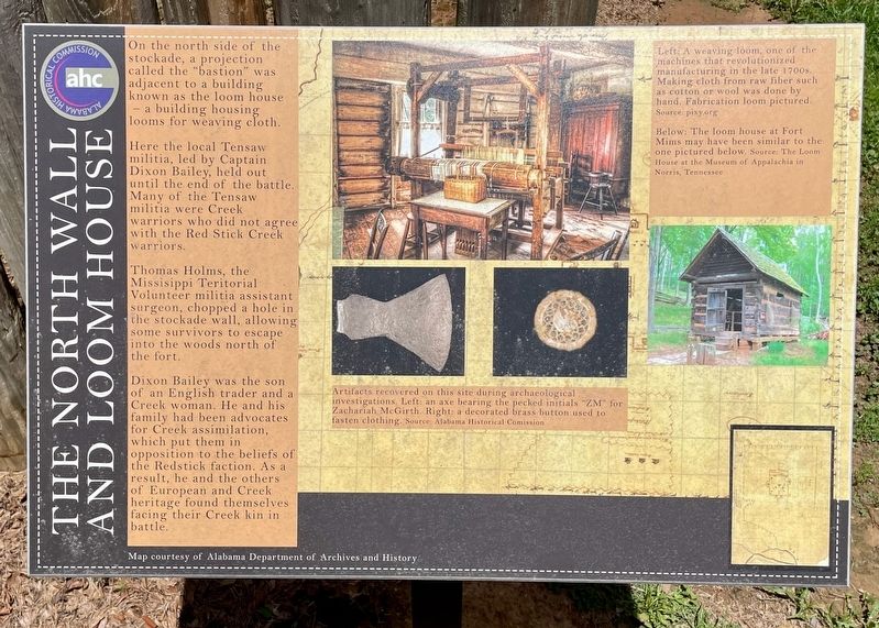
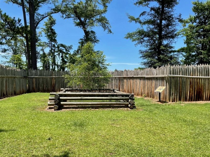
On the north side of the stockade, a projection called the "bastion" was adjacent to a building known as the loom house - a building housing looms for weaving cloth.
Here the local Tensaw militia, led by Captain Dixon Bailey, held out until the end of the battle. Many of the Tensaw militia were Creek warriors who did not agree with the Red Stick Creek warriors.
Thomas Holms, the Missisippi Teritorial Volunteer militia assistant surgeon, chopped a hole in the stockade wall, allowing some survivors to escape into the woods north of the fort.
Dixon Bailey was the son of an English trader and a Creek woman. He and his family had been advocates for Creek assimilation, which put them in opposition to the beliefs of the Redstick faction. As a result, he and the others of European and Creek heritage found themselves facing their Creek kin in battle.
Captions:
Middle:
Artifacts recovered on this site during archaeological investigations. Left: an axe bearing the pecked initials "ZM" for Zachariah McGirth. Right: a decorated brass button used to fasten clothing.
Source: Alabama Historical Commission
Top right:
Left: A weaving loom, one of the machines that revolutionized manufacturing in the late 1700s. Making cloth from raw fiber such as cotton or wool was done by hand. Fabrication loom pictured.
Source: pixy.org
Below: The loom house at Fort Mims may have been similar to the one pictured below.
Source: The Loom House at the Museum of Appalachia in Norris, Tennessee
Erected 2022
this page online
Topics. This historical marker is listed in this topic list: Forts and Castles.
Location. 31° 10.85′ N, 87° 50.278′ W. Marker is near Tensaw, Alabama, in Baldwin County. It can be reached from Fort Mims Road half a mile north of Boatyard Road, on the right when traveling west. Located at north side of Fort Mims site. Touch for map. Marker is at or near this postal address: 1813 Fort Mims Rd, Stockton AL 36579, United States of America. Touch for directions.

Regionally, this marker is on the Gulf Coast and in the Mobile Bay area. It is also in the American South, specifically in the Deep South, and on the Gulf Coast. Globally, it is in North America, a Gulf of Mexico state, the Western Hemisphere, the Western World, and the Anglosphere. Historically, it finds itself in what was once New Spain, the Viceroyalty of New France, the territory of the Mississippian Culture, one of the Confederate States of America, and the Antebellum South.
Other nearby markers. At least 8 other markers are within walking distance of this marker: Main Compound
Photographed by Mark Hilton, May 28, 2024
2. The North Wall and Loom House Marker
Projection in wall can be seen behind replica footprint of Loom House.
Photographed by Mark Hilton, July 25, 2015
3. Fort Mims Site sign.
Credits. This page was last revised on June 4, 2024. It was originally submitted on May 29, 2024, by Mark Hilton of Montgomery, Alabama. This page has been viewed 278 times since then and 18 times this year. Photos: 1, 2, 3. submitted on May 29, 2024, by Mark Hilton of Montgomery, Alabama.
