Valkenburg in Valkenburg aan de Geul, Limburg, Netherlands — Northwestern Europe
Schuilbunker
⎯⎯⎯
Air Raid Shelter
| — | 75 jaar Bevrijding fotoroute | — |
Photographed by Andrew Ruppenstein, May 29, 2024
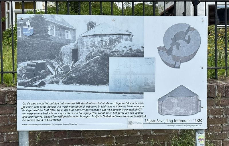
1. Schuilbunker / Air Raid Shelter Marker

This air raid shelter stood on the site of the current house number 102 until the end of the 1950s. It was probably built on behalf of Commander Neumann of the Organization Todt (a German (Nazi) organization), who lived in the house to the left. This type of bunker is a typical OT design and was intended for supervisors of construction projects, so that they could get to safety in the event of an enemy air attack. Two copies are known in the Netherlands. The other was in Culemborg.
Erected 2019. (Marker Number 16/20.)
Topics and series. This memorial is listed in these
this page online
Location. 50° 52.299′ N, 5° 49.236′ E. Memorial is in Valkenburg, Limburg, in Valkenburg aan de Geul. It is on Broekhem, on the left when traveling east. Touch for map. Memorial is at or near this postal address: Broekhem 102, Valkenburg, Limburg 6301 HE, Netherlands. Touch for directions.

Regionally, it is in Europe, the European Union, Atlantic Europe, the Benelux Low Countries, the Schengen Area, Western Europe, and the Western World. Historically, it finds itself in what was once the Roman Empire and specifically also the Holy Roman Empire.
Other nearby markers. At least 8 other markers are within walking distance of this marker: Sint-Josephkerk / Saint Joseph Church (approx. 0.3 kilometers away); Kruitmolen/ Gunpowder Mill (approx. 0.7 kilometers away); Romeinse Katakomben / Roman Catacombs (approx. 0.7 kilometers away); De Via Belgica (approx. 0.7 kilometers away); Werktuigen van Vuursteen / Flint Tools (approx.
Photographed by Andrew Ruppenstein, May 29, 2024
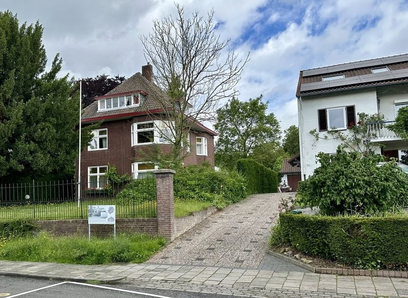
2. Schuilbunker / Air Raid Shelter Marker - wide view
Credits. This page was last revised on June 1, 2024. It was originally submitted on June 1, 2024, by Andrew Ruppenstein of Lamorinda, California. This page has been viewed 120 times since then and 4 times this year. Photos: 1, 2. submitted on June 1, 2024, by Andrew Ruppenstein of Lamorinda, California.
