
Westerville in Franklin County, Ohio — The American Midwest (Great Lakes)
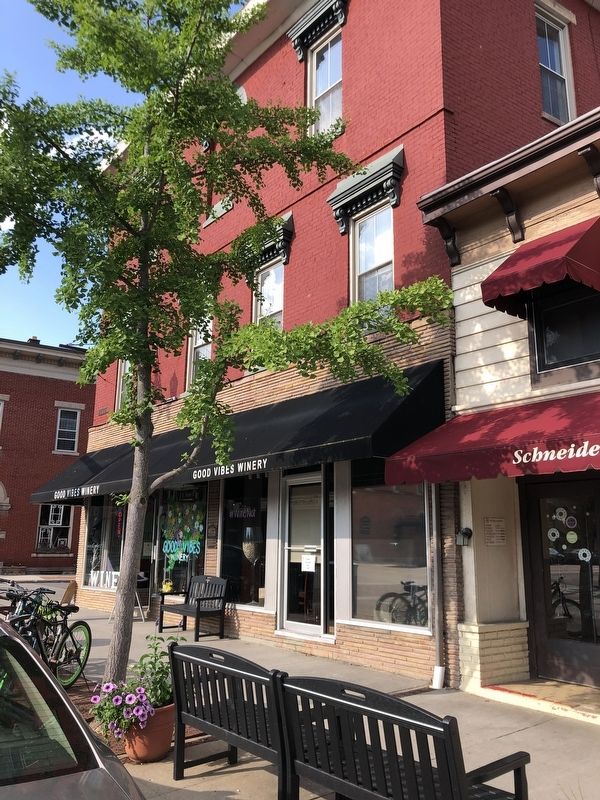
Robinson Block

Photographed by Duane and Tracy Marsteller, May 25, 2024
1. Robinson Block Marker
Original building owner, George W. Robinson, was a long-time businessman in town including being the operator of a “hack” or horse-drawn cab. Prior to the railroad coming to town in 1873, Robinson regularly transported college students and other train travelers to and from “Otterbein Station” (a few miles to the west in Sharon Township).
In 1874, George Robinson, a member of the Masons, agreed to the addition of a third floor to this building to house Blendon #339 Masonic Lodge Hall. The hall featured a hardwood floor with raised outer circumference. The Lodge used this facility until it moved into the new Masonic Temple at 130 South State Street in 1931.
Erected by Uptown Westerville Inc.
Topics. This historical marker is listed in these topic lists: Fraternal or Sororal Organizations • Industry & Commerce. A significant historical year for this entry is 1874.
Location. 40° 7.551′ N, 82° 55.887′ W.
this page online

Regionally, this marker is in the Scioto Valley and in the Columbus Metropolitan Area. It is also in the American Midwest and in the Corn Belt. Globally, it is in North America, the Western Hemisphere, the Western World, and the Anglosphere. Historically, it finds itself in what was once the Haudenosaunee (Iroquois) Confederacy, the territory of the Mississippian Culture, and the Northwest Territory.
Other nearby markers. At least 8 other markers are within walking distance of this marker: D.H. Budd Buggies (here, next to this marker); First National Bank / W.C. Bale Hardware (within shouting distance of this marker); Markley Block (within shouting distance of this marker); 14-16 South State Street (within shouting distance of this marker); State Theatre (within shouting distance of this
Photographed by Duane and Tracy Marsteller, May 25, 2024
2. Robinson Block Marker
Credits. This page was last revised on June 2, 2024. It was originally submitted on June 2, 2024, by Duane and Tracy Marsteller of Murfreesboro, Tennessee. This page has been viewed 448 times since then and 30 times this year. Photos: 1, 2. submitted on June 2, 2024, by Duane and Tracy Marsteller of Murfreesboro, Tennessee.
