
Valkenburg in Valkenburg aan de Geul, Limburg, Netherlands — Northwestern Europe
Fransche Molen
⎯⎯⎯
French Mill
Photographed by Andrew Ruppenstein, May 28, 2024
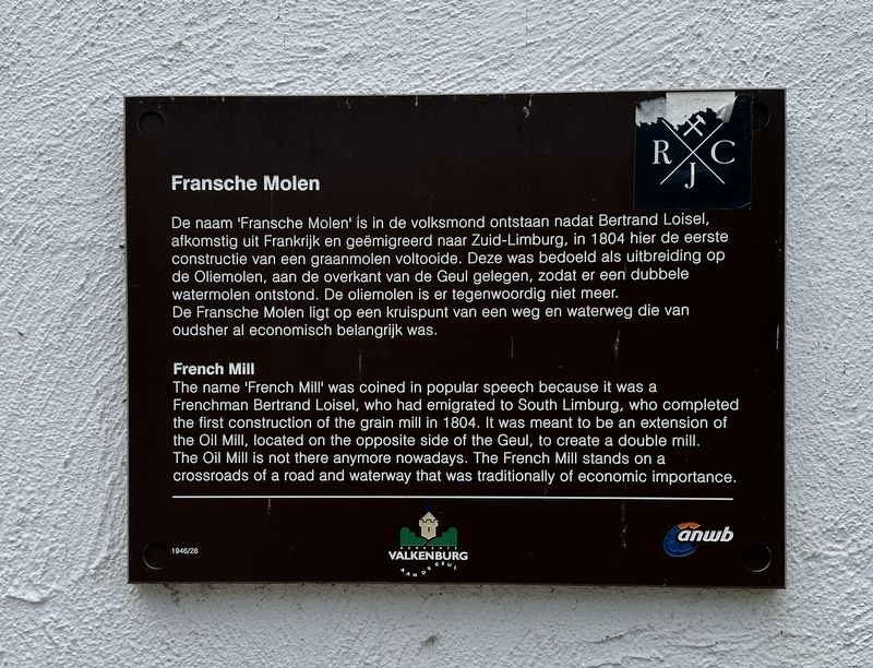
1. Fransche Molen / French Mill Marker

De naam 'Fransche Molen' is in de volksmond ontstaan nadat Bertrand Loisel, afkomstig uit Frankrijk en geëmigreerd naar Zuid-Limburg, in 1804 hier de eerste constructie van een graanmolen voltooide. Deze was bedoeld als uitbreiding op de Oliemolen, aan de overkant van de Geul gelegen, zodat er een dubbele watermolen ontstond. De oliemolen is er tegenwoordig niet meer. De Fransche Molen ligt op een kruispunt van een weg en waterweg die van oudsher al economisch belangrijk was.
The name 'French Mill' was coined in popular speech because it was a Frenchman Bertrand Loisel, who had emigrated to South Limburg, who completed the first construction of the grain mill in 1804. It was meant to be an extension of the Oil Mill, located on the opposite side of the Geul, to create a double mill. The Oil Mill is not there anymore nowadays. The French Mill stands on a crossroads of a road and waterway that was traditionally of economic importance.
Erected by ANWB, Gemeente Valkenburg aan de Geul. (Marker Number 1946/28.)
Topics. This historical marker is listed in this topic list:
this page online
Location. 50° 51.925′ N, 5° 49.901′ E. Marker is in Valkenburg, Limburg, in Valkenburg aan de Geul. It is on Lindenlaan, on the left when traveling north. Touch for map. Marker is at or near this postal address: Lindenlaan 33, Valkenburg, Limburg 6301 HB, Netherlands. Touch for directions.

Regionally, it is in Europe, the European Union, Atlantic Europe, the Benelux Low Countries, the Schengen Area, Western Europe, and the Western World. Historically, it finds itself in what was once the Roman Empire and specifically also the Holy Roman Empire.
Other nearby markers. At least 8 other markers are within walking distance of this marker: Jan Hubert Vrancken and Frans Alexander Cobbenhagen memorial (within shouting distance of this marker); Sam Jim Viviano (about 90 meters away, measured in a direct line); Kasteel den Halder (about 90 meters away); Bruggen opgeblazen - 13 September 1944 - Bridges Blown Up (about 90 meters away); Kasteel Den Halder (about 90 meters away); Brug Opgeblazen - 13 September 1944 - Bridge Blown Up (about 90 meters away); Spaans Leenhof / Spanish Feudal Court
Photographed by Andrew Ruppenstein, May 28, 2024
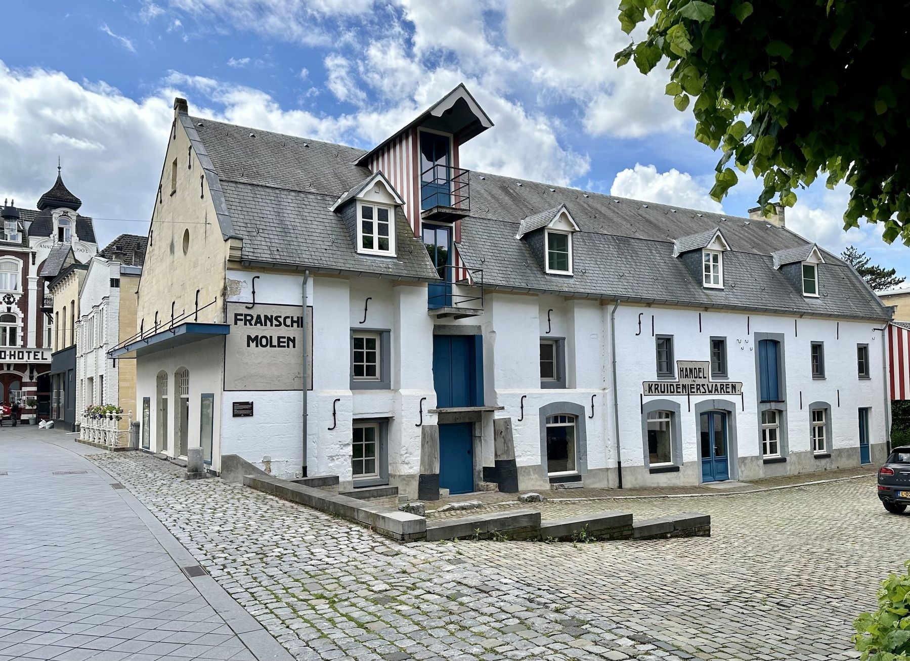
2. Fransche Molen / French Mill - north side of building, with marker
Also see . . . Franse Molen (Nederlandse Molendatabase, in Dutch). Longish entry (with pictures) from the Dutch Mill database
Excerpt (in translation): When Bertrand Loisel had a flour mill built on the right bank opposite the existing oil mill on the northern Geultak or mill branch in 1804, the mill was popularly called the French mill. Loisel was French by birth and before he came to Valkenburg, he was a military warehouse manager in Maastricht.(Submitted on June 2, 2024.)
Until the beginning of this century it was a double water mill, the buildings of which had a different character. The new mill building made of marlstone with the mansard roof and the adjacent yard with house acquired a certain distinction and charm, which undoubtedly contributed to the naming.
The old mill on the left bank was originally an oil mill, which is mentioned as such in the oldest sources from the mid-16th century. Later it was also used as a bark or tanning mill…
Photographed by Andrew Ruppenstein, May 28, 2024
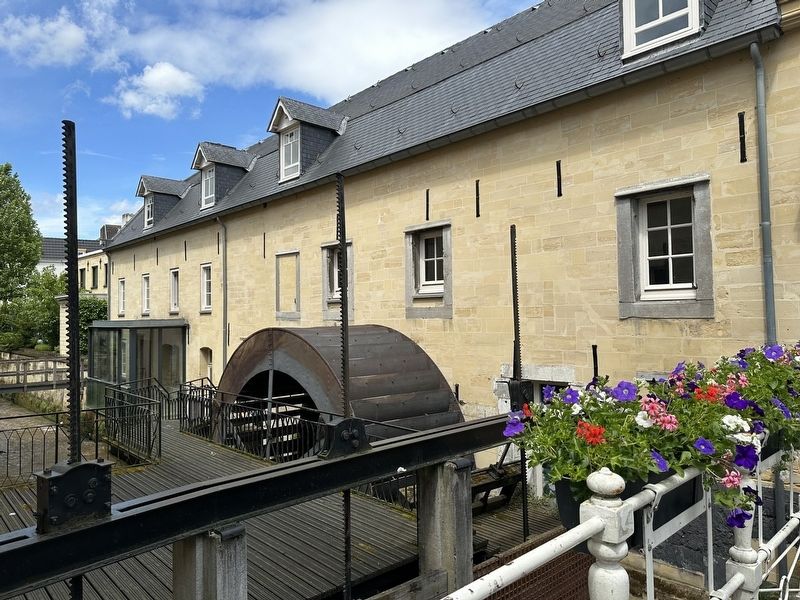
3. Fransche Molen / French Mill - south (Geul River) side of mill
circa 1907
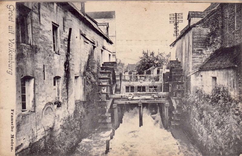
4. Fransche Molen / French Mill
Showing when the complex was a dual-mill operation, with the grain mill on the left, and oil mill on the right.
Credits. This page was last revised on June 2, 2024. It was originally submitted on June 2, 2024, by Andrew Ruppenstein of Lamorinda, California. This page has been viewed 157 times since then and 15 times this year. Photos: 1, 2, 3, 4. submitted on June 2, 2024, by Andrew Ruppenstein of Lamorinda, California.
