
Westerville in Franklin County, Ohio — The American Midwest (Great Lakes)
Markley Block
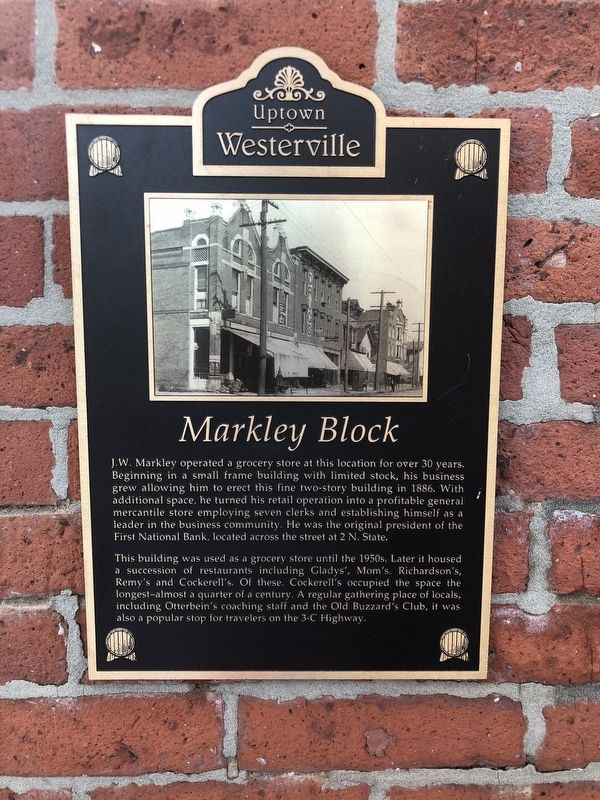
Photographed by Duane and Tracy Marsteller, May 25, 2024
1. Markley Block Marker
This building was used as a grocery store until the 1950s. Later it housed a succession of restaurants including Gladys', Mom's, Richardson's, Remy's and Cockerell's. Of these. Cockerell's occupied the space the longest – almost a quarter of a century. A regular gathering place of locals, including Otterbein's coaching staff and the Old Buzzard's Club, it was also a popular stop for travelers on the 3-C Highway.
Topics. This historical marker is listed in these topic lists: Industry & Commerce • Notable Buildings. A significant historical year for this entry is 1886.
Location. 40° 7.56′ N, 82° 55.904′ W. Marker is in Westerville,
this page online

Regionally, this marker is in the Scioto Valley and in the Columbus Metropolitan Area. It is also in the American Midwest and in the Corn Belt. Globally, it is in North America, the Western Hemisphere, the Western World, and the Anglosphere. Historically, it finds itself in what was once the Haudenosaunee (Iroquois) Confederacy, the territory of the Mississippian Culture, and the Northwest Territory.
Other nearby markers. At least 8 other markers are within walking distance of this marker: First National Bank / W.C. Bale Hardware (a few steps from this marker); Robinson Block (within shouting distance of this marker); State Theatre (within shouting distance of this marker); D.H. Budd Buggies (within shouting distance of this marker); J.R. William's Bakery (within shouting distance of this marker); 11 West College Avenue
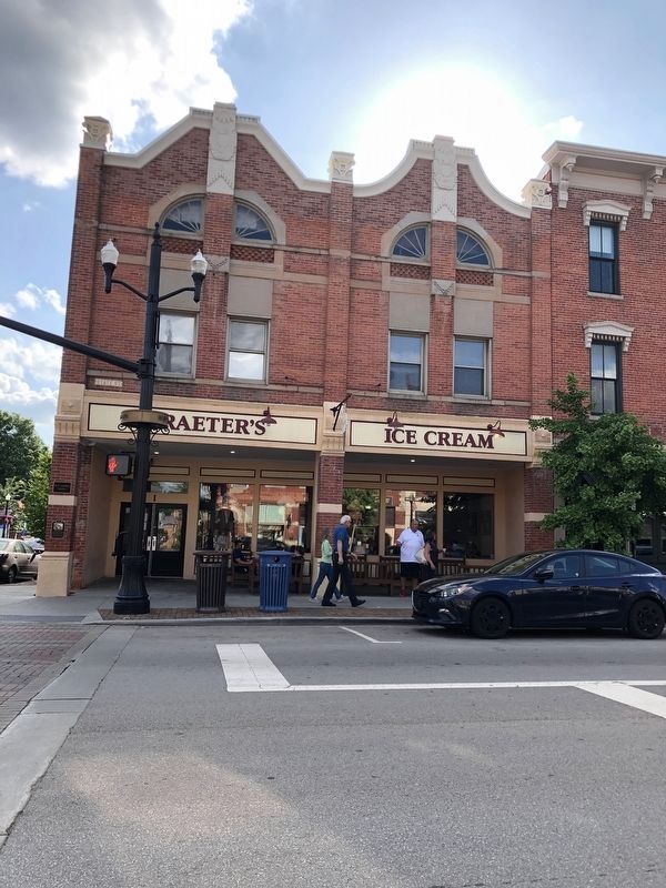
Photographed by Duane and Tracy Marsteller, May 25, 2024
2. Markley Block Marker
Marker is on the column at the building's left corner.
Credits. This page was last revised on June 2, 2024. It was originally submitted on June 2, 2024, by Duane and Tracy Marsteller of Murfreesboro, Tennessee. This page has been viewed 190 times since then and 35 times this year. Photos: 1, 2. submitted on June 2, 2024, by Duane and Tracy Marsteller of Murfreesboro, Tennessee.
