
Westerville in Franklin County, Ohio — The American Midwest (Great Lakes)
Vine Street School
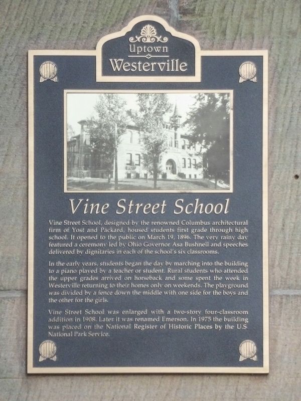
Photographed by Duane and Tracy Marsteller, May 25, 2024
1. Vine Street School Marker
In the early years, students began the day by marching into the building to a piano played by a teacher or student. Rural students who attended the upper grades arrived on horseback and some spent the week in Westerville returning to their homes only on weekends. The playground was divided by a fence down the middle with one side for the boys and the other for the girls.
Vine Street School was enlarged with a two-story four-classroom addition in 1908. Later it was renamed Emerson. In 1975 the building was placed on the National Register of Historic Places by the U.S. National Park Service.
Erected by Uptown Westerville Inc.
Topics and series. This historical marker is listed in these topic lists: Architecture • Education. In addition, it is included in the
this page online
Location. 40° 7.636′ N, 82° 55.737′ W. Marker is in Westerville, Ohio, in Franklin County. It is at the intersection of North Vine Street and Phelps Alley, on the right when traveling north on North Vine Street. Touch for map. Marker is at or near this postal address: 44 N Vine St, Westerville OH 43081, United States of America. Touch for directions.

Regionally, this marker is in the Scioto Valley and in the Columbus Metropolitan Area. It is also in the American Midwest and in the Corn Belt. Globally, it is in North America, the Western Hemisphere, the Western World, and the Anglosphere. Historically, it finds itself in what was once the Haudenosaunee (Iroquois) Confederacy, the territory of the Mississippian Culture, and the Northwest Territory.
Other nearby markers. At least 8 other markers are within walking distance of this marker: Grace Evangelical Lutheran Church / Independent Order of Odd Fellows Lodge 327 (about 500 feet away, measured in a direct line); 30 East College Avenue (about 600 feet away); Winter Garden
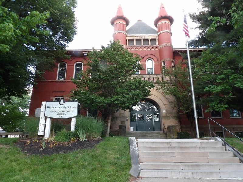
Photographed by Duane and Tracy Marsteller, May 25, 2024
2. Vine Street School Marker
Marker is on the left side of the entrance arch.
Also see . . . Westerville High School-Vine Street School (PDF). National Register nomination for the historic school building, now known as Emerson Elementary School. (Prepared by John A. Mowder and Judith E. Whitney; via National Archives) (Submitted on June 2, 2024, by Duane and Tracy Marsteller of Murfreesboro, Tennessee.)
Credits. This page was last revised on June 2, 2024. It was originally submitted on June 2, 2024, by Duane and Tracy Marsteller of Murfreesboro, Tennessee. This page has been viewed 266 times since then and 50 times this year. Photos: 1, 2. submitted on June 2, 2024, by Duane and Tracy Marsteller of Murfreesboro, Tennessee.
