Crieve Hall in Nashville in Davidson County, Tennessee — The American South (East South Central)
Smokehouse
Photographed by Darren Jefferson Clay, June 1, 2024
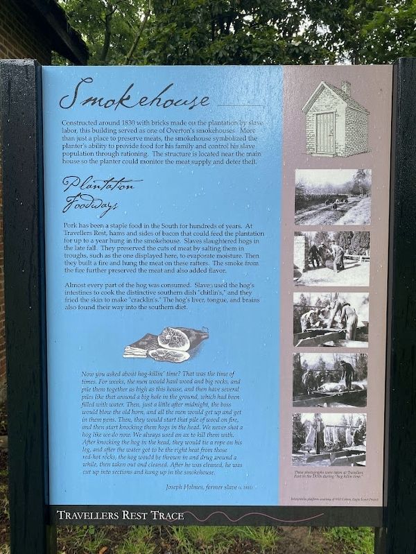
1. Smokehouse Marker
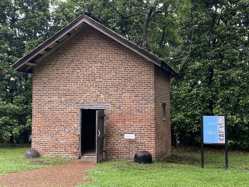
Pork has been a staple food in the South for hundreds of years. At Travellers Rest, hams and sides of bacon that could feed the plantation for up to a year hung in the smokehouse. Slaves slaughtered hogs in the late fall. They preserved the cuts of meat by salting them in troughs, such as the one displayed here, to evaporate moisture. Then they built a fire and hung the meat on these rafters. The smoke from the fire further preserved the meat and also added flavor.
Almost every part of the hog was consumed. Slaves used the hog's intestines to cook the distinctive southern dish "chitlin's," and they fried the skin to make "cracklin's." The hog's liver, tongue, and brains also found their way into the southern diet.
Now you asked about hog-killin' time? That was the time of times. For weeks, the men would haul wood and big rocks, and pile them together as high as this house, and then have several piles like that around a big hole in the ground, which had been filled with water. Then, just a little after midnight, the boss would blow the old horn, and all the men would get up and get in them pens. Then, they would start that pile of wood on fire, and then start knocking them hogs in the head. We never shot a hog like we do now. We always used an ax to kill them with. After knocking the hog in the head, they would tie a rope on his leg, and after the water got to be the right heat from those red-hot rocks, the hog would be thrown in and drug around a while then taken out and cleaned. After he was cleaned, he was cut up into sections and hung up m the smokehouse. Joseph
this page online
Topics. This historical marker is listed in these topic lists: African Americans • Industry & Commerce.
Location. 36° 4.627′ N, 86° 45.799′ W. Marker is in Nashville, Tennessee, in Davidson County. It is in Crieve Hall. It can be reached from Farrell Pkwy west of Regent Drive. Touch for map. Marker is at or near this postal address: 636 Farrell Pkwy, Nashville TN 37220, United States of America. Touch for directions.

Regionally, this marker is in Middle Tennessee. It is also in the American South and specifically in the Upper South. Globally, it is in North America, the Western Hemisphere, the Western World, and the Anglosphere. Historically, it finds itself in what was once the territory of the Mississippian Culture, one of the Confederate States of America, and the Antebellum South.
Other nearby markers. At least 8 other markers are within walking distance of this marker: Herb Garden (within shouting distance of this marker); Historic Travellers Rest Herb Garden (within shouting distance of this marker); Arabian Horses (within shouting
Photographed by Darren Jefferson Clay, June 1, 2024
2. Smokehouse Marker
Another marker is no longer nearby. Travellers Rest (was about 500 feet away but has been replaced with another marker now near it).
Credits. This page was last revised on June 2, 2024. It was originally submitted on June 2, 2024, by Darren Jefferson Clay of Duluth, Georgia. This page has been viewed 239 times since then and 23 times this year. Photos: 1, 2. submitted on June 2, 2024, by Darren Jefferson Clay of Duluth, Georgia. • James Hulse was the editor who published this page.
