Annehurst East in Westerville in Franklin County, Ohio — The American Midwest (Great Lakes)
The Milk House
Built - late 1800's

Photographed by Duane and Tracy Marsteller, May 26, 2024
1. The Milk House Marker
Erected by City of Westerville Parks and Recreation Department.
Topics. This historical marker is listed in this topic list: Notable Buildings.
Location. 40° 7.584′ N, 82° 56.872′ W. Marker is in Westerville, Ohio, in Franklin County. It is in Annehurst East. It can be reached from Lindimore Way north of West Main Street, on the left when traveling north. Marker is in the Everal Barn and Homestead within Heritage Park. Touch for map. Marker is at or near this postal address: 60 N Cleveland Ave, Westerville OH 43081, United States of America. Touch for directions.

Regionally, this marker is in the Scioto Valley and in the Columbus Metropolitan Area. It is also in the American Midwest and in the Corn Belt. Globally, it is in North
this page online
Other nearby markers. At least 8 other markers are within walking distance of this marker: The Carriage House (here, next to this marker); The Bank Barn (a few steps from this marker); The Outhouse (a few steps from this marker); The Hen House (within shouting distance of this marker); The Smoke House (within shouting distance of this marker); The Farmhouse (within shouting distance of this marker); Thomas C. Ullom (approx. 0.2 miles away); "The Crossing" (approx. 0.2 miles away). Touch for a list and map of all markers in Westerville.
Also see . . . John W. Everal Farm Buildings (PDF). National Register of Historic Places nomination for the Milk House and related farm buildings, which were listed in 1975. (Prepared by Robert Price and Mary Alice Busick, Westerville Historical Society; via National Archives) (Submitted on June 4, 2024, by Duane and Tracy Marsteller of Murfreesboro, Tennessee.)
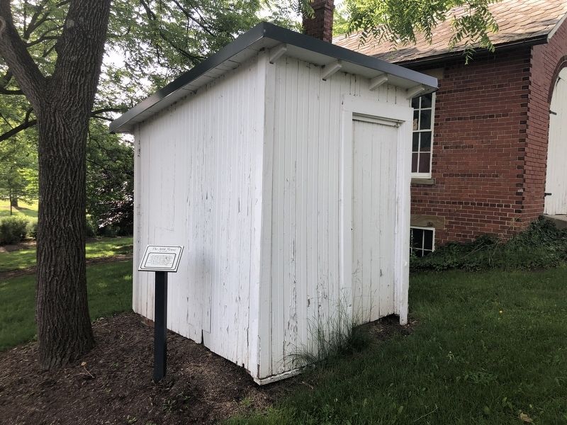
Photographed by Duane and Tracy Marsteller, May 26, 2024
2. The Milk House Marker
Credits. This page was last revised on June 4, 2024. It was originally submitted on June 4, 2024, by Duane and Tracy Marsteller of Murfreesboro, Tennessee. This page has been viewed 205 times since then and 22 times this year. Photos: 1, 2. submitted on June 4, 2024, by Duane and Tracy Marsteller of Murfreesboro, Tennessee.
