Valkenburg in Valkenburg aan de Geul, Limburg, Netherlands — Northwestern Europe
Kapsporen/ Cut Marks
⎯⎯⎯
Schlagspuren
Photographed by Andrew Ruppenstein, May 28, 2024
1. Kapsporen/ Cut Marks / Schlagspuren Marker

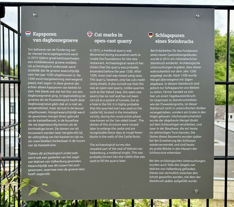
Ten behoeve van de fundering van de nieuwe horecagelegenheid werd in 2012 tijdens graafwerkzaamheden een middeleeuwse groeve ontdekt. Uit archeologisch onderzoek werd duidelijk dat de groeve waarschijnlijk vóór het jaar 1200 uitgehouwen is. Na 1200 vond mergelwinning overwegend plaats met zagen. In deze groeve zijn echter alleen kapsporen van beitels te zien. Het bleek ook dat het hier om een dagbouwgroeve ging. In tegenstelling tot groeves als de Fluweelengrot heeft deze dagbouwgroeve géén dak en is niet als gangenstelsel, maar als kuil in de heuvel uitgehouwen. Hoogstwaarschijnlijk werd de gewonnen mergel direct gebruikt op de kasteelheuvel, in de bouwfase die wij tegenwoordig kennen als de tienhoekige toren. De stenen van dit bouwwerk werden later hergebruikt bij de uitbreiding van het kasteel en zijn nu als ruwe blokken herkenbaar in de muren van de Kasteelruïne.
Tijdens dit archeologisch onderzoek werd ook een gedeelte van het zegel van Walram van Valkenburg gevonden. Waarschijnlijk was dit tussen het puin geworpen, waarmee men
this page online
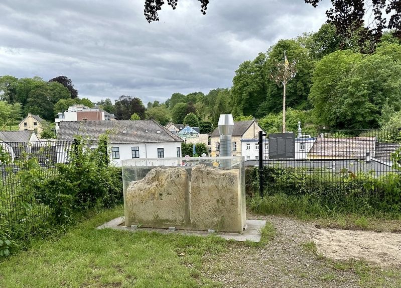
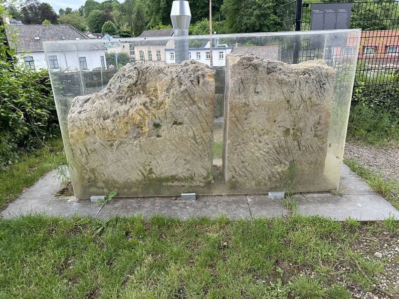
In 2012, a medieval quarry was discovered during excavation work to create the foundations for the new restaurant. Archaeological research has shown that the quarry was probably excavated before the year 1200. After 1200, most marl was mined using saws. This quarry, however, only has cuts made using chisels. It also turned out that this was an open-cast quarry. Unlike quarries such as the Velvet Cave, this open-cast quarry has no roof and has not been carved as a system of tunnels, but as a hole in the hill. It is highly probable that the quarried marl was used on the castle hill, located in the immediate vicinity, during the construction phase now known as the 'ten-sided tower'. The stones of this structure were reused later to enlarge the castle and are recognizable these days as rough-hewn blocks in the walls of the Castle Ruins.
The archaeological survey also revealed part of the seal of Walram van Valkenburg, a medieval knight. This was probably thrown into the rubble that was used to fill the quarry later.
Bei
Photographed by Andrew Ruppenstein, May 28, 2024
2. Kapsporen/ Cut Marks / Schlagspuren Marker - wide view
Bei den archäologischen Untersuchungen wurden auch Teile des Siegels von Walram von Valkenburg gefunden. Dieses war vermutlich zwischen den Schutt geworfen worden, mit dem der Steinbruch später aufgefüllt wurde.
Topics.
Photographed by Andrew Ruppenstein, May 28, 2024
3. Cut stones showing cut marks
Location. 50° 51.751′ N, 5° 49.813′ E. Marker is in Valkenburg, Limburg, in Valkenburg aan de Geul. It can be reached from Grendelplein. The marker is on the site of the Valkenburg Castle Ruins, outside of the paid entrance area. Touch for map. Marker is in this post office area: Valkenburg, Limburg 6301 BK, Netherlands. Touch for directions.

Regionally, it is in Europe, the European Union, Atlantic Europe, the Benelux Low Countries, the Schengen Area, Western Europe, and the Western World. Historically, it finds itself in what was once the Roman Empire and specifically also the Holy Roman Empire.
Other nearby markers. At least 8 other markers are within walking distance of this marker: Construction of the Valkenburg Castle / Opbouw Kasteel Valkenburg (a few steps from this marker); Grendelpoort / Grendel Gate (within shouting distance of this marker); Grendelpoort - Tweede Wereldoorlog / Grendel Gate - WW II (within shouting distance of this marker); Karel Cahn (within shouting distance of this marker); Louis Cahn (within shouting distance of this marker); Grendelpoort (city gate) (within shouting distance of this marker); Gemeentegrot als schuilplaats / Municipal Cave as Shelter (about 90 meters away, measured in a direct line); Gemeentegrot / Municipal Cave (about 90 meters away). Touch for a list and map of all markers in Valkenburg.
Also see . . . Valkenburg Castle Ruins (Wikipedia).
Overview: Valkenburg Castle is a ruined castle in Valkenburg aan de Geul, Netherlands. It is unique in the Netherlands in that it is the only castle in the country built on a hill. The castle is listed in the top hundred of Dutch cultural monuments.(Submitted on June 5, 2024.)
Credits. This page was last revised on June 5, 2024. It was originally submitted on June 5, 2024, by Andrew Ruppenstein of Lamorinda, California. This page has been viewed 116 times since then and 10 times this year. Photos: 1, 2, 3. submitted on June 5, 2024, by Andrew Ruppenstein of Lamorinda, California.
