
Valkenburg in Valkenburg aan de Geul, Limburg, Netherlands — Northwestern Europe
Gemeentegrot als schuilplaats
⎯⎯⎯
Municipal Cave as Shelter
| — | 75 jaar Bevrijding fotoroute | — |
Photographed by Andrew Ruppenstein, May 28, 2024
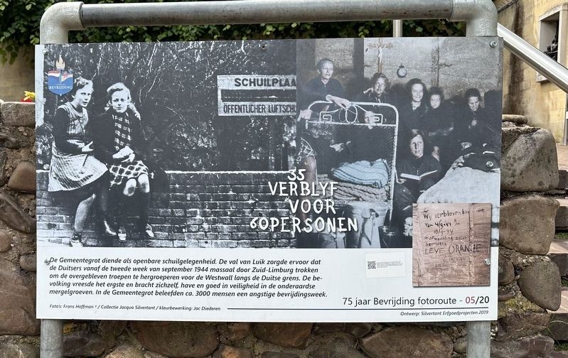
1. Gemeentegrot als schuilplaats / Municipal Cave as Shelter Marker

The Municipal Cave served as a public shelter. The fall of Liège caused the Germans to march en masse through South Limburg from the second week of September 1944 to regroup the remaining troops for the West Wall along the German border. The population feared the worst and took themselves, their possessions and property to safety in the underground marl pits. In the Municipal Cave, approximately 3,000 people experienced an anxious liberation week.
Erected 2019. (Marker Number 05/20.)
Topics and series. This historical marker is listed in these topic lists: Forts and Castles • War, World II. In addition, it is included in the Valkenburg Bevrijding/Liberation Route series list. A significant historical date for this entry is September 8, 1944.
Location. 50° 51.742′ N, 5° 49.731′ E.
this page online

Regionally, it is in Europe, the European Union, Atlantic Europe, the Benelux Low Countries, the Schengen Area, Western Europe, and the Western World. Historically, it finds itself in what was once the Roman Empire and specifically also the Holy Roman Empire.
Other nearby markers. At least 8 other markers are within walking distance of this marker: Gemeentegrot / Municipal Cave (a few steps from this marker); Karel Cahn (within shouting distance of this marker); Louis Cahn (within shouting distance of this marker); 19e eeuws klooster / 19th Century Convent/Monastery (about 90 meters away, measured in a direct line); Kapsporen/ Cut Marks / Schlagspuren (about 90 meters away); Strijd om de bevrijding / Battle for Liberation (about 120 meters away); Construction of the Valkenburg Castle / Opbouw Kasteel Valkenburg (about 120 meters away); Grendelpoort / Grendel Gate (about 120 meters away). Touch for a list and map of all markers in Valkenburg.
Also see . . . Gemeentegrot as a safe haven (Liberation Route Europe).
Photographed by Andrew Ruppenstein, May 28, 2024
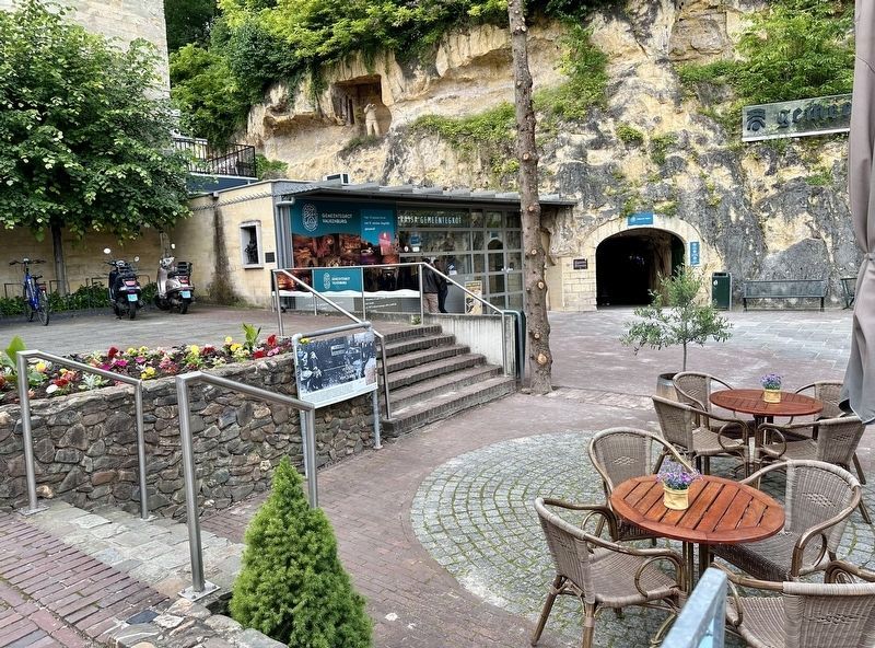
2. Gemeentegrot als schuilplaats / Municipal Cave as Shelter Marker - wide view
Excerpt: Throughout the centuries, the caves around Valkenburg offered a safe haven in turbulent times. Intensive marl mining had gradually created a gigantic labyrinth of corridors. The caves with their wide ramifications also served as hiding places during the Second World War, especially from mid-September 1944 when the residents fled en masse from fierce shelling. The hundreds of Valkenburg residents in the Gemeentegrot were only liberated after a week.(Submitted on June 6, 2024.)
In total, an estimated five thousand people had sought refuge in the vast labyrinths. After the liberation, the Americans set up a field hospital in the Gemeentegrot. It also gave the men a chance to recuperate from the fighting at the frontline. Their signatures in the soft marl of the corridor system are silent witnesses to their presence.
Credits. This page was last revised on June 6, 2024. It was originally submitted on June 6, 2024, by Andrew Ruppenstein of Lamorinda, California. This page has been viewed 133 times since then and 16 times this year. Photos: 1, 2. submitted on June 6, 2024, by Andrew Ruppenstein of Lamorinda, California.
