Russell in Louisville in Jefferson County, Kentucky — The American South (East South Central)
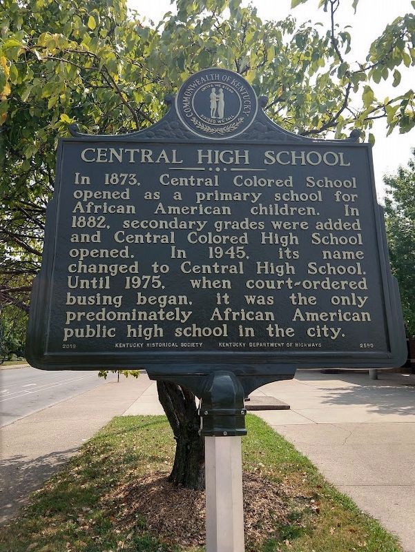
Central High School

Photographed by Alison G Schureck
1. Central High School Marker
Erected 2019 by Kentucky Historical Society. (Marker Number 2590.)
Topics. This historical marker is listed in these topic lists: African Americans • Education • Sports. A significant historical year for this entry is 1960.
Location. 38° 14.959′ N, 85° 46.247′ W. Marker is in Louisville, Kentucky, in Jefferson County. It is in Russell. It can be reached from the intersection of South 11th Street and West Chestnut School, on the left when traveling north. Touch for map. Marker is at or near this postal address: 1170 W Chestnut St, Louisville KY 40203, United States of America. Touch for directions.

Regionally, this marker is in the American South, specifically in the Upper South, and in the Ohio River Valley. Globally, it is in North America, the Western Hemisphere, the Western
this page online
Other nearby markers. At least 8 other markers are within walking distance of this marker: Louisville Western Branch Library (approx. 0.2 miles away); Samuel M. Plato, Architect / Buildings by Samuel M. Plato (approx. 0.2 miles away); Knights of Pythias Temple / Hub of Culture and History (approx. 0.2 miles away); Dr. James Bond (1863-1929) / Early Leader and Educator (approx. 0.2 miles away); Louisville and Nashville Railroad / L&N Expansion (approx. 0.2 miles away); Center Street C.M.E. Church / Brown Memorial C.M.E. Church (approx. 0.3 miles away); Nannie Helen Burroughs / Notable Educator, Social Activist (approx. 0.4 miles away); The Good Shepherd Order (approx. 0.4 miles away). Touch for a list and map of all markers in Louisville.
Photographed by Chris Gerstle, August 7, 2021
2. Central High School Marker
Other side of marker
Credits. This page was last revised on August 26, 2026. It was originally submitted on June 6, 2024, by Alison G Schureck of Louisville, Kentucky. This page has been viewed 499 times since then and 108 times this year. Photos: 1. submitted on June 6, 2024, by Alison G Schureck of Louisville, Kentucky. 2. submitted on August 23, 2026, by Chris Gerstle of Louisville, Kentucky. • Devry Becker Jones was the editor who published this page.
