
Nottingham city centre , England, United Kingdom — Northwestern Europe (the British Isles)
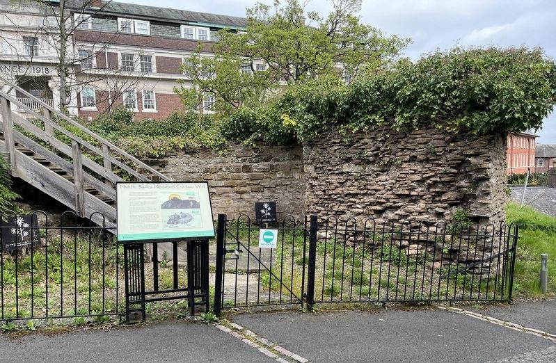
Middle Bailey Medieval Curtain Wall

Photographed by Ray Gurganus, April 13, 2024
1. Middle Bailey Medieval Curtain Wall Marker
This wall would originally have been a wooden palisade (a wall made of sharpened stakes) as part of the first Norman castle built in 1068.
Between 1171 and 1189 over £1800 was spent on the Castle including enclosing the Middle and Upper Baileys in stone walls that were completed in 1173 and then further heightened in 1187 during the reign of Henry II.
To the right would have been the North-East Tower Built around 1251 in the reign of Henry III, this would have been a formidable fortification should attackers get past the Outer Bailey gatehouse. The 13th century chronicler Thomas Wykes described Nottingham Castle's defences as "peerless in the realm".
To the left at the top of the road is what has become known as Richard's Tower-named after Richard II, though it was actually built by his brother, Edward IV, between 1476 and 1480. It cost over £3000 along with new state apartments,
this page online
The curtain wall and both towers were destroyed in 1651 after the British Civil War with the Council of State commanded the then Governor, Major Thomas Poulton, that "the Castle and all the outworks and fortifications be altogether demolished".
Erected by Nottingham Castle.
Topics. This historical marker is listed in this topic list: Forts and Castles. A significant historical year for this entry is 1068 CE.
Location. 52° 57.023′ N, 1° 9.303′ W. Marker is in Nottingham, England. It is in Nottingham city centre. It can be reached from no nearby street. On the Nottingham Castle grounds. Touch for map. Marker is in this post office area: Nottingham, England NG1 6EL, United Kingdom. Touch for directions.

Regionally, this marker is in England’s Midlands. Globally, it is on the Atlantic Ocean, in the North Atlantic Region, in Europe, in Atlantic Europe, on one of the British Isles, in the Western
Photographed by Ray Gurganus, April 13, 2024
2. Middle Bailey Medieval Curtain Wall Marker
Other nearby markers. At least 8 other markers are within walking distance of this marker: Great Hall (within shouting distance of this marker); English Civil War (within shouting distance of this marker); Medieval Nottingham Castle (within shouting distance of this marker); a different marker also named Medieval Nottingham Castle (within shouting distance of this marker); Robin Hood Rifles (about 90 meters away, measured in a direct line); Castle Ditch (about 90 meters away); A rebel. A revolutionary. An icon. (about 120 meters away); Rebel City (about 120 meters away). Touch for a list and map of all markers in Nottingham.
Credits. This page was last revised on June 23, 2026. It was originally submitted on June 9, 2024, by Ray Gurganus of Washington, District of Columbia. This page has been viewed 159 times since then and 22 times this year. Photos: 1, 2. submitted on June 9, 2024, by Ray Gurganus of Washington, District of Columbia. • Andrew Ruppenstein was the editor who published this page.
