Near Manning in Clarendon County, South Carolina — The American South (South Atlantic)
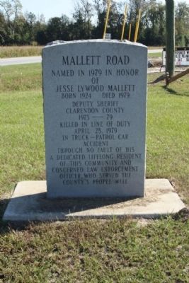
Mallett Road
of
Jesse Lywood Mallett
Born 1924 Died 1979
Deputy Sheriff
Clarendon County
1975 — 79
Killed in line of duty
April 28, 1979
in truck - patrol car
accident
through no fault of his
A dedicated, lifelong resident
of this community and
concerned Law Enforcement
Officer, who served the
county's people well.
Erected 1979.
Topics. This historical marker is listed in this topic list: Roads & Vehicles. A significant historical month for this entry is April 1918.
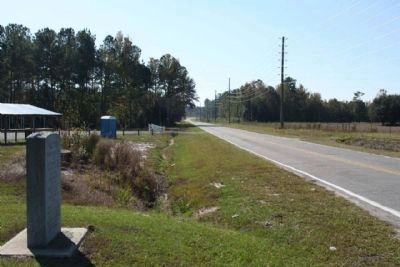
Location. 33° 40.879′ N, 80° 9.95′ W. Marker is near Manning, South Carolina, in Clarendon County. Marker is at the intersection of Greeleyville Highway (U.S. 521) and Mallett Road (State Highway 14-384), on the right when traveling east on Greeleyville Highway. Touch for map. Marker is in this post office area: Manning SC 29102, United States of America. Touch for directions.
Other nearby markers. At least 8 other markers are within 3 miles of this marker, measured as the crow flies. Battle of Wyboo Swamp (approx. 2.6 miles away); Ebenezer Baptist Church (approx. 2.7 miles away); Help for Marion's Militia, 1780-1781 (approx. 2.7 miles away); Citizen Soldier 220 Years Ago (approx. 2.8 miles away); Clarendon County Veterans Memorial (approx. 2.8 miles away); Murray's Ferry - Santee River (approx. 2.8 miles away); Clarendon County Confederate Monument (approx. 2.8 miles away); Fuel 24 (approx. 2.8 miles away). Touch for a list and map of all markers in Manning.
Credits. This page was last revised on September 10, 2021. It was originally submitted on November 26, 2009, by Mike Stroud of Bluffton, South Carolina. This page has been viewed 681 times since then and 24 times this year. Photos: 1, 2, 3. submitted on November 26, 2009, by Mike Stroud of Bluffton, South Carolina. • Craig Swain was the editor who published this page.


