
Angeles National Forest in Los Angeles County, California — The American West (Pacific Coastal)
New Line to Alpine Tavern
Mount Lowe Railway
| — | Opened 1895 | — |
Photographed by Craig Baker
1. New Line to Alpine Tavern Marker
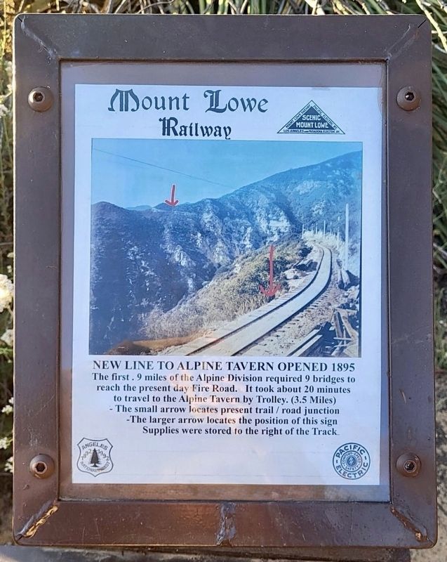
The first .9 miles of the Alpine Division required 9 bridges to reach the present day Fire Road. It took about 20 minutes to travel to the Alpine Tavern by Trolley (3.5 Miles).
-The small arrow locates present trail / road junction.
-The larger arrow locates the position of this sign.
Supplies were stored to the right of the track.
Topics. This historical marker is listed in this topic list: Railroads & Streetcars. A significant historical year for this entry is 1895.
Location. 34° 12.778′ N, 118° 7.32′ W. Marker is in Angeles National Forest, California, in Los Angeles County. It can be reached from the intersection of Mt Lowe Railway Trail and Lower Sam Merrill Trail. Hike three miles up a steep trail with a 1,500-foot altitude gain. Touch for map. Marker is in this post office area: Altadena CA 91001, United States of America. Touch for directions.

Regionally, this marker is in Greater Los Angeles and in the Transverse Ranges. It is also on the American Pacific Coast. Globally, it is in North America, on the Ring of Fire, in the Pacific Rim, in the Western Hemisphere, in the Western World, and
this page online
Other nearby markers. At least 8 other markers are within walking distance of this marker: The White City (within shouting distance of this marker); End of the Line (within shouting distance of this marker); The Lowe Observatory (about 300 feet away, measured in a direct line); Echo Mtn Service Pit (about 400 feet away); Casino, Tennis Courts, Power Plants, and Car Barn (about 400 feet away); Mount Lowe Power Plants (about 400 feet away); Caretaker’s Cottage and Cable House (about 600 feet away); Mount Lowe Railway (about 800 feet away). Touch for a list and map of all markers in Angeles National Forest.
Regarding New Line to Alpine Tavern. The Alpine Division was an electric trolly which ran from the top of the Incline Railway to the Alpine Tavern. Today the first section is a hiking trail, and the rest of the route is part of a fire road. Mt Lowe Trail Camp is at the site of the Alpine Tavern. Interpretive signs have been installed along the route.
On January 6, 1993, the Mount Lowe Railway was listed on the National

Photographed by Craig Baker
2. New Line to Alpine Tavern Marker
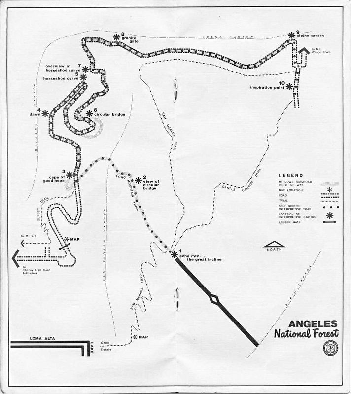
3. Mt Lowe Railway Map - 1977
Shows the site of the incline railway, the Alpine Division trail, and the Alpine Division fire road.
Credits. This page was last revised on January 8, 2025. It was originally submitted on June 11, 2024, by Craig Baker of Sylmar, California. This page has been viewed 197 times since then and 13 times this year. Photos: 1, 2, 3. submitted on June 11, 2024, by Craig Baker of Sylmar, California.
