Angeles National Forest in Los Angeles County, California — The American West (Pacific Coastal)
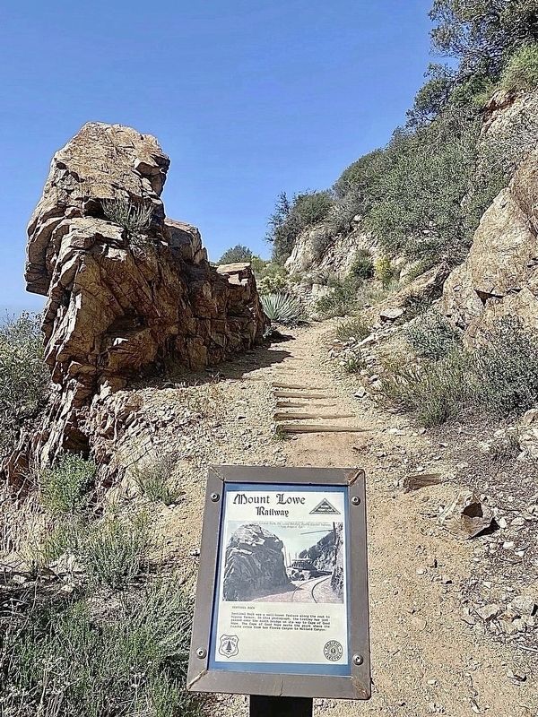
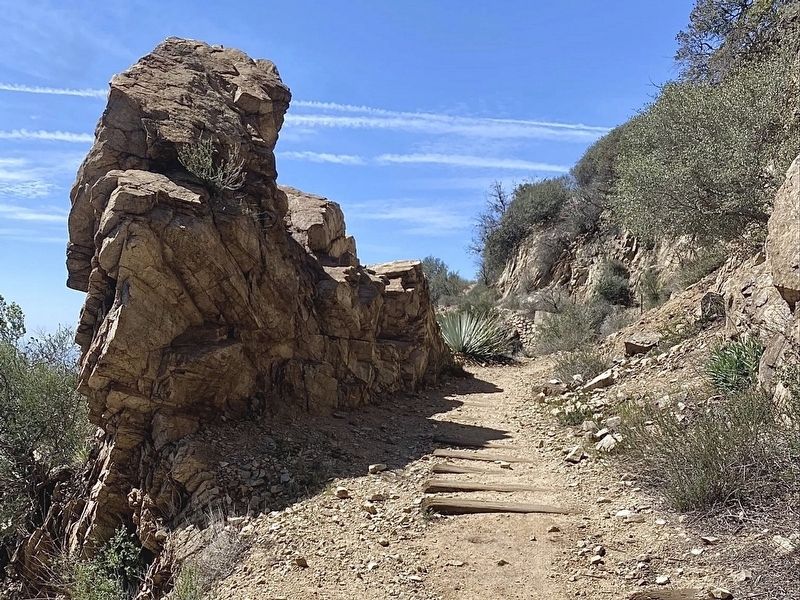
Sentinel Rock
Mount Lowe Railway
| — | 1895 - 1938 | — |
Photographed by Craig Baker
1. Sentinel Rock Marker
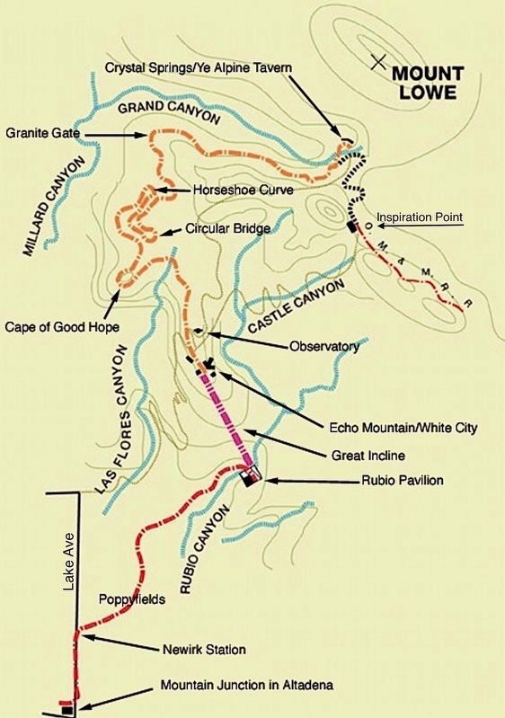
Sentinel Rock was a well-known feature along the route to Alpine Tavern. In this photograph, the trolley has just passed over the ninth bridge on its way to Cape of Good Hope. The Cape of Good Hope marks the point where the tracks cross from Las Flores Canyon to Millard Canyon.
Topics. This historical marker is listed in this topic list: Railroads & Streetcars. A significant historical year for this entry is 1895.
Location. 34° 13.125′ N, 118° 7.523′ W. Marker is in Angeles National Forest, California, in Los Angeles County. It can be reached from Mt Lowe Railway Trail east of Mount Lowe Road. Hike 3½ miles up a steep trail with a 1,600-foot altitude gain from the Cobb Estate trailhead. Touch for map. Marker is in this post office area: Altadena CA 91001, United States of America. Touch for directions.

Regionally, this marker is in Greater Los Angeles and in the Transverse Ranges. It is also on the American Pacific Coast. Globally, it is in North America, on the Ring of Fire, on the Pacific Rim, in the Western Hemisphere, in the Western World, and in the Anglosphere. Historically, it finds itself in what was
this page online
Other nearby markers. At least 8 other markers are within walking distance of this marker: High Bridge (within shouting distance of this marker); On The Rail Again (within shouting distance of this marker); Longest Straight Stretch of Track (about 300 feet away, measured in a direct line); Circular Bridge (about 800 feet away); Cape of Good Hope / Circular Bridge (approx. 0.2 miles away); Dawn Station (approx. ¼ mile away); The Lowe Observatory (approx. 0.4 miles away); The White City (approx. 0.4 miles away). Touch for a list and map of all markers in Angeles National Forest.
Regarding Sentinel Rock. The Alpine Division was an electric trolly which ran from the top of the Incline Railway 3½ miles to the Alpine Tavern. Today the first mile is a hiking trail, and the rest of the route is part of a fire road. Mt Lowe Trail Camp is at the site of the Alpine Tavern.
On January 6, 1993, the Mount Lowe Railway was listed on the National Register of Historic Places.

2. Sentinel Rock
This postcard is featured on the marker.
Photographed by Craig Baker
3. Sentinel Rock
from Wikimedia Commons
4. Mt Lowe Railway Map
Credits. This page was last revised on January 15, 2025. It was originally submitted on June 12, 2024, by Craig Baker of Sylmar, California. This page has been viewed 187 times since then and 23 times this year. Photos: 1, 2, 3. submitted on June 12, 2024, by Craig Baker of Sylmar, California. 4. submitted on May 30, 2024, by Craig Baker of Sylmar, California.
