
Fraser in Stikine Region, British Columbia — Canada’s West Coast (North America)
Fraser

Photographed by Sandra Hughes Tidwell, June 5, 2024
1. Fraser Marker
Construction of the White Pass railway began in May of 1898 and was completed to Whitehorse in July 1900. The 180-kilometre (110 miles) narrow-gauge line ran from Skagway, at tidewater, through Alaska and British Columbia to White Horse, Yukon.
Fraser is located on the stretch of track between the Summit, the site of the International border, and Bennett, at the south end of Bennett Lake.
This section of track was built during the winter of 1898-99, a winter that saw exceptionally heavy snowfall and cold temperatures. Not only did this section of track have to be constructed at the worst time of the year, but it also involved the most backbreaking work: cutting a railway roadbed through solid rock. In those days, there was no heavy equipment available for blasting. Rock debris had to be hauled by hand or by horse-drawn wagons, and in some places near the Summit, the slopes were so steep that even horses couldn't be used.
In the words of the company's first president Samuel Haughton Graves, "Between Skaguay (sic) and Fraser, near Log Cabin, a distance of 28 miles, there was not a wheelbarrow full of gravel or loose earth...the line was entirely on solid rock or bridges.
Left: Map of the Chikoot and White passes c.1898, taken from the original version, published in the Seattle Post-Intelligencer.
Top: W.P. & Y. R. sod-turning ceremony at the Meadows, not far from here, October 4, 1898.
Above: Blasting crews cutting a line through the rock, 1898. Both photographs courtesy of Barley Collection, Yukon Archives.
Topics. This historical marker
this page online
Location. 59° 43.078′ N, 135° 2.62′ W. Marker is in Fraser, British Columbia, in Stikine Region. It is on Klondike Highway, on the left when traveling south. Fraser is located on the Klondike Highway, just north of the Fraser station. Touch for map. Marker is in this post office area: Fraser BC V0W 1A0, Canada. Touch for directions.

Regionally, this marker is in Northern BC. Globally, it is in North America, on the Ring of Fire, in the Pacific Rim, in the Western Hemisphere, in the Western World, and in the Anglosphere. Historically, it finds itself in what was once a British colony.
Other nearby markers. At least 8 other markers are within 14 kilometers of this marker, measured as the crow flies: A different marker also named Fraser (approx. 0.3 kilometers away); Me`n Cho`Bennett Lake (approx. 11.6 kilometers away); St. Andrew's Church (approx. 11.6 kilometers away); Bennett (approx. 11.6 kilometers away); End of Trail / Fin de la piste (approx. 14.4 kilometers away); St. Andrew's Church / Église St. Andrew's (approx.
Photographed by Sandra Hughes Tidwell, June 5, 2024
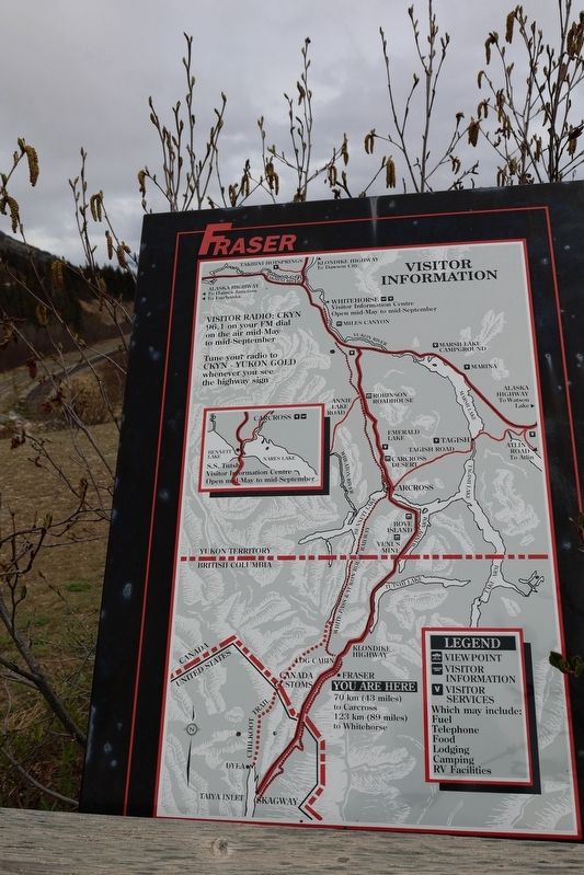
2. Fraser Visitor Information

Photographed by Sandra Hughes Tidwell, June 5, 2024
3. Fraser Marker
Credits. This page was last revised on June 15, 2024. It was originally submitted on June 12, 2024, by Sandra Hughes Tidwell of Killen, Alabama, USA. This page has been viewed 255 times since then and 60 times this year. Photos: 1, 2, 3. submitted on June 12, 2024, by Sandra Hughes Tidwell of Killen, Alabama, USA. • Andrew Ruppenstein was the editor who published this page.
