
Valkenburg in Valkenburg aan de Geul, Limburg, Netherlands — Northwestern Europe
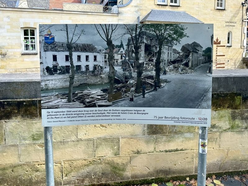
Brug Opgeblazen - 13 September 1944 - Bridge Blown Up
| — | 75 jaar Bevrijding fotoroute | — |
Photographed by Andrew Ruppenstein, May 28, 2024
1. Brug Opgeblazen - 13 September 1944 - Bridge Blown Up Marker

On September 13, 1944, this bridge over the Geul was blown up by the Germans, which severely damaged the buildings in the immediate area. In particular, the Croix de Bourgogne and Du Pont hotels (right) and the Otten building (left) were irreparably destroyed.
Erected 2019. (Marker Number 12/20.)
Topics and series. This historical marker is listed in these topic lists: Bridges & Viaducts • War, World II. In addition, it is included in the Valkenburg Bevrijding/Liberation Route series list. A significant historical date for this entry is September 13, 1944.
Location. 50° 51.87′ N, 5° 49.913′ E. Marker is in Valkenburg, Limburg, in Valkenburg aan de Geul. It is at the intersection of Pelerinstraat and Grotestraat Centrum, on the left when traveling east on Pelerinstraat. Touch for map. Marker is in this post office area: Valkenburg, Limburg 6301 DZ,
this page online

Regionally, it is in Europe, the European Union, Atlantic Europe, the Benelux Low Countries, the Schengen Area, Western Europe, and the Western World. Historically, it finds itself in what was once the Roman Empire and specifically also the Holy Roman Empire.
Other nearby markers. At least 8 other markers are within walking distance of this marker: H.H. Nicolaas en Barbara Kerk / St. Nicholas and St. Barbara Church (within shouting distance of this marker); Theodoor Joseph Hubert Dorren (within shouting distance of this marker); Mariakapel / Marian Chapel (within shouting distance of this marker); Sam Jim Viviano (within shouting distance of this marker); Kasteel den Halder (within shouting distance of this marker); Spaans Leenhof / Spanish Feudal Court (within shouting distance of this marker); R.K. kerk H.H. Nicolaas en Barbara / Sts. Nicholas and Barbara Roman Catholic Church (within shouting distance of this marker); Kasteel Den Halder (within shouting distance of this marker). Touch for a list and map of all markers in Valkenburg.
Photographed by Andrew Ruppenstein, May 28, 2024
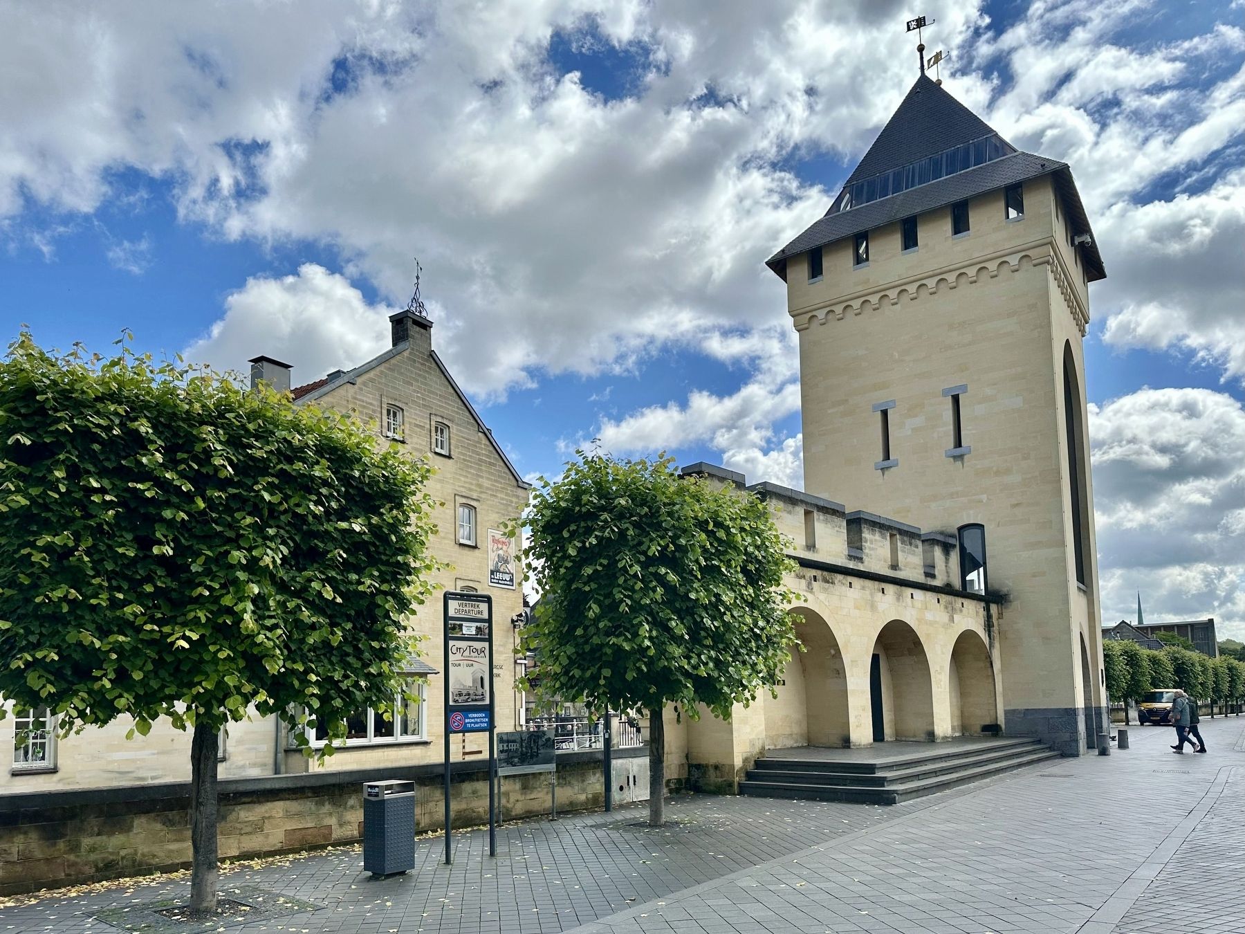
2. Brug Opgeblazen - 13 September 1944 - Bridge Blown Up Marker - wide view
The marker is visible here by the low retaining wall, between the two trees. This is roughly the same perspective as the photo shown on the marker, with the difference being that in the interim, a portion of the city wall and gate (De Geulpoort) have been reconstructed (on the right).
Credits. This page was last revised on June 17, 2024. It was originally submitted on June 16, 2024, by Andrew Ruppenstein of Lamorinda, California. This page has been viewed 176 times since then and 22 times this year. Photos: 1. submitted on June 16, 2024, by Andrew Ruppenstein of Lamorinda, California. 2. submitted on June 17, 2024, by Andrew Ruppenstein of Lamorinda, California.
