Valkenburg in Valkenburg aan de Geul, Limburg, Netherlands — Northwestern Europe
Berkelpoort (city gate)
| — | Rijksmonument | — |
Photographed by Andrew Ruppenstein, May 28, 2024
1. Berkelpoort (city gate) Marker

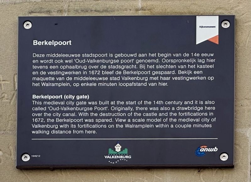
Deze middeleeuwse stadspoort is gebouwd aan het begin van de 14e eeuw en wordt ook wel 'Oud-Valkenburgse poort' genoemd. Oorspronkelijk lag hier tevens een ophaalbrug over de stadsgracht. Bij het slechten van het kasteel en de vestingwerken in 1672 bleef de Berkelpoort gespaard. Bekijk een maquette van de middeleeuwse stad Valkenburg met haar vestingwerken op het Walramplein, op enkele minuten loopafstand van hier.
Berkelpoort (city gate)
This medieval city gate was built at the start of the 14th century and it is also called 'Oud-Valkenburgse Poort'. Originally, there was also a drawbridge here over the city canal. With the destruction of the castle and the fortifications in 1672, the Berkelpoort was spared. View a scale model of the medieval city of Valkenburg with its fortifications on the Walramplein within a couple minutes walking distance from here.
Erected by ANWB, Gemeente Valkenburg aan de Geul. (Marker Number 1946/12.)
Topics. This historical marker is listed in this topic list: Forts and Castles. A significant historical year for this entry is 1672.
Location. 50° 51.717′ N, 5° 49.921′ E.
this page online

Regionally, it is in Europe, the European Union, Atlantic Europe, the Benelux Low Countries, the Schengen Area, Western Europe, and the Western World. Historically, it finds itself in what was once the Roman Empire and specifically also the Holy Roman Empire.
Other nearby markers. At least 8 other markers are within walking distance of this marker: Duitse invasie - May 10, 1940 - German Invasion (a few steps from this marker); Construction of the Valkenburg Castle / Opbouw Kasteel Valkenburg (about 120 meters away, measured in a direct line); Huis De Guasco (about 120 meters away); Kapsporen/ Cut Marks / Schlagspuren (about 150 meters away); Strijd om de bevrijding / Battle for Liberation (about 150 meters away); Karel Cahn (about 150 meters away); Louis Cahn (about 150 meters away); Grendelpoort / Grendel Gate (about 180 meters away). Touch for a list and map of all
Photographed by Andrew Ruppenstein, May 28, 2024
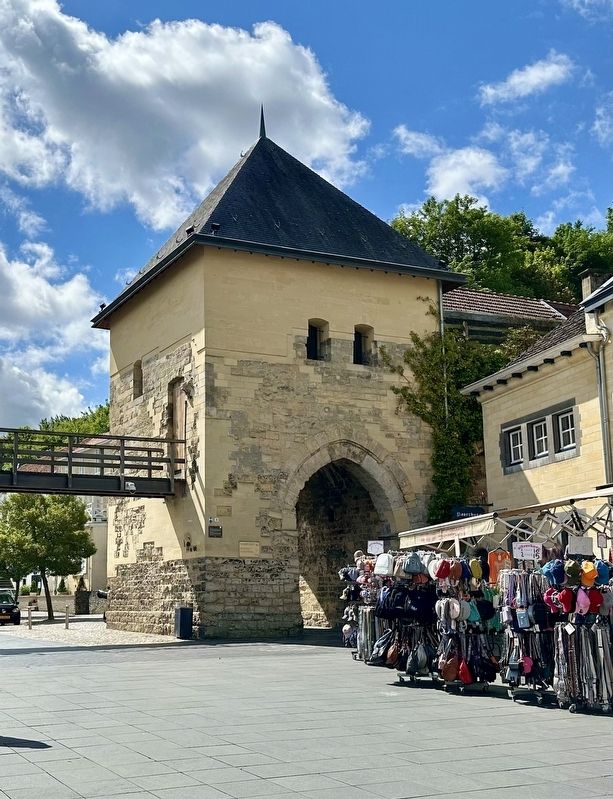
2. Berkelpoort (city gate) and Marker
Also see . . . Berkelpoort (Valkenburg) (Wikipedia, in Dutch).
Excerpt (in translation): …The gate, which was probably built around 1335, is named after a certain Heinric van Birckelaer, owner of the fief of Nederheim, the present Neerhem.(Submitted on June 17, 2024.)
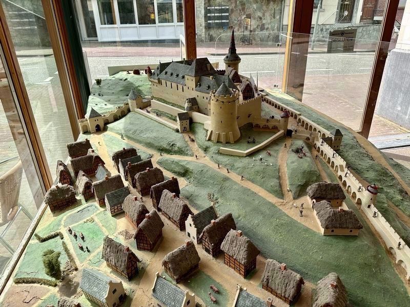
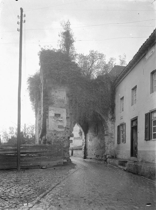
The area outside the Berkelpoort is still called Neerhem today. There used to be a city moat with a drawbridge on the field side of the gate. The canal was fed by the Geul river. The gate provided access for travelers approaching the city from the southeast in the direction of Aachen via Schin op Geul and Oud Valkenburg. The Heunsberg rises on the southwest side of the city gate. Here is still the gate to the main gate of the castle, a sunken road, intended to protect the castle. After the Dutch troops of William III blew up Valkenburg castle in 1672, the fortifications no longer had much of a function and partly disappeared. However, the western part with the Grendelpoort and the Berkelpoort was preserved. The Berkelpoort was closed daily until 1830. Until 1920, the gate was enclosed by houses built against the city wall. A market has been held on the city sideof the gate since the 15th century.Photographed by Andrew Ruppenstein, May 28, 20243. Valkenburg town and castle modelAs mentioned on the marker, there is a model of the castle and town only a few minutes away from the marker on the Walramplein (which is about 100 meters to the east). This model is not that one, however, but is a different one, roughly 100 meters to the west, located in the Fluweelengrot (Velvet cave) tour ticket office. And if that is not sufficient for one’s modeling needs, there is also a similar additional model about 150 meters away, outside the castle ruins ticket office.
The Berkelpoort gate is depicted here in the center-left of the picture, towards the rear.
By Cornelis J. Steenbergh - Rijksdienst voor het Cultureel Erfgoed (CC ), 1922
4. Berkelpoort (city gate) - prior to restoration
Credits. This page was last revised on June 17, 2024. It was originally submitted on June 17, 2024, by Andrew Ruppenstein of Lamorinda, California. This page has been viewed 198 times since then and 32 times this year. Photos: 1, 2, 3, 4. submitted on June 17, 2024, by Andrew Ruppenstein of Lamorinda, California.
