Oud Valkenburg in Schin op Geul in Valkenburg aan de Geul, Limburg, Netherlands — Northwestern Europe
Johannes de Doperkerk
⎯⎯⎯
John the Baptist Church
| — | Rijksmonument | — |
Photographed by Andrew Ruppenstein, May 29, 2024
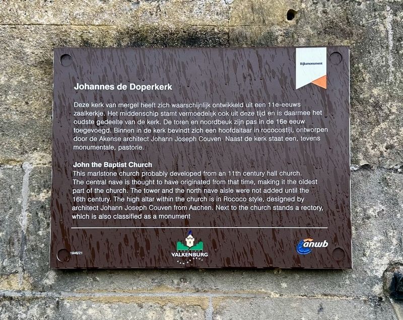
1. Johannes de Doperkerk / John the Baptist Church Marker

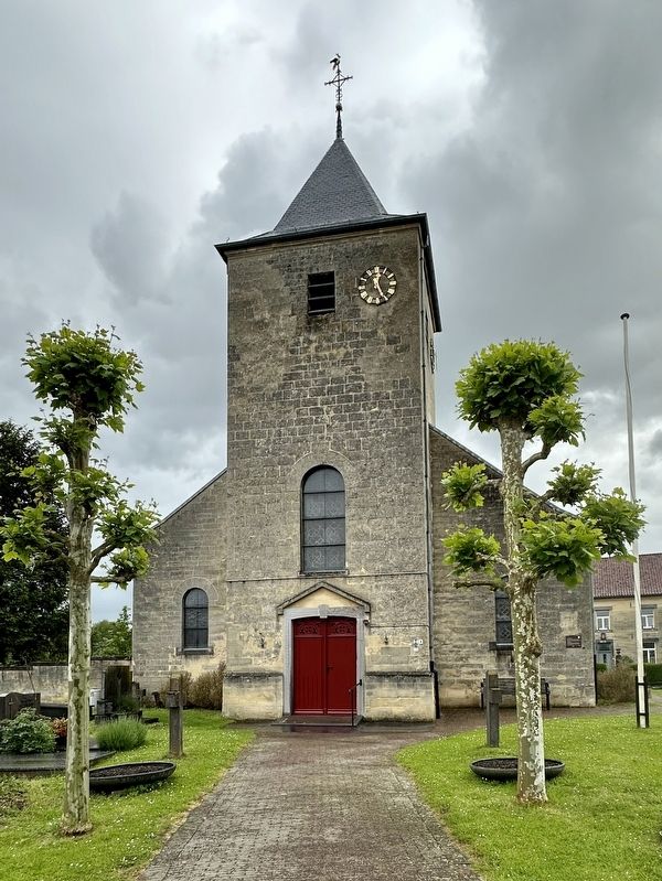
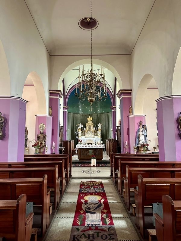
Deze kerk van mergel heeft zich waarschijnlijk ontwikkeld uit een 11e-eeuws zaalkerkje. Het middenschip stamt vermoedelijk ook uit deze tijd en is daarmee het oudste gedeelte van de kerk. De toren en noordbeuk zijn pas in de 16e eeuw toegevoegd. Binnen in de kerk bevindt zich een hoofdaltaar in rococostijl, ontworpendoor de Akense architect Johann Joseph Couven. Naast de kerk staat een, tevens monumentale, pastorie.
This marlstone church probably developed from an 11th century hall church. The central nave is thought to have originated from that time, making it the oldest part of the church. The tower and the north nave aisle were not added until the 16th century. The high altar within the church is in Rococo style, designed by architect Johann Joseph Couven from Aachen. Next to the church stands a rectory, which is also classified as a monument.
Erected by Gemeente Valkenburg aan de Geul, ANWB. (Marker Number 1946/21.)
Topics. This historical marker is listed in this topic list: Religion & Religious Structures.
Location. 50° 51.291′ N, 5° 51.259′ E. Marker is in Schin op Geul, Limburg, in Valkenburg aan de Geul. It is in Oud Valkenburg. It is on Oud Valkenburg, on the left when
this page online

Regionally, it is in Europe, the European Union, Atlantic Europe, the Benelux Low Countries, the Schengen Area, Western Europe, and the Western World. Historically, it finds itself in what was once the Roman Empire and specifically also the Holy Roman Empire.
Other nearby markers. At least 8 other markers are within walking distance of this marker: A different marker also named Johannes de Doperkerk / John the Baptist Church (a few steps from this marker); Crash Vliegtuig Kasteel Schaloen / Kasteel Schaloen Plane Crash (approx. 0.6 kilometers away); Halifax JB 907 Crash Memorial (approx. 0.6 kilometers away); Geologisch Monument Groeve Kasteel Oost / Kasteel Oost Quarry Geological Monument (approx. one kilometer away); Kasteel Oost (approx. 1.2 kilometers away); Kasteel Oost / Oost Castle (approx. 1.2 kilometers away); Bèr Houben Memorial (approx. 1.2 kilometers away); Schin op Geul - May 10, 1940 (approx. 1.2 kilometers away). Touch for a list and map of all markers in Schin op Geul.
Also see . . . Johannes de Doperkerk (Oud-Valkenburg) (Wikipedia, in Dutch).
Overview (in translation): The John the Baptist Church is a church(Submitted on June 18, 2024.)building in Oud-Valkenburg in the Dutch South Limburg municipality of Valkenburg aan de Geul. The building is one of the oldest churches in the region and has been a national monument since 1967. The Roman Catholic parish church is dedicated to John the Baptist. Since 1959, Saint Rita of Cascia, patroness of impossible and hopeless things, has also been venerated in this church.Photographed by Andrew Ruppenstein, May 29, 20242. Johannes de Doperkerk / John the Baptist Church and MarkerThe marker can be seen here on the right side of the church.
Photographed by Andrew Ruppenstein, May 29, 2024
3. Johannes de Doperkerk / John the Baptist Church - interior
Credits. This page was last revised on June 18, 2024. It was originally submitted on June 18, 2024, by Andrew Ruppenstein of Lamorinda, California. This page has been viewed 100 times since then and 11 times this year. Photos: 1, 2, 3. submitted on June 18, 2024, by Andrew Ruppenstein of Lamorinda, California.
