Chino in San Bernardino County, California — The American West (Pacific Coastal)
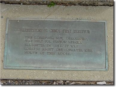
Cornerstone to Chino’s First Reservoir
Topics. This historical marker is listed in these topic lists: Charity & Public Work • Waterways & Vessels. A significant historical year for this entry is 1894.
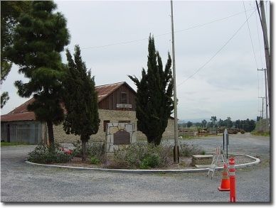
Location. 33° 56.301′ N, 117° 39.831′ W. Marker is in Chino, California, in San Bernardino County. Marker is on Pomona Rincon Road north of Euclid (California Route 83). Take Highway 71 (the Corona Expressway) to the Euclid Avenue exit. It is near to the 1984 Olympics shooting range. Touch for map. Marker is at or near this postal address: 17127 Pomona Rincon Road, Chino CA 91710, United States of America. Touch for directions.
Other nearby markers. At least 5 other markers are within 4 miles of this marker, measured as the crow flies. Yorba-Slaughter Adobe (approx. 0.2 miles away); WWII Army Air Corps Pilots (approx. 3.3 miles away); Communist Military Casualties of the Korean War (approx. 3.4 miles away); A World Turned Upside Down (approx. 3.4 miles away); “Operation Moolah” (approx. 3.4 miles away). Touch for a list and map of all markers in Chino.
Additional commentary.
1. discovery
Fenton Slaughter's great great grandaughter, Lynda Wells, discovered the cornerstone in 1979, on the property formerly owned by Laurinda Slaughter-Wells (a mile or so north of the Adobe).
— Submitted November 16, 2023, by John Wells of Plano, Texas.
Credits. This page was last revised on March 5, 2024. It was originally submitted on April 15, 2006, by Joseph Beeman of Upland, California. This page has been viewed 2,636 times since then and 17 times this year. Photos: 1, 2. submitted on April 14, 2006, by Joseph Beeman of Upland, California. • J. J. Prats was the editor who published this page.

